
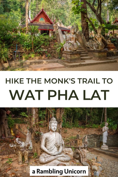
If you’re looking to get off the beaten path in Chiang Mai, there’s no lovelier place than Wat Pha Lat (also spelled Wat Palad). This picturesque temple nestled in the jungle is a peaceful place to meditate and get away from it all.
Also known as Wat Sakithaka, Wat Pha Lat is comprised of several buildings that are scattered among the forest alongside a tranquil stream. This sacred retreat is built in harmony with nature in such a way that it’s difficult to tell where the buildings end and the forest begins.
In fact, the temple’s name translates to Monastery at the Sloping Rock. This is because there are a number of statues and shrines that are incorporated into caves on the side of the hill. Today, the temple is primarily used as a meditation center for monks.
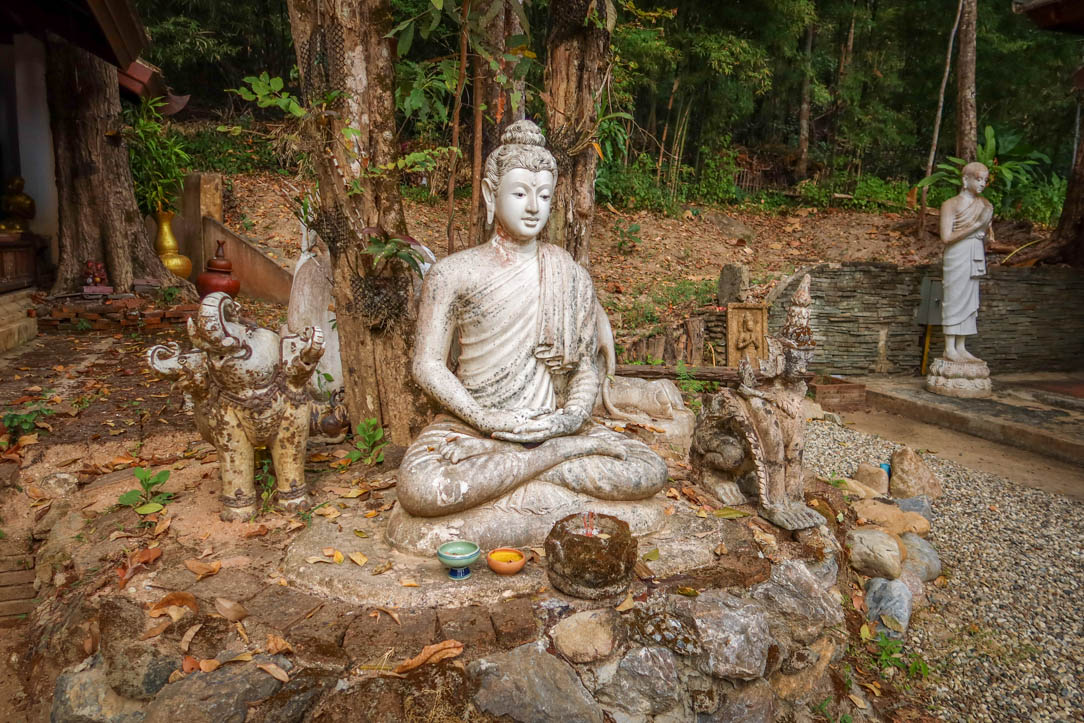
Buddha statue in the garden
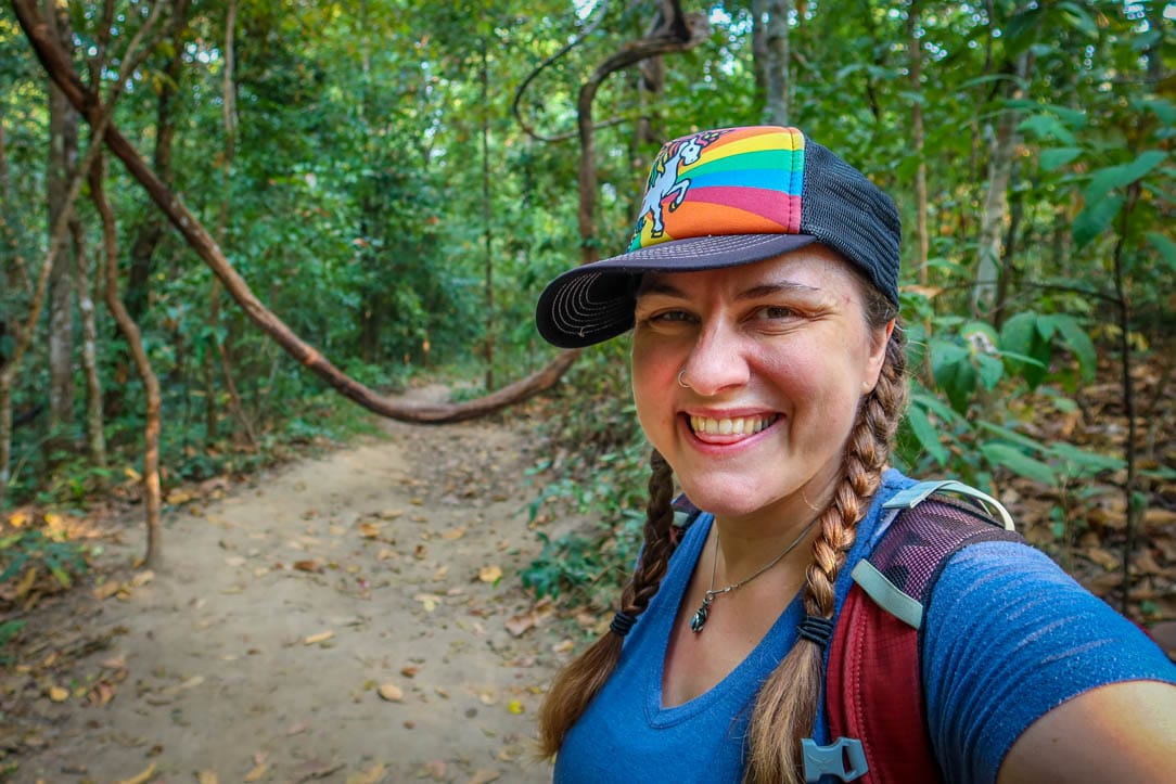
I first learned about the temple when researching hiking trails near Chiang Mai. The Monk’s Trail is a popular walking path on Doi Suthep Mountain that leads to Wat Pha Lat. This scenic trek was originally used by monks to descend from their jungle retreat and visit the city of Chiang Mai.
I’m a sucker for pilgrimage paths (the Portuguese Camino being another one of my favorites). So, of course, I had to check it out for myself.
I’m so glad I did!
The temple is by far one of the coolest places that I’ve seen during our visit to Northern Thailand. It’s definitely worth a trip even if you decide not to take the Monk’s Trail to reach it.
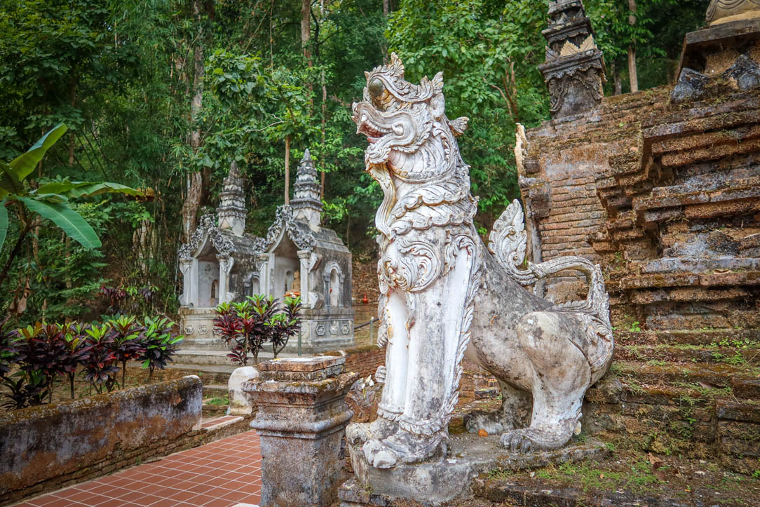
Singha lions guard the base of the Chedi
Table of Contents
A Brief History of Wat Pha Lat
The temple dates to the 14th century during the reign of King Kuena. According to legend, a monk named Sumanathera found part of Buddha’s shoulder bone and brought it to the king. He placed the holy relic on the back of a white elephant and sent it into the jungle to look for a new home.
The elephant eventually climbed to the top of Doi Suthep mountain, pausing along the way to rest at a waterfall. Once the animal reached the top of the mountain, it stopped and trumpeted three times. Then it died.
This was interpreted as an omen and the opulent temple Wat Phra That Doi Suthep was established at that spot. Temples were also created at the places where the elephant stopped to rest, one of them being Wat Pha Lat.
The locale served as an important stopping place for monks on pilgrimage up the mountain for many years. After construction of the road up the mountain in 1935, however, the spot transitioned into a monk’s residence and meditation retreat.
Today, this holy site is typically overlooked by visitors who head right past it to Doi Suthep Temple at the top of the mountain. As a result, it generally doesn’t get many visitors and is a nice peaceful place to visit.
Elephants have special significance for the temple and are found throughout the grounds
Key Sights at Wat Palad
The temple grounds feature a number of buildings and shrines that are worth exploring. The area is not terribly huge, but there is enough to keep you busy for at least an hour (maybe longer if you plan to meditate or take lots of pictures).
Be sure to dress and act respectfully as you would when entering any Thai Buddhist Temple. This means you should dress modestly and ensure your knees and shoulders are covered. Also keep your voice down as the site is an active meditation retreat.
Pro tip: I always bring a pair of Thai pants and a long-sleeved sun shirt along in my backpack in case I decide to visit any temples.
Temple and Chedi
One of the most important buildings at the site is the temple. This building was restored in 1935 by a wealthy Burmese businessman and now features a brilliant peacock on the side of the roof. The peacock is widely seen as a symbol of the Burmese people.
The chedi (also known as a stupa) is a separate structure that towers gracefully behind the temple. These mound-like structures are common at all the temples I’ve seen in Chiang Mai and typically hold relics.
Entrance to the temple
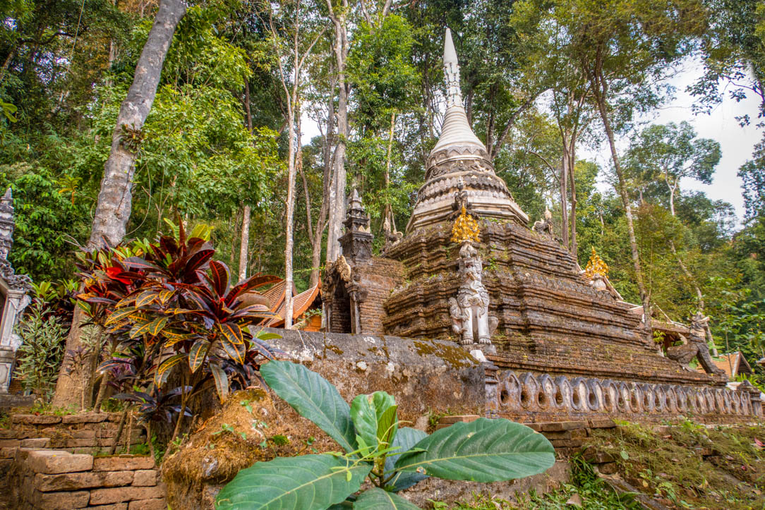
The Chedi
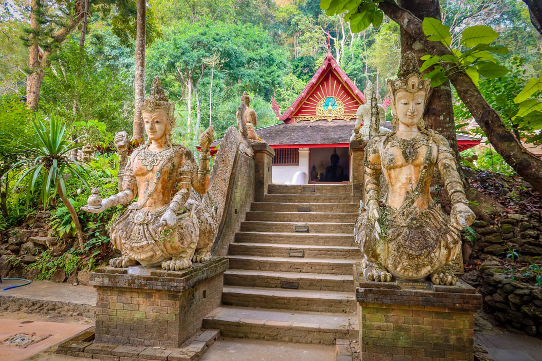
Naga Staircase
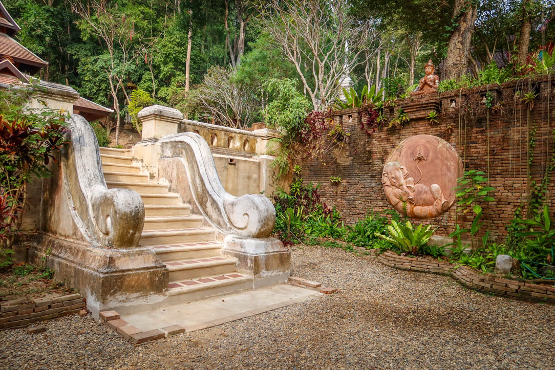
Given the retreat center’s hillside location, there are lots of stairs found throughout the site. Most are decorated with ornamental statues and figurines that are important to the Thai Buddhist tradition.
The most impressive set of stairs is flanked by a pair of long white serpents (a mythical being known as a Naga). This is a common feature found in many Thai temples. In fact, the magnificent Naga staircase located up the mountain at Doi Suthep features 309 steps.
At Wat Pha La, the Naga staircase is quite a bit smaller but has its own rustic charm.
Note: during my visit, the stairs were roped off to prevent visitors from climbing them.
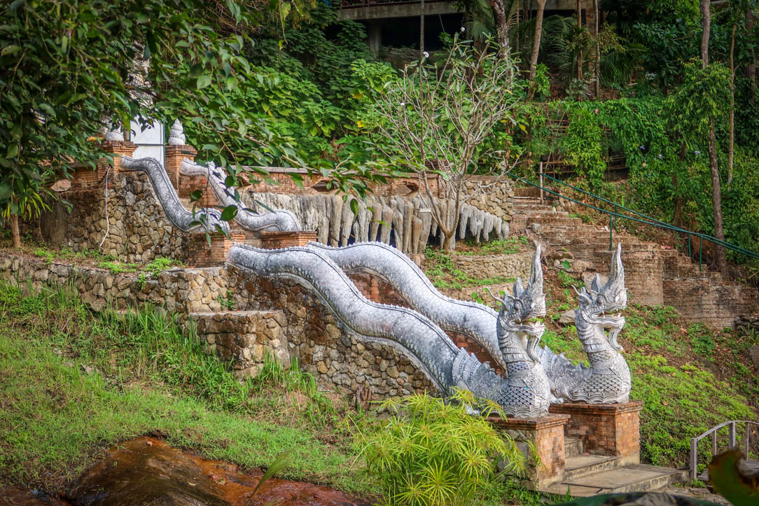
Naga Staircase
Mountain Stream and View
One of the best parts about visiting this particular temple is its location on a tranquil stream. An ancient bridge provides easy access to structures on the other side of the water (along with the Monk’s Trail).
It is from this bridge where the best views are located. On a clear day, you can see all the way across the entire city of Chiang Mai. I happened to visit on a day with poor visibility so I didn’t get much of a view (it was still pretty though!).
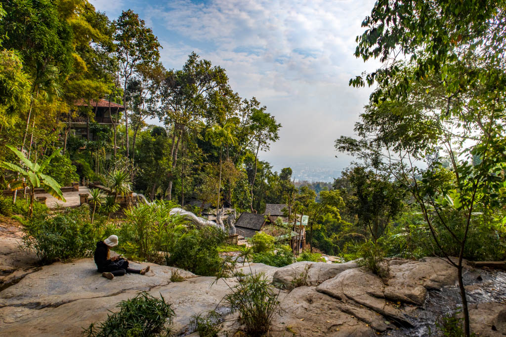
View of Chiang Mai from the bridge
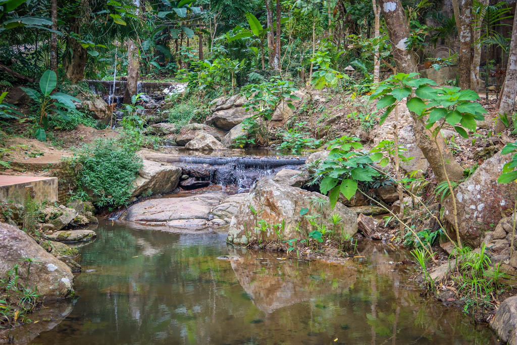
Mountain stream featuring a series of small waterfalls
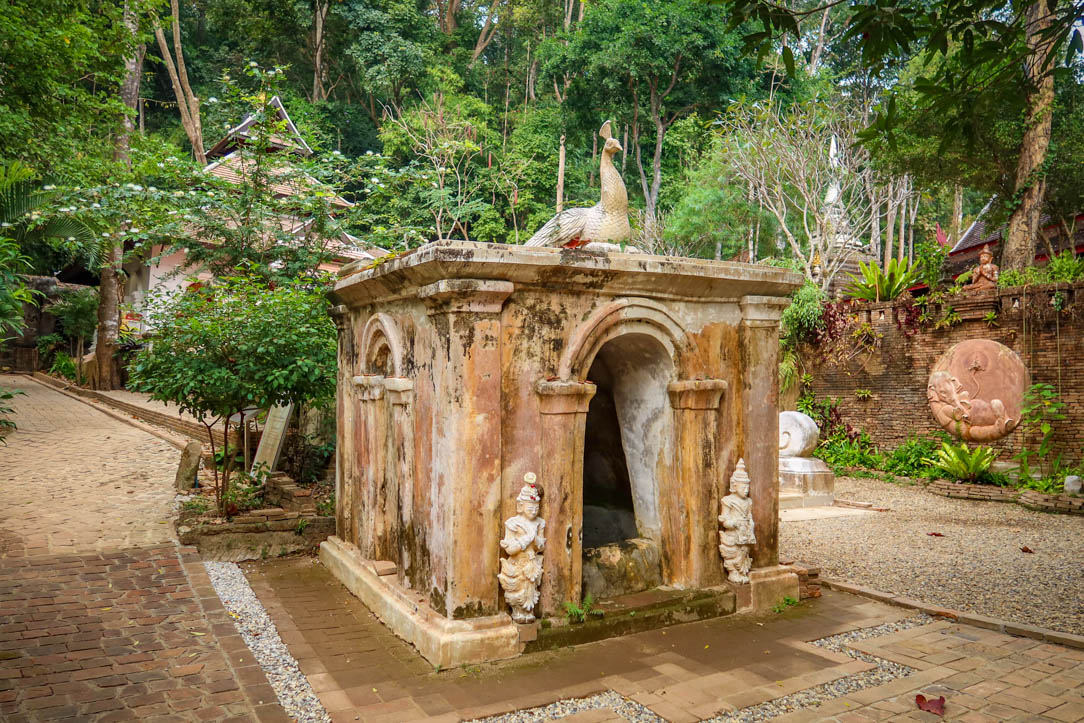
Caves
An ornate structure on the opposite side of the stream is one of the most eye-catching buildings at the site. This edifice makes natural use of the hillside in a cave-like environment to house several Buddha statues.
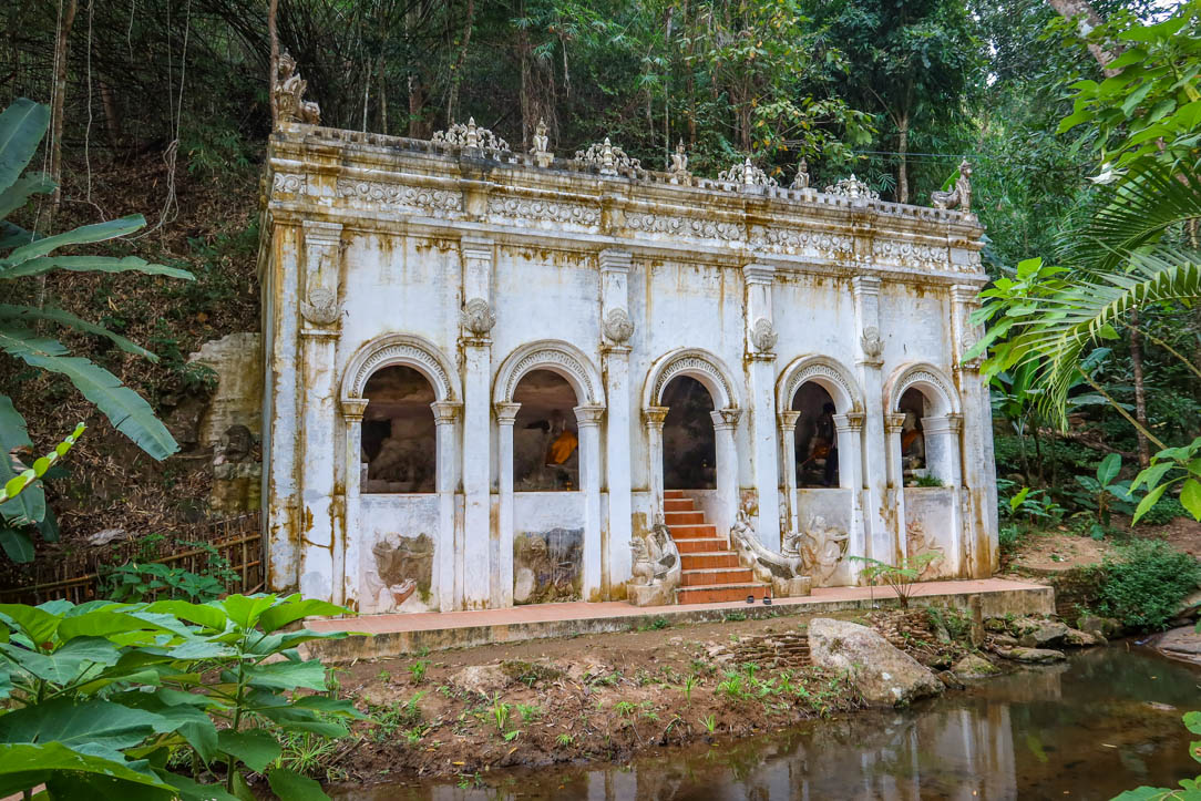
This structure is part building and part cave
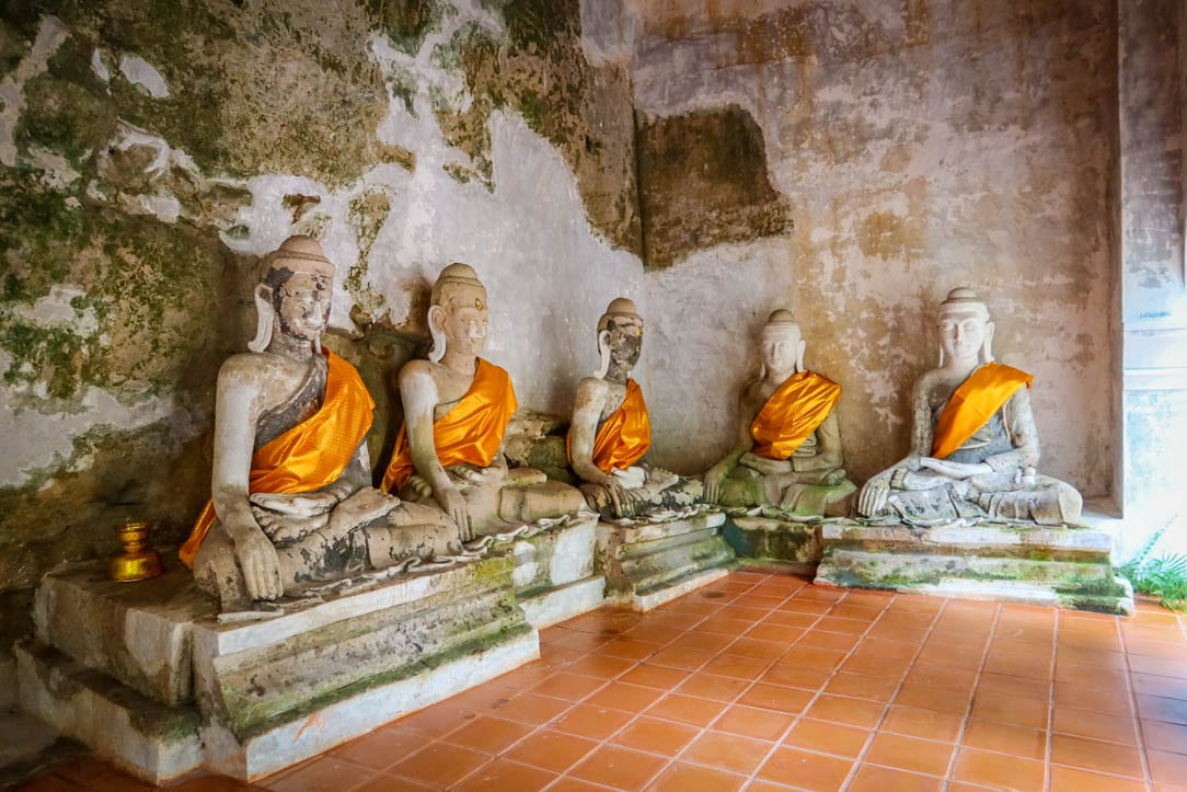
Buddha statues inside the cave
Hiking the Monk’s Trail from Chiang Mai
Monk’s Trail is an easy 3 km (roundtrip) trail to the temple that is suitable for most skill levels.
Key hike details (when hiking to Wat Pha Lat):
- Distance: 2.9 km (1.8 miles) there-and-back
- Elevation Gain: 187 m (614 feet)
- Highest Point of Elevation: 635 m (2084 feet)
- Difficulty Level: Easy
Key hike details (when hiking to all the way to Doi Suthep):
- Distance: 6.3 km (3.9 miles) there-and-back
- Elevation Gain: 600 m (1968 feet)
- Highest Point of Elevation: 1052 m (3453 feet)
- Difficulty Level: Challenging
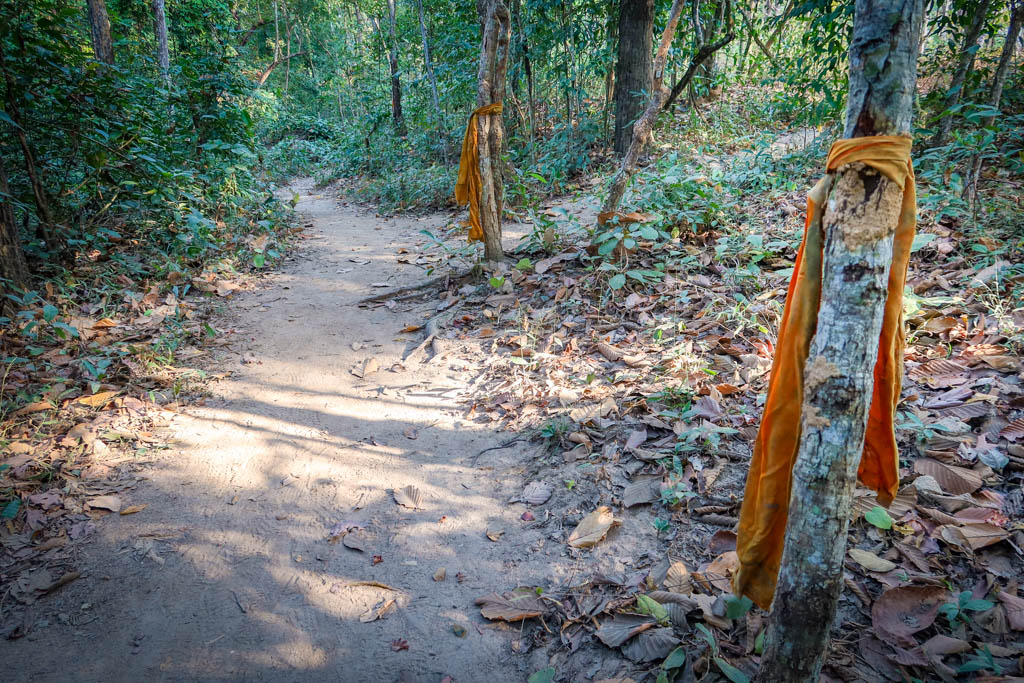
Orange cloths tied to trees along the path mark the way
How to Reach the Trailhead
Trailhead for Monk’s Trail:Â Google Maps
The trailhead for Monk’s Trail is located at the base of Doi Suthep mountain. The road begins climbing just past Chiang Mai University and continues uphill for about 1 km or so until the hike begins. These days, it is fairly easy to find because the location is marked on Google Maps.
Be aware that parking is limited at the trailhead so you may have to park down the hill at Basecamp Trail Cafe and walk from there.
Or, better yet, take a Grab car. (Grab is a delivery service in Thailand that also provides transportation). This is how I reached the trailhead and it was super easy and convenient.
Trailhead for the Monk’s Trail
What to Expect along the Monk’s Trail
The Monk’s Trail is a fairly easy hike that winds through the jungle and alongside a stream. The trail does go up a mountain so elevation gain is involved, but it’s generally not too difficult.
That being said, there are a couple of steep bits so be prepared to negotiate them. It takes about 45 minutes to reach the top, depending on your ability level.
There are some orange cloths hung on the trees along the way by the monks to mark the trail. Don’t count on them for navigation, however, as they seem to be disappearing with time.
One of the highlights of the Monk’s Trail is a waterfall about halfway up. I also particularly liked a vine that looped down across the path (pictured below).
Hello from the Monk’s Trail!
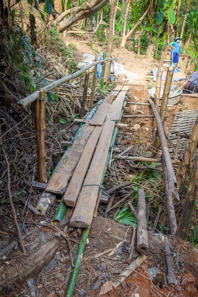
Just before reaching the temple, the Monk’s Trail crosses over a bridge. This bridge was under construction at the time I crossed it and a bit sketchy as a result.
Hopefully it will be finished when you visit.
Bridge under construction
Monk’s Trail Map
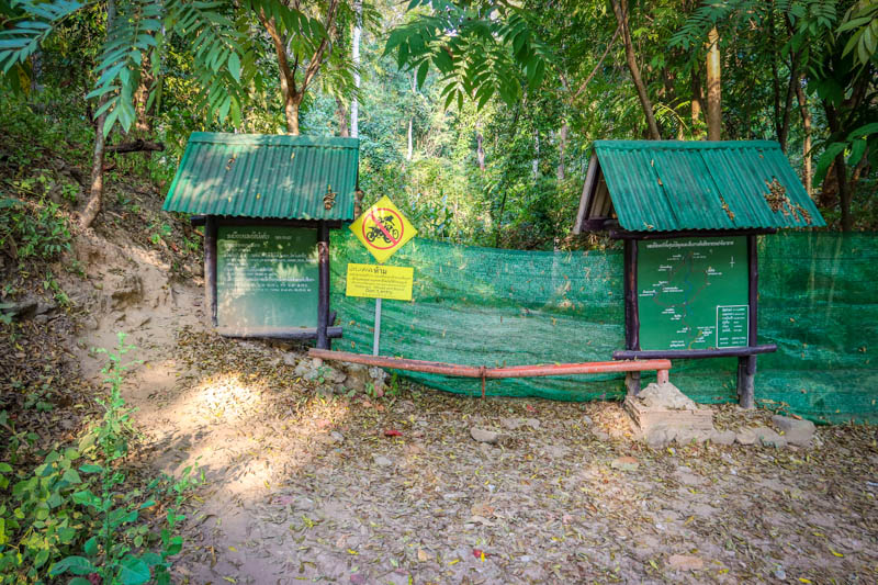
Before hiking this or any trail, be sure to bring a map along so you don’t get lost. I recommend downloading a map to your phone in advance because cell reception is spotty in and around the temple.
Extend Your Hike to Doi Suthep
Many visitors choose to extend their hike and continue all the way to Doi Suthep at the top of the mountain.
Once you pass Wat Pha Lat, be warned that the trail isn’t as easy to follow. It is also much steeper and exposed since the path mostly travels under some power lines. This part isn’t nearly as scenic as the first half of the hike.
That being said, the views at the top are pretty great.
If you decide to do this, here are some tips:
- After crossing the stream at Wat Pha Lat, take a left and continue heading uphill. The path gets really steep here until it reaches the road.
- There is a tall guard rail blocking access to the road at this point. The only way I found past it was to climb up and over the rail.
- Take a left and walk along the road for about 350 meters until the trail continues up the hill. Here is the Google Maps location.
- Here the path is at its steepest as it climbs sharply uphill under some power lines.
- Eventually, the trail reaches the road again. You can either follow the road to the official entrance or take the back way. To do this, take a right at the driveway entrance. Then look for a stairwell on the left which continues uphill to the monk’s living quarters.
Or you could skip this part of the hike and take a car the rest of the way.
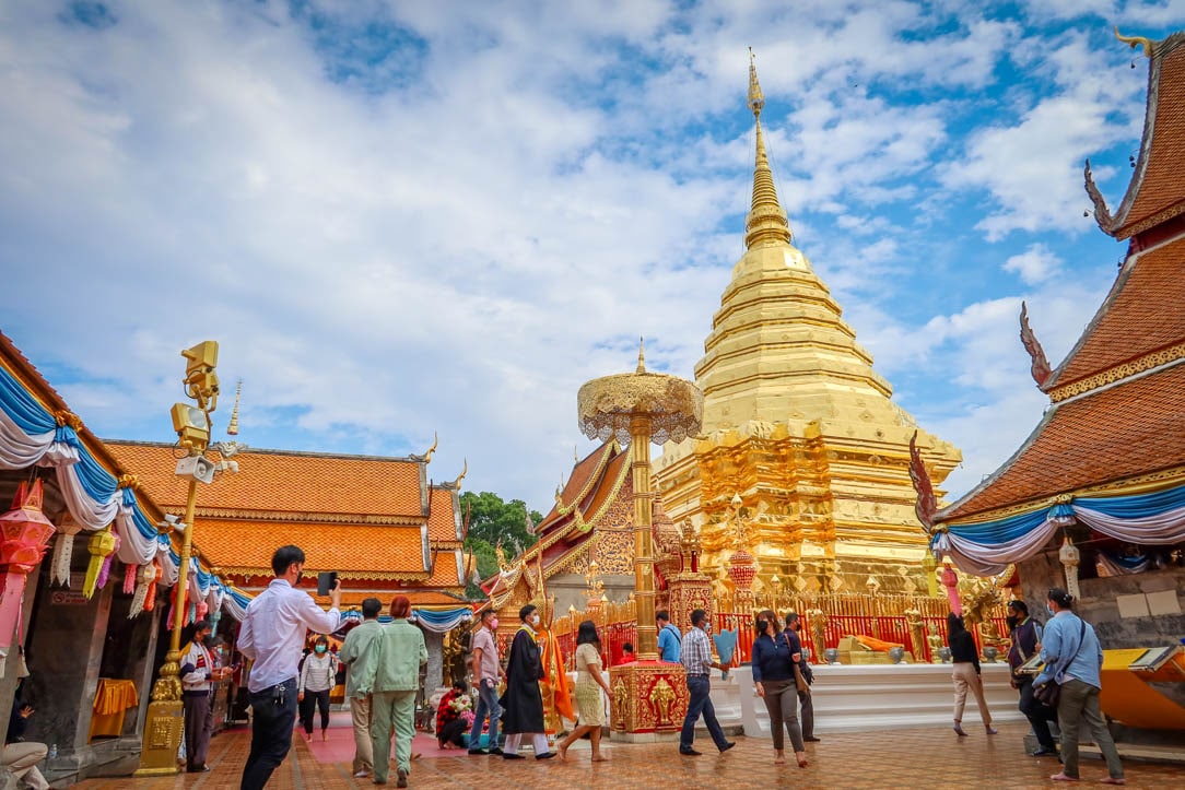
Doi Suthep
Preparing for your Hike
When planning your walk, be aware that there are no vendors selling food or water at the temple. Be sure to pack plenty of water and snacks. Also bring clothing to cover your knees and shoulders as you will need to wear those when visiting the temple.
Check the weather forecast and make sure you’re prepared for the weather conditions. The trail can become muddy and slippery during (or after) rainfall so wear shoes with good traction. This is especially true if you decide to hike all the way up to Doi Suthep (I wouldn’t advise it in the rain).
The best time to hike is in the early morning or late afternoon hours. Avoid hiking during the middle of the day when the temperatures are hottest.
I’m not sure if there are any public restrooms at the temple (I didn’t see any but I may have missed them). Regardless, learn how to pee outside properly before heading out and be sure to leave no trace of your visit behind.
Hiking Gear
Here are a few of my favorite pieces of gear for day hikes:
- Hiking Shoes – Sturdy hiking shoes are important. I’m a big fan of Altra Lone Peak Trail Running Shoes and pair them with Dirty Girl Gaiters to keep rocks from getting into my shoes.
- Socks – Good thick socks are key. I usually wear a pair of double-walled Wrightsock Coomesh II socks with my Altras.
- Hiking Poles – Hiking poles reduce pressure on your joints and help maintain your balance if you trip. My current favorites are the LEKI Micro Vario Carbon Trekking Poles.
- Electronics – if you are using your phone for navigation, bring a portable battery such as the Anker portable battery charger.
- Camera – I love taking photos and always bring a camera along on my hiking trips. I use the Canon PowerShot G7X Mark III because it is lightweight yet has many advanced features.
Reaching the Temple by Car
If you prefer not to hike to the temple, you can also reach it by car. The site is located along the Doi Suthep mountain road about 7 km before reaching Doi Suthep Temple. There is room for a few cars to park by the side of the road before a driveway leads into the jungle where the temple is located.
Visitors could probably also take a Grab car here but I’m not sure how easy it would be to arrange a return trip due to poor cell reception. The road has lots of traffic on it, however, with people going up and down to Doi Suthep. You may be able to flag a songthaew (a shared taxi on the back of a red truck).
Entrance to the monastery retreat as accessed from the Monk’s Trail
Like this article? Pin it!
Note: This post contains affiliate links, which means I may receive a commission if you click a link and purchase something. While clicking these links won’t cost you anything, they will help me to keep this site up and running!

![9 Amazing Chiang Mai Markets, Walking Streets and Flea Markets [2022]](https://aramblingunicorn.com/wp-content/uploads/2022/12/Chiang-Mai-Gate-Market-Outside-400x250.jpg)
0 Comments