
Winchester is a quiet city located along the picturesque banks of the River Itchen. The town is filled with charming buildings and situated near gorgeous water meadows and the rolling hills of South Downs National Park.
Thanks to the city’s important historical role, it sits at a busy crossroads. Many ancient and modern walking paths begin or pass through the area. As a result, there are countless Winchester walks to choose from that lead all over the country.
The city is fun to explore, too, and is filled with interesting historical buildings if you’re looking for what to do in Winchester.
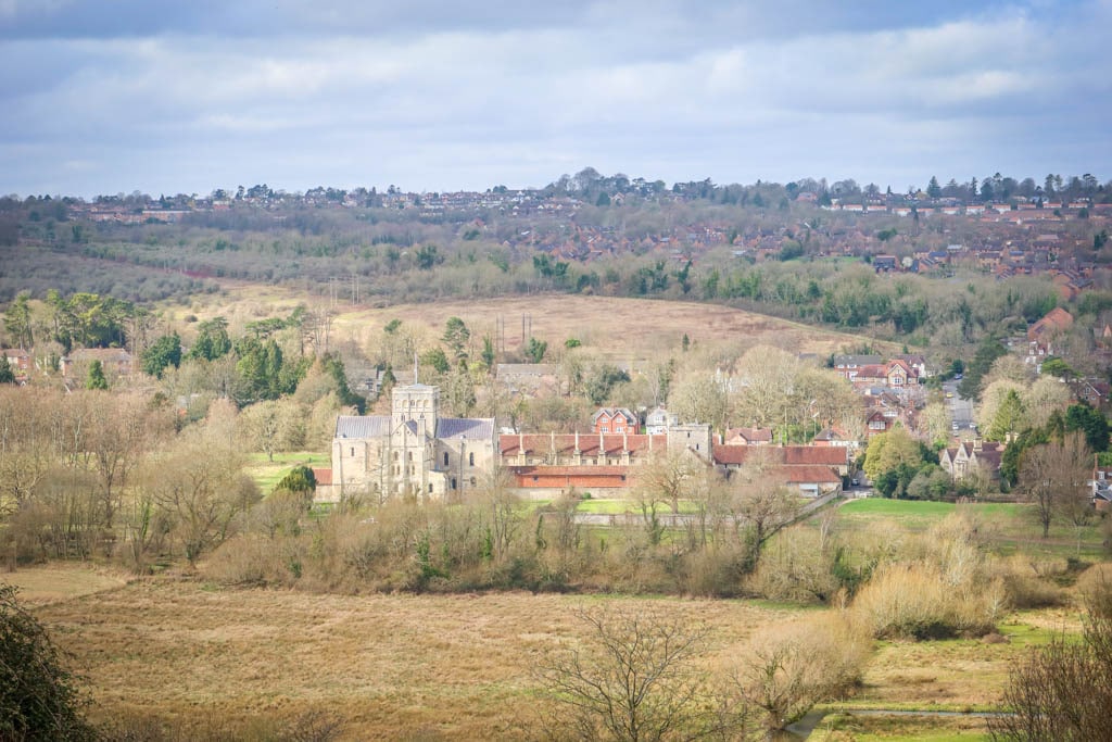
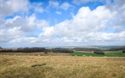
View from St. Catherine’s Hill
A statue of King Alfred the Great towers above the city center. England’s first true king, Alfred rebuilt Winchester in the 9th century and made it his capital city.
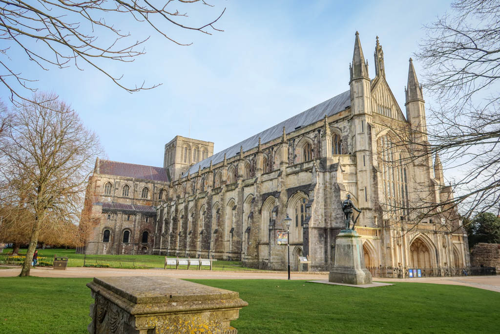
Other notable landmarks include the Winchester Cathedral, Wolvesey Castle and Winchester College – along with several intact Tudor-era structures.
Located only an hour away from London by train, Winchester is easy to access and makes a great location for a walking holiday. Whether you are looking for a short ramble through the South Downs or a long-distance pilgrimage, you are sure to find walks in Winchester that pique your interest!
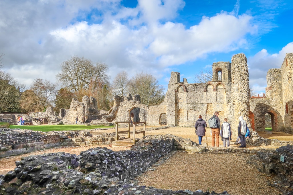
Wolvesey Castle, a popular stop along the Keats Trail in Winchester
Table of Contents
Preparing for Walks in Hampshire
Before setting out on this or any hike, make sure you are prepared with water, snacks, sturdy walking shoes and any other gear you may need for the day’s weather (sun hat, rain gear, etc). Learn how to pee outside and be sure to leave no trace of your visit behind.
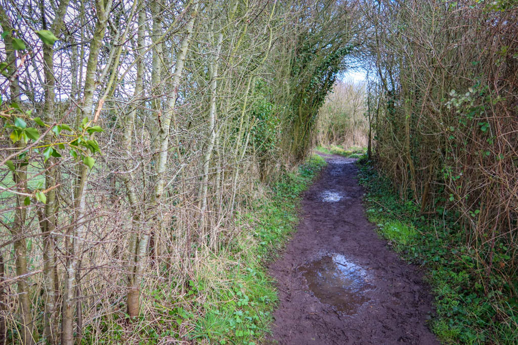
Be aware that the paths in and around Winchester can get quite muddy if it’s been raining. So be prepared with proper footwear.
Here is a list of some of my favorite gear for day hiking.
- Hiking Shoes – Sturdy hiking or walking shoes are a must. Personally, I’m a big fan of Altra Timp Trail Running Shoes. That being said, they aren’t waterproof and so consider a waterproof boot or shoe if it’s super muddy out.
- Socks – Good thick socks are also important. I usually wear a pair of double-walled Wrightsock Coolmesh II socks with my Altras. For longer hikes, I switch to Injinji Midweight socks to prevent toe blisters.
- Backpack – A backpack is essential so you can carry water, layers, and snacks. I love Ospreys and use the Osprey Manta pack which is technically a men’s pack (because I have a longer torso than most women). The women’s equivalent is the Osprey Mira pack.
- Hiking Poles – Hiking poles reduce pressure on your joints and help maintain your balance if you trip. My current favorites are the LEKI Micro Vario Carbon Trekking Poles because they are super lightweight and fold down to easily fit into my suitcase.
- Electronics – if you are using your phone for navigation, bring a portable battery such as the Anker portable battery charger.
- Camera – I love taking photos and always bring a camera along on my hiking trips. I use the Canon PowerShot G7X Mark III because it is lightweight yet has many advanced features.
3 Easy-Moderate Walks in Winchester
The following Winchester walks are relatively easy ones that most hikers can manage in a half a day or less. They are all easily accessible from the downtown Winchester area or the Winchester train station.
For more walking opportunities in Winchester not listed below, consider exploring the Winnall Moors Nature Reserve, the Hockley Railway Viaduct, Hillier’s Haven or Old Winchester Hill.
For other short walks around Winchester, consider following a portion of the many long-distance Winchester paths listed below.

Map of easy Winchester walks
Keats Walk
- Distance: 2 miles (3.2 km) there-and-back
- Elevation Gain: 50 feet (15.2 m)
- Difficulty: easy
- Trailhead: King Alfred’s Statue
Keats Walk is an easy ramble that traces the banks of the River Itchen from downtown Winchester to the Hospital of St. Cross.
The walk is named after the poet John Keats who famously lived in Winchester for a short time. He enjoyed a daily walk from the Cathedral Close through the water meadows along this very path In fact, he was inspired to write the poem “To Autumn” in 1819 after going for a walk in Winchester.
According to the official Keats Walk Map and Pamphlet (courtesy of the tourism office), the walk begins at the King Alfred statue. It then winds past some historic buildings and places that were important during Keats’ time in Winchester – such as the Cathedral, King’s Gate, Winchester College and Wolvesey Castle.
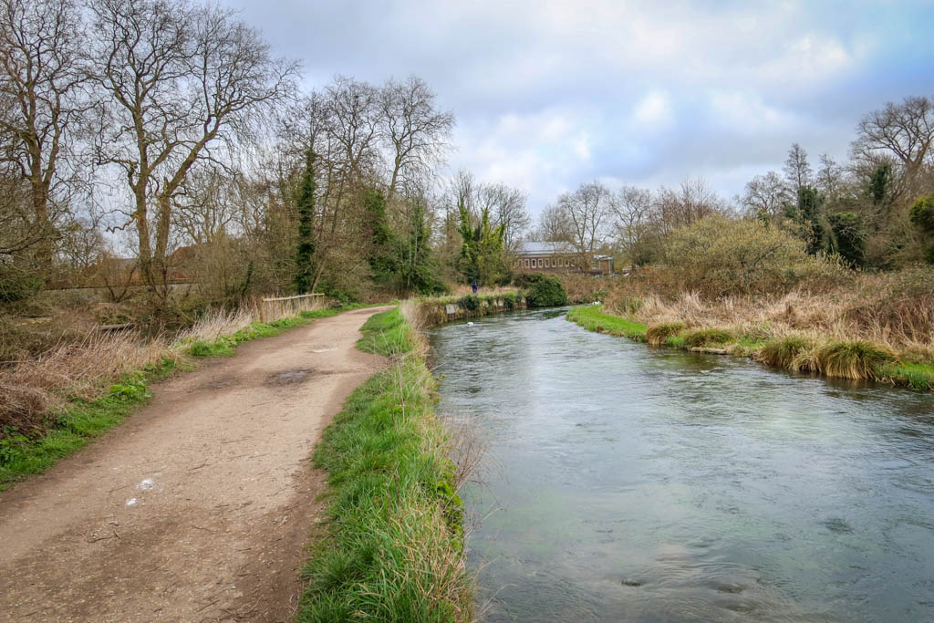
Keats Walk along the River Itchen
At this point the trail leaves the road and traces the footpath along the River Itchen. If you are just after the river views, you can skip the walk through town and start your hike here.
It’s a really gorgeous walk with lovely views of the river along with the meadows and St. Catherine’s Hill in the distance (and swans!).
After reaching St. Cross, simply return to town the way you came. Or, to extend your walk, you can continue to Five Bridges Road and loop back to Winchester via St. Catherine’s Hill.
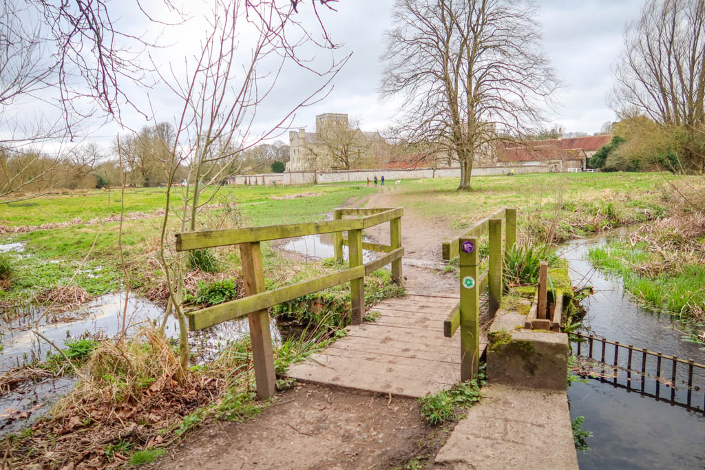
Approaching the Hospital of St. Cross
St. Catherine’s Hill Circular
- Distance: 2 miles (3.2 km) loop
- Elevation Gain: 362 feet (110 m)
- Difficulty: easy (but involves some stairs)
- Trailhead: Garnier Road Car Park Entrance
St. Catherine’s Hill is a mound just south of Winchester that is the site of an ancient fort. It is a favorite destination for walkers due to sweeping views of Winchester and one of the best circular walks in Winchester.
Iron Age people first settled on the hill over 2500 years ago. Later, a Norman chapel dedicated to St. Catherine was constructed on the site. While the chapel was destroyed in 1537, the area still bears the name of the former church.
The walk begins at the Car Park on Garnier Road. While there are trails that lead to the top of the hill near the car park, I don’t recommend them as they are quite steep (unless you like that sort of thing!)
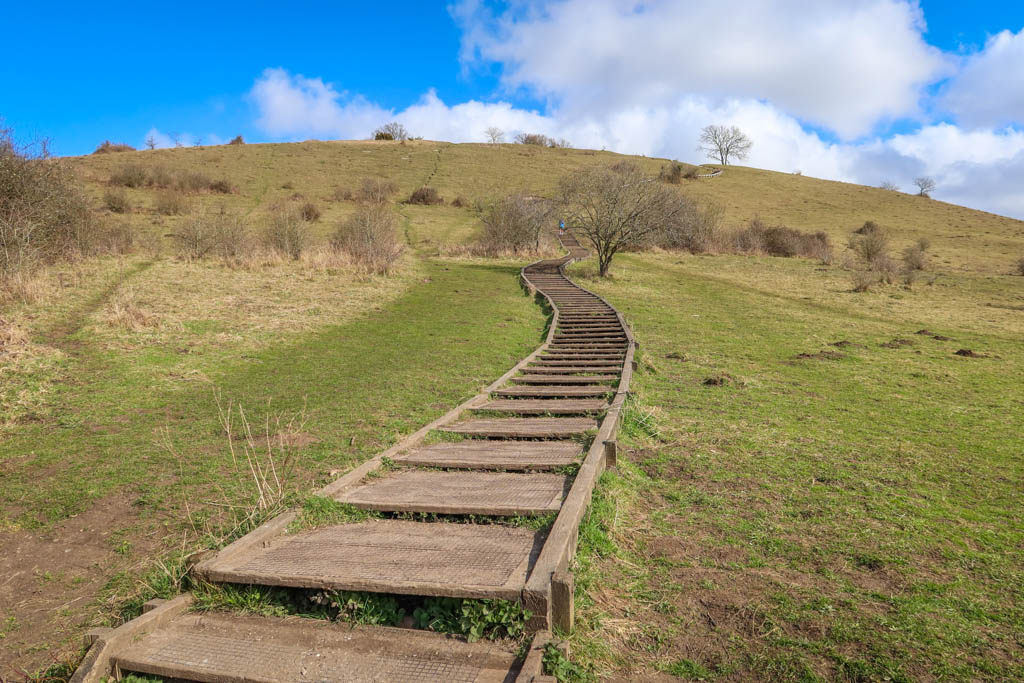
The steps leading up St. Catherine’s Hill
Rather, I suggest walking past the cafe along Itchen Way for about half a mile until you reach an information sign. There is a broad path with steps leading up the hill’s southern side which is much easier to navigate.
Once you’ve reached the top of the hill, you can follow the circular path around the top or take a side trail to the summit. Be sure not to miss the minimaze which dates to the 17th century.
If you wish to extend your walk, you can make a loop along Itchen Way to Keats Walk as depicted in this map (for an overall total of approx. 3.5 miles or 5.6 km). Or, you can just head back to the parking lot.
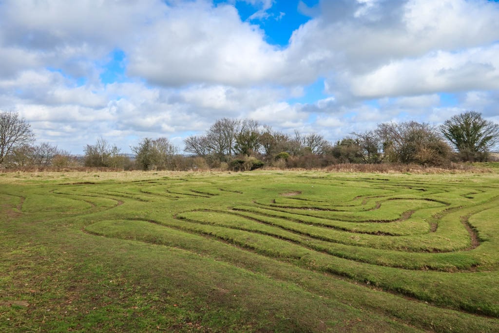
MiniMaze on St. Catherine’s Hill
Cheesefoot Head Walk
- Distance: 5.6 miles (9 km) there-and-back
- Elevation Gain: 400 feet (120 m)
- Difficulty: moderate
- Trailhead: South Downs Way Trailhead (or you could start at King Alfred’s Statue)
Cheesefoot Head is a naturally-occurring amphitheater located along the South Downs Way Trail a few miles east of Winchester.
The amphitheater was used as a central gathering point for troops during World War II who were stationed in the area. British and American troops watched boxing matches at the site, including one with heavyweight world champion Joe Louis. Today it is the site of an annual music festival called Boomtown.
Walking along the South Downs Way to Cheesefoot Head
Also called Matterley Bowl, Cheesefoot Head is also the first major waypoint along the South Downs Way National Trail. It’s a great turnaround point for those who want to sample just a section of the trail on a day hike.
While some walkers begin at the Cathedral, the pedestrian portion starts on Petersfield Road just prior to crossing the Winchester Bypass. From here, the trail follows hedgerows through the rolling hills of South Downs National Park and past the village of Chilcomb until reaching Cheesefoot Head.
There’s a parking lot with a coffee cart at Cheesefoot Head for those who’d like a treat before heading back to Winchester.
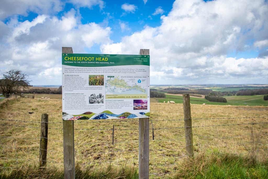
Cheesefoot Head
Pilgrim Routes in Winchester
Winchester is an ancient hub for pilgrims since St. Swithun is buried at the magnificent Winchester Cathedral. There are several pilgrim routes that start or pass through the city of Winchester as a result.
St. Swithun’s Way
- Distance: 34 miles (54.8 km)
- Starting Point:Â Winchester
- Ending Point: Farnham
St. Swithun’s Way is part of an ancient pilgrimage route that begins at St. Swithun’s Shrine in the Winchester Cathedral. Alternatively, some pilgrims choose to start at the Hospital of St. Cross where they are offered the traditional Wayfarer’s Dole of bread and a cup of ale.
As the original path has been subsumed by the A31 motorway, the trail now follows picturesque walking paths along the River Itchen and through the countryside.
Winchester Cathedral, the starting point for St. Swithun’s Way
After leaving the Cathedral, the trail follows the Nun’s Path through the gorgeous water meadows in the Winnall Moors Nature Reserve. Highlights include Mill Lane, St Swithun’s Martyr Worthy church, the famous watercress fields in Alresford and a former home of Jane Austen.
For those wanting to sample a shorter portion of the trail, walk for the first 10.5 miles (16.9 km) to the town of New Alresford and take the #64 bus back to Winchester.
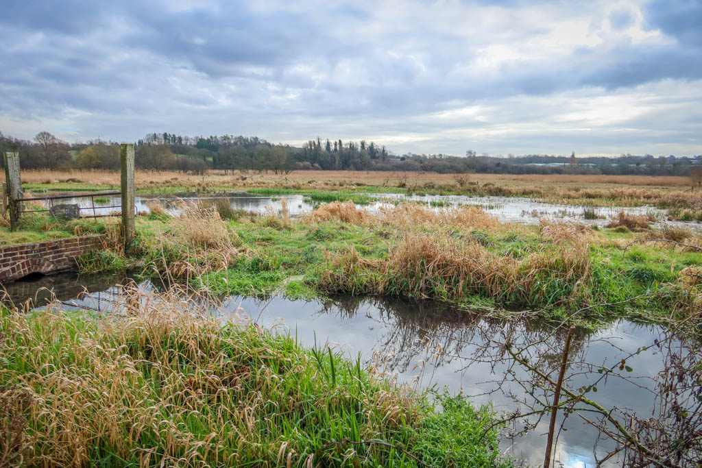
Winnall Moors Nature Reserve near the beginning of St. Swithun’s Way
Pilgrim’s Way
- Distance: 153 miles (246 km)
- Starting Point:Â Winchester
- Ending Point: Canterbury
Pilgrim’s Way connects the ancient pilgrimage site of Winchester with the tomb of St. Thomas Becket in Canterbury. The path was established in the 12th century following Becket’s death by a group of knights from the court of King Henry II.
Today, those who walk the Pilgrim’s Way start by following St. Swithun’s Way from Winchester to Farnham. From there, pilgrims follow the North Downs Way to Canterbury.
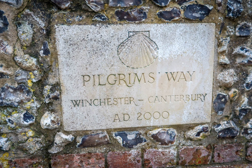
Signpost for Pilgrim’s Way
Pilgrim’s Trail (Hampshire Millennium Pilgrims’ Trail)
- Distance: 155 miles (246 km)
- Starting Point:Â Winchester
- Ending Point: Portsmouth (continues to Mont Saint Michel, France)
Not to be confused with the Pilgrim’s Way, the Pilgrim’s Trail also begins in Winchester.
Instead of leading to Canterbury, this trail leads to Portsmouth along an ancient Roman road. From there, pilgrims take a ferry to France and continue to Mont Saint Michel in Normandy.
Also called the Hampshire Millennium Pilgrims’ Trail, the path is part of the longer St. Michael’s Way Trail. The trail follows in the footsteps of the Miquelots, which is the name for pilgrims who walk to Normandy to worship at Mont Saint Michel.
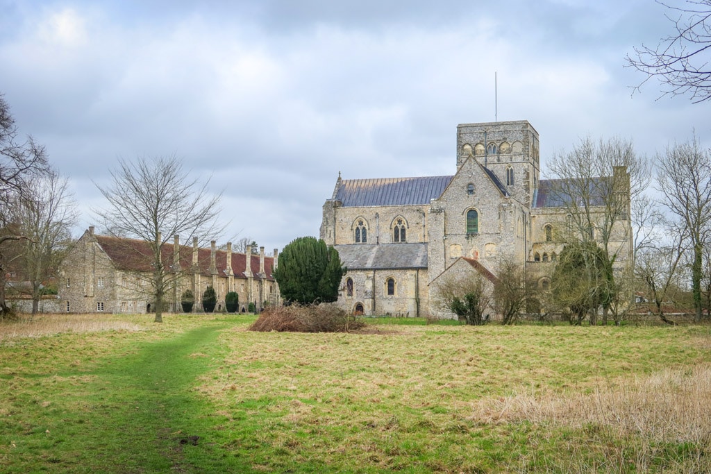
Pilgrims can stop by the Hospital of St. Cross for the Wayfarer’s Dole
Other Long-Distance Winchester Walks
The number of long-distance walks available in and around Winchester is truly amazing. The following walks are some of the best-known routes that begin in or pass through the Hampshire area.
Other walks not listed below include: Three Castles Path (which links Winchester to Windsor), Watercress Way in Alresford, and the scenic 185-mile (298 km) Hampshire Way Loop.
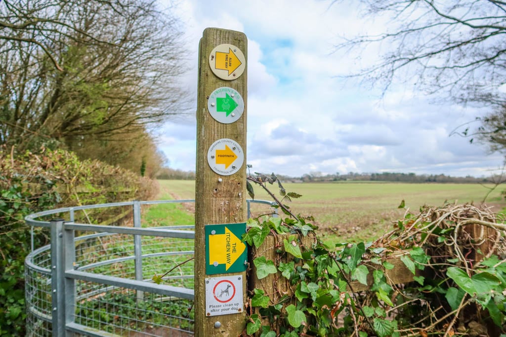
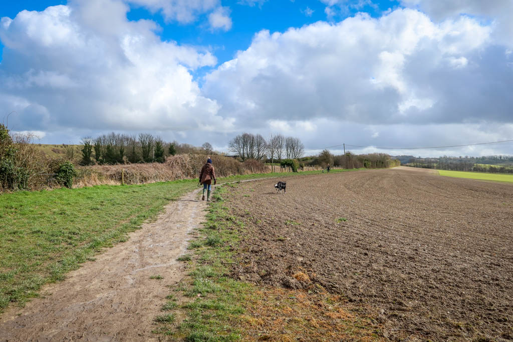
Many long-distance routes share the same walking paths, at least for short periods of time. The route pictured in this photo is used by the Itchen Way, Allan King Way, and St. Swithun’s Way.
South Downs Way
- Distance: 100 miles (160 km)
- Starting Point:Â Winchester
- Ending Point: Eastbourne
South Downs Way is a National Trail that stretches for 100 miles (160 km) along the rolling hills of South Downs National Park. The hike begins in Winchester and ends in Eastbourne, taking approximately 8 days to complete.
The first major waypoint along the South Downs Way is the aforementioned Cheesefoot Head amphitheater. Other highlights include Buster Hill (a popular spot with paragliders), the spectacular chalk cliffs of the Seven Sisters, and Beachy Head.

Trail sign for the South Downs Way
Clarendon Way
- Distance: 24 miles (39 km)
- Starting Point:Â Salisbury
- Ending Point: Winchester
Clarendon Way is a long-distance path that connects the celebrated cathedral cities of Clarendon and Winchester. The path is named after Clarendon Peak, which was once the site of Clarendon Palace.
The route passes through some of the oldest remaining royal hunting forests and woodland in Hampshire along with quaint village churches and gently rolling farmland.
At 24 miles in length (39 km), it is one of the shorter long-distance paths in this guide. While it is divided into 4 easy sections, it can be completed in a couple of long days.
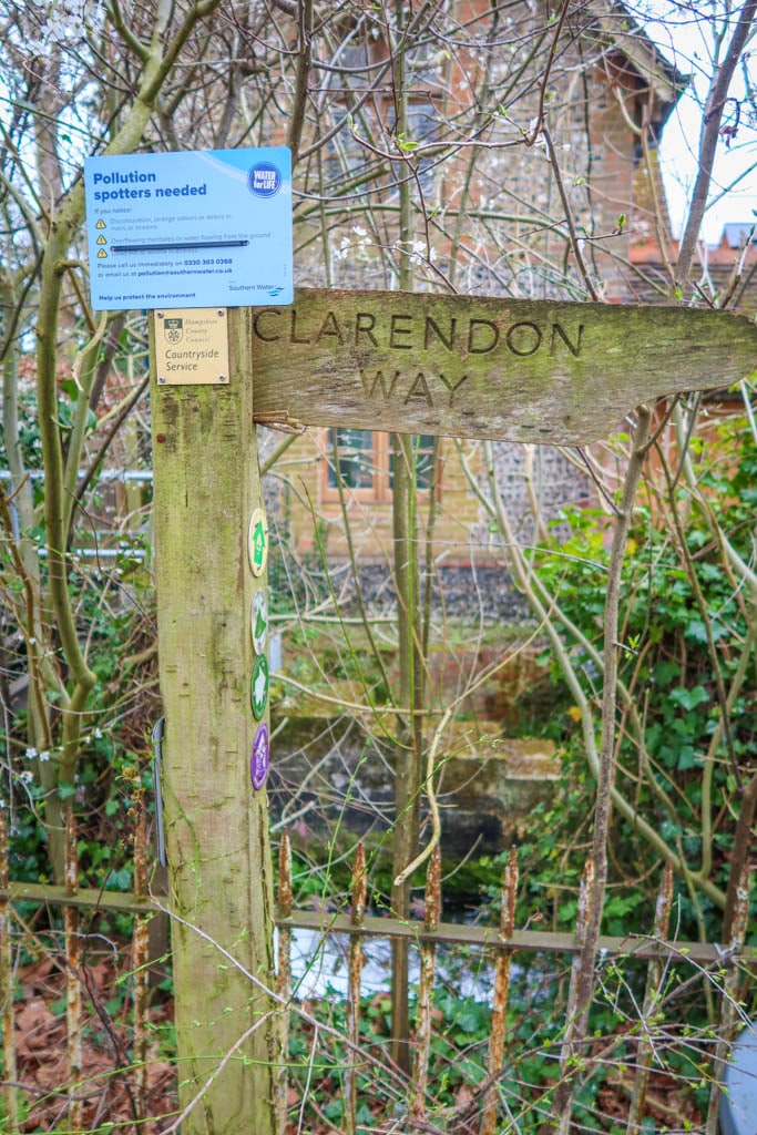
Clarendon Way
Allan King Way
- Distance: 42 miles (68 km)
- Starting Point: Porchester Castle
- Ending Point: King Alfred’s Statue in Winchester
The Allan King Way, also called King’s Way, is a walking path that begins at Porchester Castle. The route passes through Bishops Waltham and South Downs National Park before eventually following the River Itchen and ending at Winchester.
Unlike some of the other trails in this guide, this path is a more recent creation. The route was established by the Hampshire Rambler’s Association in honor of Allan King who was one of their founding members.
The FTK (Fastest Known Time) for completing King’s Way is held by Paul Webster. In 2019, he finished the entire trail in 6 hours and 43 minutes (supported).
Allan King Way just north of Winchester
Itchen Way
- Distance: 31 miles (50 km)
- Starting Point:Â Source of the River Itchen (near Hinton Ampner House)
- Ending Point: Southampton
Itchen Way follows the River Itchen in Hampshire. The path begins at the river’s source near Hinton Ampner House to its mouth in Southampton.
Itchen Way passes through the city of Winchester and shares some of the same footpaths as the other walks in this article.
A guidebook for Itchen Way is available for purchase from the Hampshire Rights of Way Improvement Trust here.
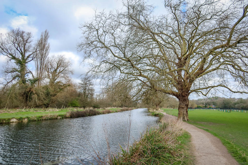
The River Itchen
Additional Resources
- Enjoy a Walk in Winchester – Winchester Tourism Center
- Walking Routes in the Hampshire Countryside – Hampshire City Council
Like this article? Pin it!

Note: This post contains affiliate links, which means I may receive a commission if you click a link and purchase something. While clicking these links won’t cost you anything, they will help me to keep this site up and running!

0 Comments