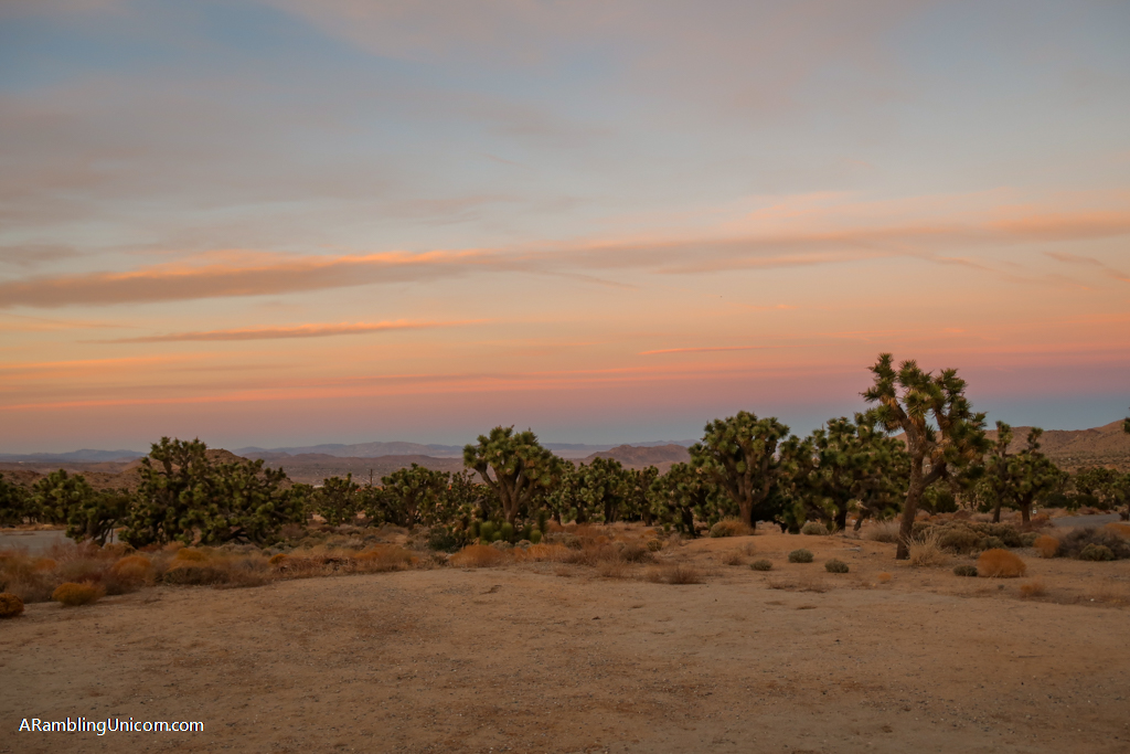
Escape the crowds in busy Joshua Tree National Park with these two easy yet rewarding trails. Tucked away in the park’s remote northwest corner, the South Park Peak and High View Nature Trails are great family-friendly hikes offering inspiring views. During my visit to Joshua Tree, I combined both trails into a single loop at dusk and was rewarded with a fabulous sunset from the top of High View Point.
Located near the Black Rock Canyon Campground and Nature Center, these short trails tend to experience less traffic than other routes in the main part of the park. Yet the are some of the best hikes in Joshua Tree National Park.
Only have one day to spend in Joshua Tree? Make the most out of your visit with this Joshua Tree day trip itinerary.
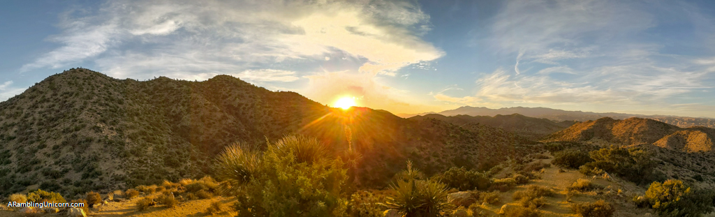
Sunset from High View Point on High View Nature Trail
Table of Contents
Trailhead and Parking Information
Both of these hikes are located at the same trailhead which is located just outside of Joshua Tree National Park’s northern boundary near the Black Rock Canyon Campground. Nestled among one of the area’s thicker stands of Joshua Trees, the campground is a short drive away from the town of Yucca Valley. The Black Rock Nature Center is worth a visit before starting the hike and provides natural exhibits as well as park information and maps.
Driving directions from Highway 62: turn south onto Joshua Lane in the town of Yucca Valley (this is about 5 miles west of the park’s west entrance). Drive about 5 miles and take a right onto San Marino Drive which turns into Black Rock Road. Just before the entrance to Back Rock Canyon Campground, take a right onto a dirt road. The parking area is another .7 miles along the dirt road past a horse camp parking area and an interagency fire station.
To access the Black Rock Nature Center and grab a trail map, continue into the campground rather than taking a right at the dirt road as described above.

Parking area for South Park Peak and High View Nature Trails
Preparing for a Hike in Joshua Tree
When planning your hike, remember that you are entering a desert environment and pack accordingly. There are no stores or restaurants once you enter the park, so you should come prepared with everything you need for your visit. Daytime temperatures can get really hot in Joshua Tree, especially in the summer months, so be prepared with adequate sun protection and plenty of water.
Avoid hiking during the hottest part of the day if you can help it (or hike during the winter months when it is cooler). Be sure to leave no trace of your visit behind and learn how to pee outside in case the urge strikes away from a bathroom.
Hiking Gear
This list includes some of my favorite gear for day hiking in the desert. If you’d like to spend more time in the backcountry, consider backpacking in Joshua Tree.
- Hiking Shoes – Sturdy hiking or walking shoes are a must. Personally, I’m a big fan of Altra Lone Peak Trail Running Shoes. I pair them with Dirty Girl Gaiters to keep sand and rocks from getting into my shoes.
- Socks – Good thick socks are also important. I usually wear a pair of double-walled Wrightsock Coomesh II socks with my Altras. For longer hikes, I switch to Injinji Midweight socks to prevent toe blisters.
- Backpack – A backpack is essential so you can carry water, layers, and snacks. I love Ospreys and use the Osprey Manta pack which is technically a men’s pack (because I have a longer torso than most women). The women’s equivalent is the Osprey Mira pack.
- Hiking Poles – Hiking poles reduce pressure on your joints and help maintain your balance if you trip. My current favorites are the LEKI Micro Vario Carbon Trekking Poles because they are super lightweight and fold down to easily fit into my suitcase.
- Electronics – if you are using your phone for navigation, bring a portable battery such as the Anker portable battery charger. For longer hikes or backpacking trips, consider bringing a Garmin InReach Explorer. This is a Personal Locator Device (PLB) that enables you to trigger a SOS call to search and rescue and 2-way texting over satellite.
South Park Peak Trail
- Distance – .6 miles
- Elevation gain – 216 feet
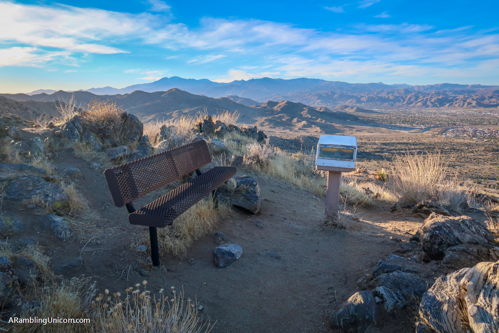
At .6 miles roundtrip, the South Park Peak Trail is a short but mighty hike with amazing views of Yucca Valley and beyond. The trail starts in a sandy wash and quickly climbs the 216 feet of elevation to the summit. A park bench perched on top of the hill provides a great place to relax and take in the valley below. The loop trail continues east past the summit and circles around the southern portion of the hill before returning to the parking area.
Although technically situated just outside of Joshua Tree’s boundary, the South Park Peak Trail shares the same trailhead as the High View Nature Trail (which is located inside of the park).
South Park Peak

The South Park Peak Trail begins by following this sandy wash
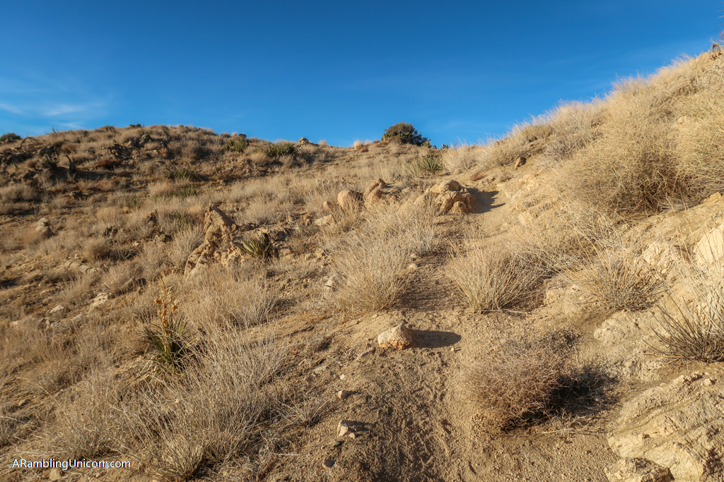
The trail climbs uphill towards South Park Peak
High View Nature Trail
- Distance – 1.3 miles roundtrip
- Elevation – 321 feet elevation gain
High View Nature Trail is a 1.3-mile loop that wanders through pinyon-juniper and Joshua Tree woodlands as it ascends up a short ridge. The highest point provides great views both towards Yucca Valley and San Gorgonio Mountain.
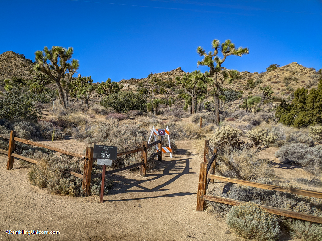
This trail begins to the left of the dirt parking area through a wooden fence. I chose to hike this trail counter-clockwise, so I stayed to the right at the junction. After passing an intersection for the West Side Loop Trail, I continued south until the trail circled back around heading north again. Here the trail climbs up a saddle and a short spur leads to High View Point. I happened to be here just at sunset and the views were incredible.
From here, the trail continues north towards the parking area. Several benches are positioned along the way to take advantage of the great views along the ridge.
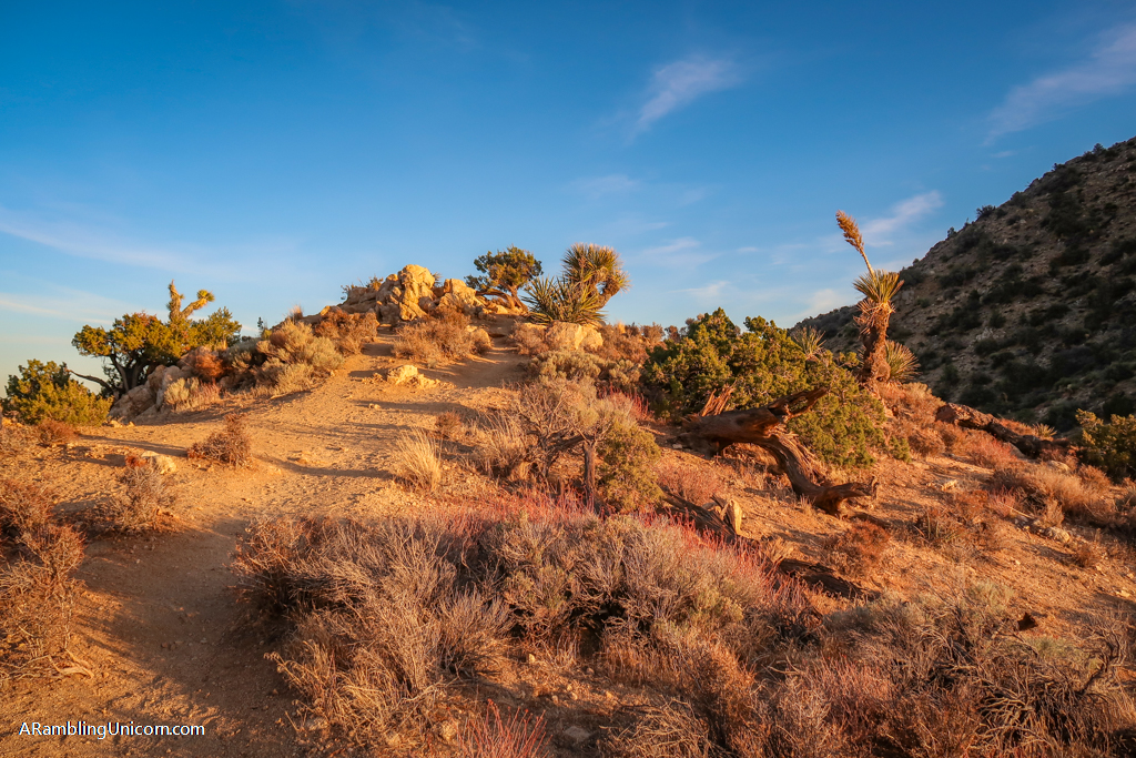
High View Point

A lovely vista as seen from High View Point
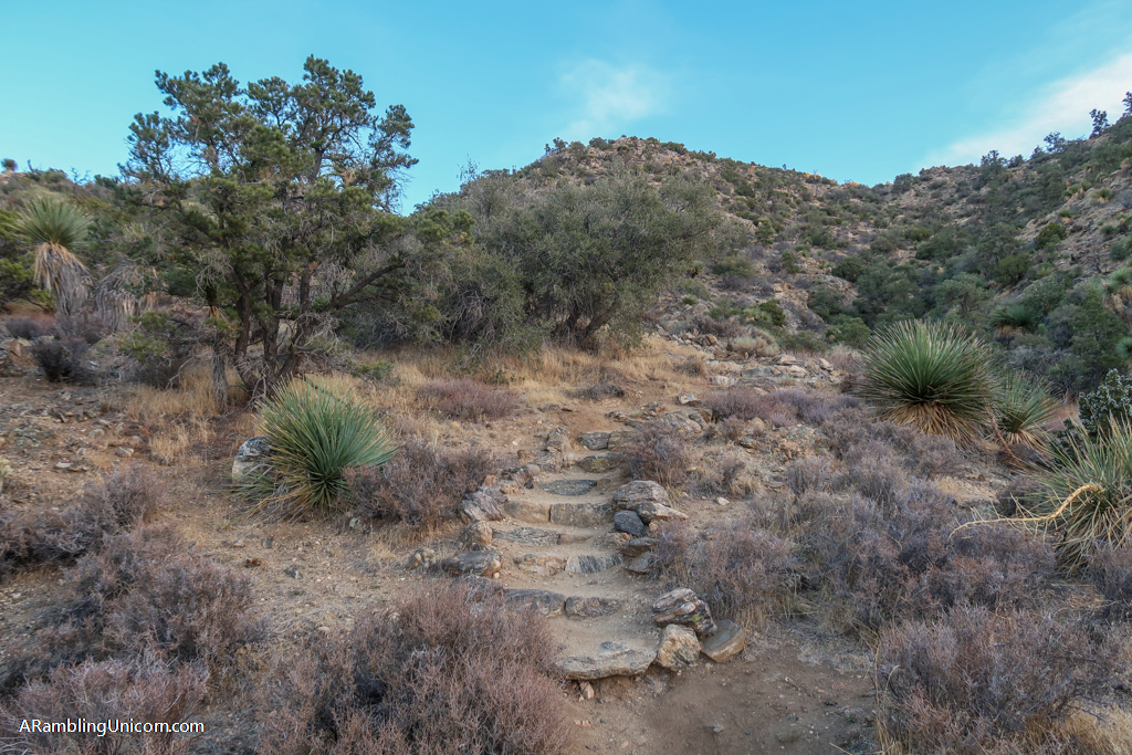
Some steps along the High View Nature Trail
South Park Peak-High View Nature Trail Loop
- Distance – 3 miles
- Elevation – 596 feet
During my visit to Joshua Tree, I decided to combine both the South Park Peak and High View Nature Trails into one loop starting at the Black Rock Canyon Nature Center. There are many trails to choose from in the Black Rock Canyon area and it’s easy to design your own route – just grab a trail map from the Nature Center and you’re good to go.
I started my 3-mile hike at the West Side Loop Trailhead near the Black Rock Nature Center. After hiking west for about half a mile, I reached the trailhead for South Park Peak and High View Nature Trails. I hadn’t initially planned to summit South Park Peak, but it’s such a cute little hill that I couldn’t help myself. I was glad I did.
After returning to the parking area, I headed south along High View Nature Trail and made it to High View Point just in time for sunset. From there, I retraced my steps back down to the saddle below. According to the map, there was a trail here that headed east towards the Black Rock Canyon Nature Center. After a little sleuthing, I found a faint trail that obviously hadn’t seen much use. The trail was steep and not in the best condition, but it did eventually lead back to the West Side Loop and the parking area.
If I had it to do over again, I would have completed the High View Nature Loop and then retraced my steps along the West Side Loop Trail back to the Black Rock Nature Center.
I began my hike at the West Side Loop Trailhead west of the Black Rock Canyon Nature Center
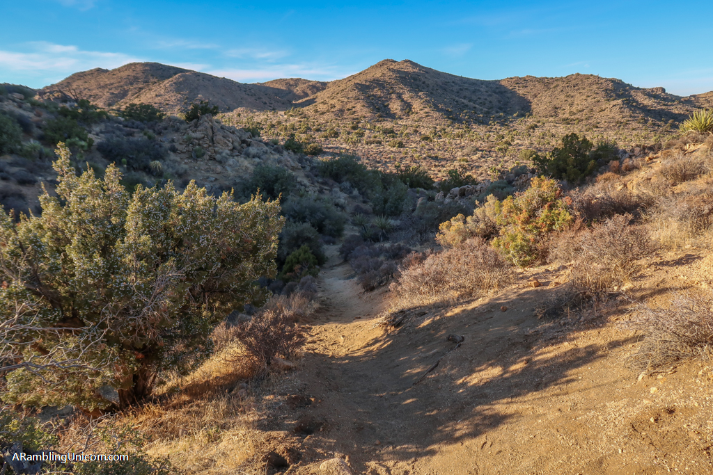
West Side Loop Trail. South Park Peak is the middle hill in the distance.
Black Rock Canyon at the golden hour
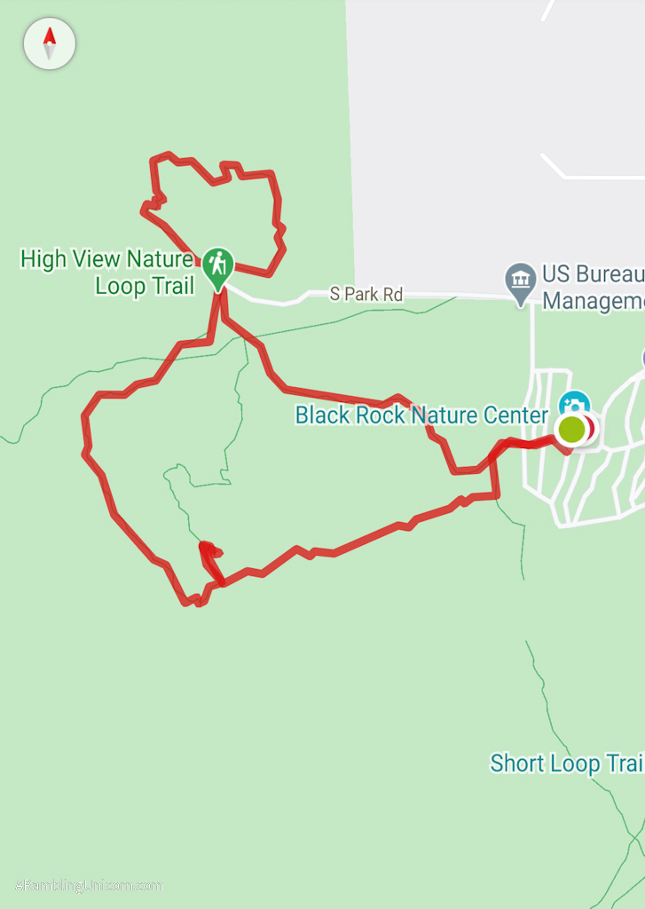
South Park Peak-High View Nature Trail Loop Map
Park and Parking Information
The fee to enter Joshua Tree National Park is $30 per vehicle which is good for seven days. I recommend buying the America the Beautiful Interagency Pass, however, which costs $80. This allows entry to all National Parks for an entire year, as well as most federal lands (including National Forests, Bureau of Land Management and more).
Be sure to check the Joshua Tree National Park web site for current conditions before heading to the park.
While you’re in the area, don’t forget to explore outside of the national park as well. There are lots of fun fun and quirky things to do near Joshua Tree besides hiking and camping.
Further Reading
If you enjoyed this trail guide, be sure to check out my other articles about Joshua Tree National Park!
- Joshua Tree Day Trip: The Ultimate One-Day Itinerary
- Best Hikes in Joshua Tree: The Ultimate Hiking Guide
- Backpacking in Joshua Tree: Tips for Successful Wilderness Camping
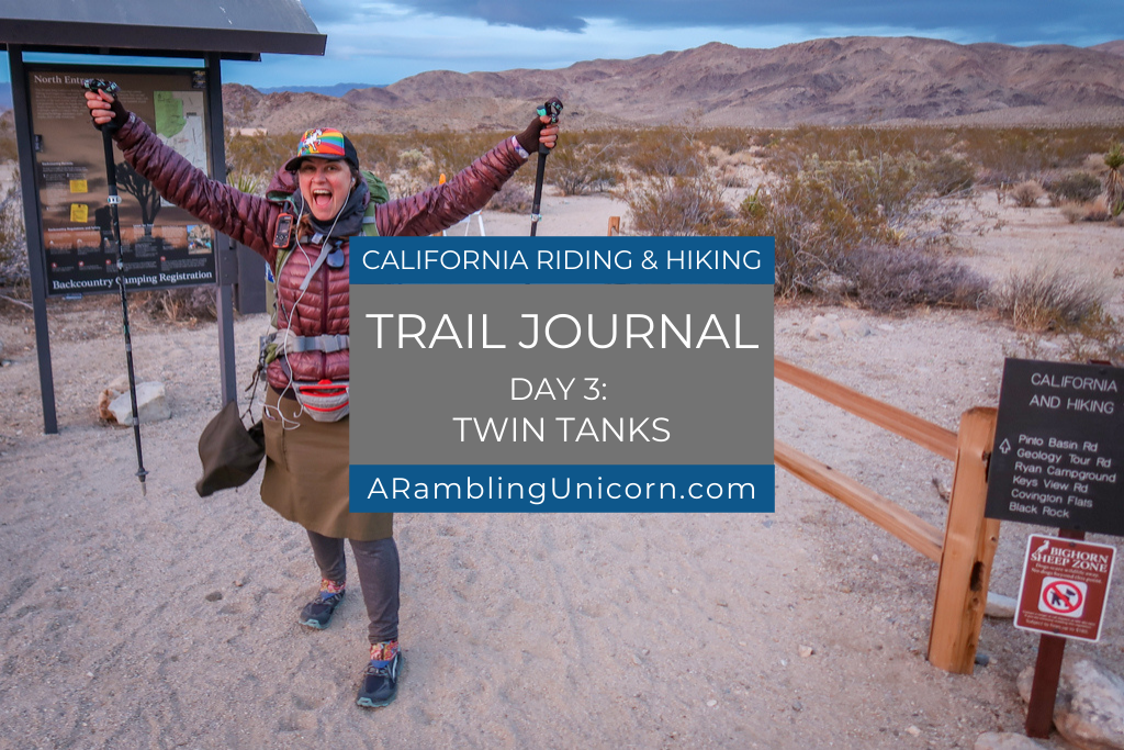
- California Riding and Hiking Trail: An Epic Joshua Tree Backpacking Adventure
- 10 Fun and Quirky Things to Do Near Joshua Tree
Have you hiked either the South Park Peak or the High View Nature Trails? I’d love to hear from you! Share your experience in the comments below.
Like this article? Pin it!

0 Comments