
Death Valley National Park. The name conjures images of a barren desert landscape filled with parched salt flats and inhospitable heat. Death Valley is notorious for being one of the hottest and driest places on earth with temperatures so high that you could fry an egg in a pan on the sidewalk. Literally.
In fact, so many people have tried to fry eggs in Death Valley that park officials have had to ask visitors to stop cracking eggs on the ground.
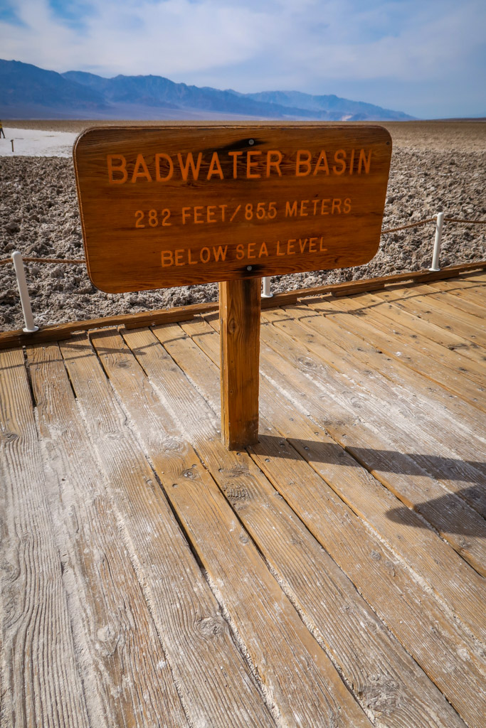
A land of extremes, Death Valley has many claims to fame. In 1913, the hottest official temperature on earth was recorded at Furnace Creek Ranch of a staggering of 134.1 °F (56.7 °C). With an average rainfall of less than 2 inches (5 cm) annually, Death Valley is the driest place in North America. The park also holds the distinction as the lowest point in the continent with an elevation point of 282 feet (85.5 meters) below sea level.
Yet despite its foreboding name, Death Valley National Park is full of life in unexpected places. The park is home to the rare Salt Creek Pupfish, which has evolved to survive the harsh conditions found in Death Valley. Other animals such as bighorn sheep and the desert tortoise have also adapted to desert life and thrive in the park.
The area’s unique nature and haunting beauty make it a fascinating place to visit. A million visitors flock to Death Valley each year who are drawn to the park’s surreal saltwater flats and undulating sand dunes. Given the harsh desert conditions at the park, however, it’s wise to do some advance preparation before heading to the park. About 3 people per year die from heat-related illnesses at Death Valley National Park.
Read on to learn how to best prepare for a visit to this magnificent national park. Since many visitors can only spend one day in Death Valley, this itinerary will walk you through the best things to see in a Death Valley day trip and how to make the most of your day.
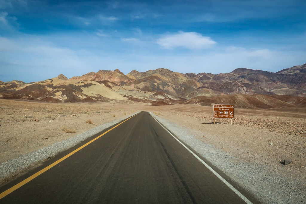
Driving towards Artist’s Palette in Death Valley National Park
Table of Contents
When is the Best Time to Visit Death Valley?
The first thing you should consider before heading to Death Valley is when to go. Temperatures regularly reach 120 F (48.8C) in the summertime, making it a potentially dangerous place to be at that time. Because of this, the best time to visit Death Valley National Park is typically from October to May.
Spring and fall are especially popular times to visit. When my husband Daniel and I visited Death Valley in March 2021, the temperatures were in the mid-80s (30C) during the day time. It was warm but still comfortable.
Despite the heat (or perhaps because of it), many people choose to visit Death Valley National Park in the summertime. If you do visit during the summertime, the National Park Service recommends you stick close to your air-conditioned vehicle and limit outdoor activities (such as hikes) to the early morning or evening hours.
Another way to beat the heat during summer is to stay at higher elevations. The park is surrounded by two mountain ranges that trap hot air inside of the valley. In fact, these mountains are frequently covered with snow – especially Telescope Peak which is over 11,00 feet (3350 meters) tall.
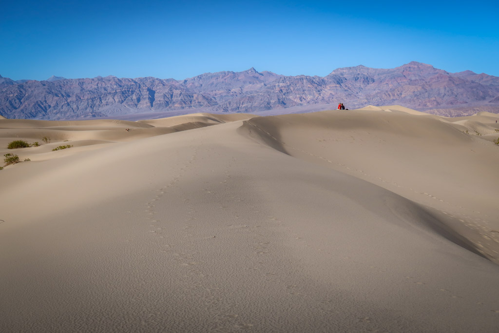
The Mesquite Flat Sand Dunes in Death Valley National Park
One Day in Death Valley at a Glance
This Death Valley one day itinerary is based on the assumption that you not visiting in the summertime. If you choose to visit in the summer, you may want to modify the timeline to avoid any activities during the hottest part of the day.
Please note: do not drive a vehicle off of the roadway onto the sand flats or sand dunes. Driving off designated roads is illegal in Death Valley.
- 9:00 am – Furnace Creek Visitor Center
- 10:00 am – Mesquite Flat Sand Dunes
- 11:30 am – Salt Creek Trail
- 12:30 – Lunch at Furnace Creek
- 2:00 pm – Harmony Borax Works
- 3:30 pm – Badwater Basin
- 4:30 pm – Artist’s Palette Scenic Drive
- 6:00 pm – Zabriskie Point at Sunset
One Day in Death Valley Full Itinerary

Much of Death Valley is below sea level
Furnace Creek Visitor Center
It’s best to begin your one day in Death Valley National Park at the Visitor Center. Here you can pay the park entrance fee, pick up park maps and talk to the rangers about current conditions and weather. For the National Park fans out there, you can get your passport stamped and pick up a collectible coin at the gift store. Other facilities located nearby include the Furnace Creek Gas Station, Furnace Creek Campground, the Ranch at Death Valley, Texas Springs Campground and the Oasis at Death Valley.
The Furnace Creek Visitor Center is located about a 30 minute drive west of the intersection of CA-190 and CA-127 at Death Valley Junction.
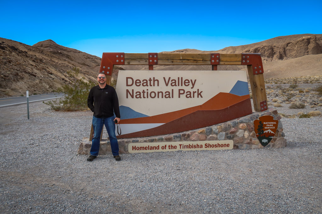
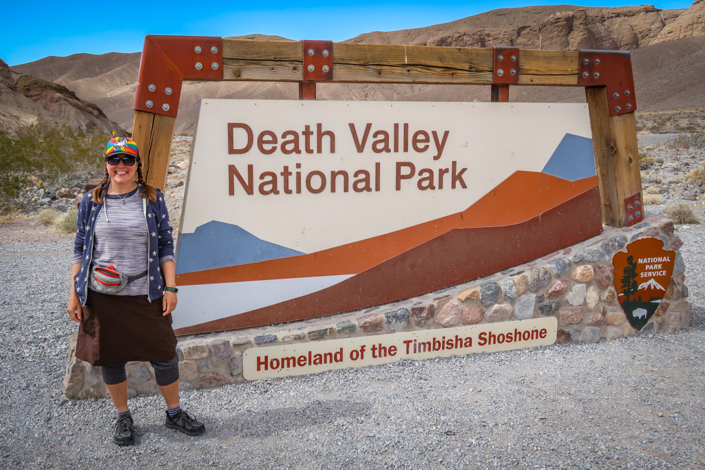
Welcome to Death Valley National Park!
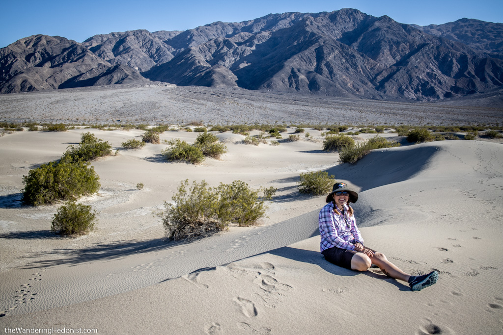
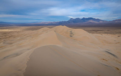
Mesquite Flat Sand Dunes
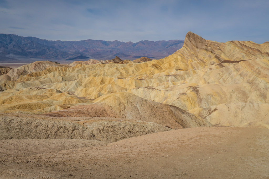
Death Valley is famous for the surreal salt flats that cover the valley floor in an endless expanse. Salt flats aren’t the only desert terrain in the park, however. Death Valley is home to five distinct sand dune systems. Of these, the Mesquite Flat Sand Dunes are the most popular. Here, visitors can explore the endless sea of dunes or play in the sand. You can also bring sand board and ride or sled down the dunes.
The Mesquite Flat Sand Dunes are easily accessible with a large parking area just off of just off of CA-190 near Stovepipe Wells. Note that sand boarding is only allowed at certain places in Death Valley National Park; be sure to check the official Death Valley sand dunes web page for more information before hitting the sandy slopes.
Hanging out on the Mesquite Flat Sand Dunes. Photo by Daniel.
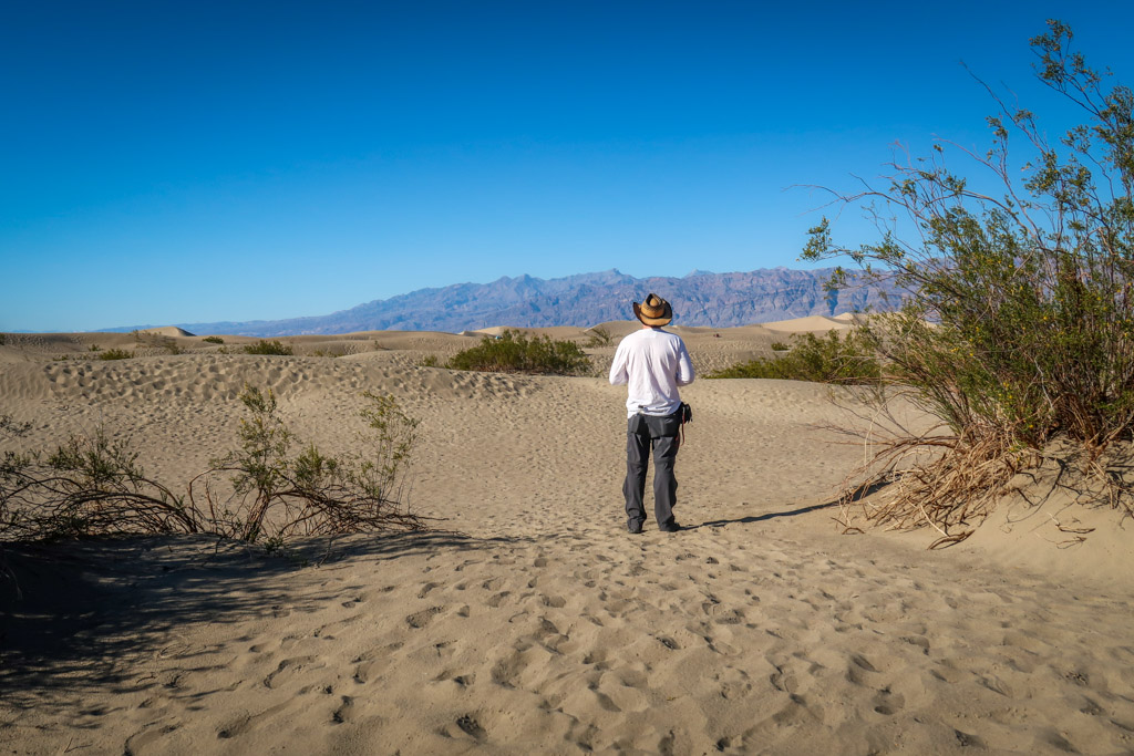
Daniel regards the sand dunes
Salt Creek Trail
Salt Creek is a seasonal creek that runs through Death Valley National Park near Highway 190. This is surprising to many visitors who assume the desert is devoid of any water. In fact, there are hundreds of small spring-fed seeps spread throughout the park, some of which create natural oases.
Salt Creek is notable because it is home to the rare Salt Creek Pupfish. These fascinating creatures are only found in Death Valley National Park and have evolved to withstand the area’s extreme dry conditions and high salinity of the creek’s water.
The Salt Creek Trail is an easy one-mile wheelchair-accessible boardwalk that is appropriate for all skill levels. The trail follows the creek and provides ample opportunities for viewing these remarkable fish. The best time to view the Pupfish is in the spring.
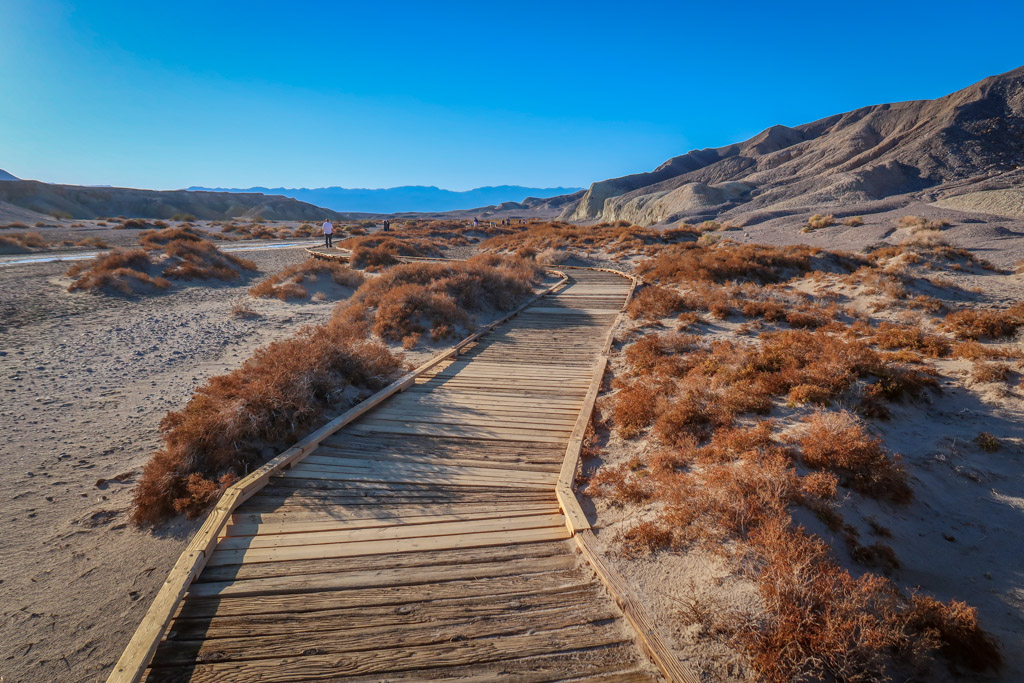
Walking the boardwalk along the Salt Creek Trail
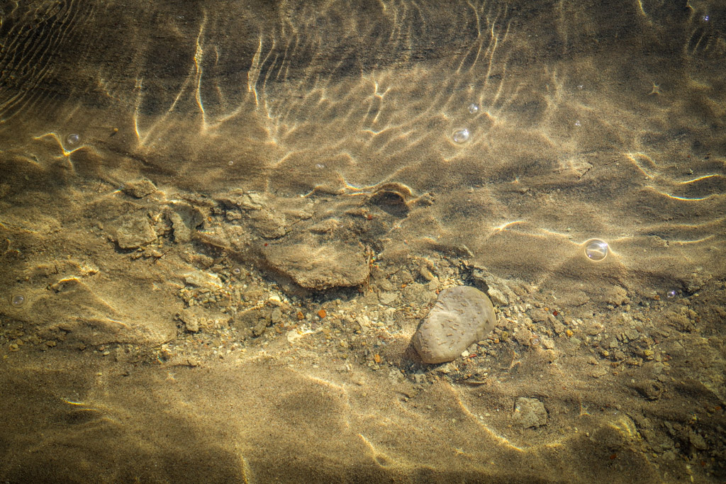
The Salt Water Pupfish are adept at blending in with their surroundings. How many Pupfish can you find in this photo?
Harmony Borax Works
Being the National Park nerd that I am, I have watched the Ken Burns documentary National Parks – America’s Best Idea several times. It was while watching this series that I learned about the history of Borax mining in Death Valley National Park. The Pacific Coast Borax Company mined Borax from Death Valley in the 1800s and used mule-drawn teams to haul out tons of Borax.
In fact, these mule-drawn teams served as the inspiration for the company’s slogan “20 Mule Team Borax”. Former National Park Service Director Stephen Mather worked at the Pacific Coast Borax Co. as a salesman early in his career and coined the slogan – which is still used to this day.
Visitors to Death Valley can see this piece of history by visiting the Harmony Borax Works. A short .4-mile trail (650 meters) loops around the abandoned mine and is accessible for all skill levels.
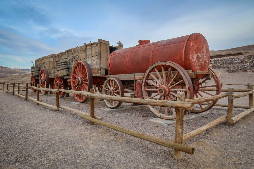
Mule teams pulled loads like this one full of Borax from the Harmony Borax Works in the 1800s.
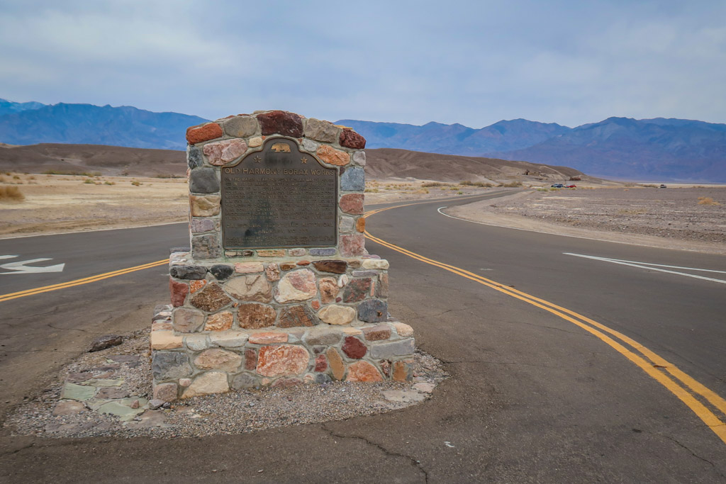
The Old Harmony Borax Works is a California Registered National Landmark
Lunch at the Furnace Creek Area
If you’ve been following along with this itinerary, you should pass through the Furnace Creek area again around lunch time. This is a good place to stop for lunch as there are lots of palm trees nearby to provide shade if you packed a picnic lunch.
A couple of restaurants are available to serve lunch including The Last Kind Words Saloon & Steakhouse and the Ranch 1849 Restaurant. Note that some of these facilities shut down for the summer months so be sure to check the status of the Oasis at Death Valley dining options online ahead of time.

The Inn at Death Valley in Furnace Creek
Badwater Basin
After lunch, head south on Badwater Road to access one of the highlights of Death Valley National Park: Badwater Basin. This spot officially marks the lowest point of elevation in the entire Northern Hemisphere at 282 feet (85.5 meters) below sea level. Here the salt flats stretch in either direction for nearly 200 square miles (518 square km).
For those wanting a closer look at the salt flats, an easy 1.5-2 mile (2.4-3.2 km) roundtrip trail leads deep into the basin. Be sure to look up at the rock face behind the basin for a sign marking where the sea level would be if the basin was full of water.
Please note: hiking the Badwater Basin Trail is *NOT* advisable in the summertime after 10:00 am.
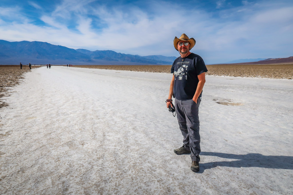
Daniel takes a stroll on the Badwater Basin Trail
Welcome to Badwater Basin!
Artist’s Palette Scenic Drive
Artist’s Palette is a scenic drive a that winds through the hills north of Badwater Basin. Here, the hills are splashed with an array of colors ranging from blues and pinks to reds and greens. These stunning colors are the result of volcanic deposits that are rich in various compounds such as iron oxides and chlorite.
This lovely drive is 9.7 miles in length and takes about an hour to complete, depending on how many stops you make. There are several pull-outs along the route so that visitors can get a closer look. The route is one-way, so look for the southern entrance to the loop drive on Badwater Road.
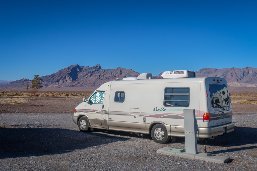
Please note: vehicles over 25 feet are prohibited due to sharp twists and turns along the road. It’s quite a hilly drive and we almost had to stop and let our transmission cool down in our Volkwagen Rialta motorhome.
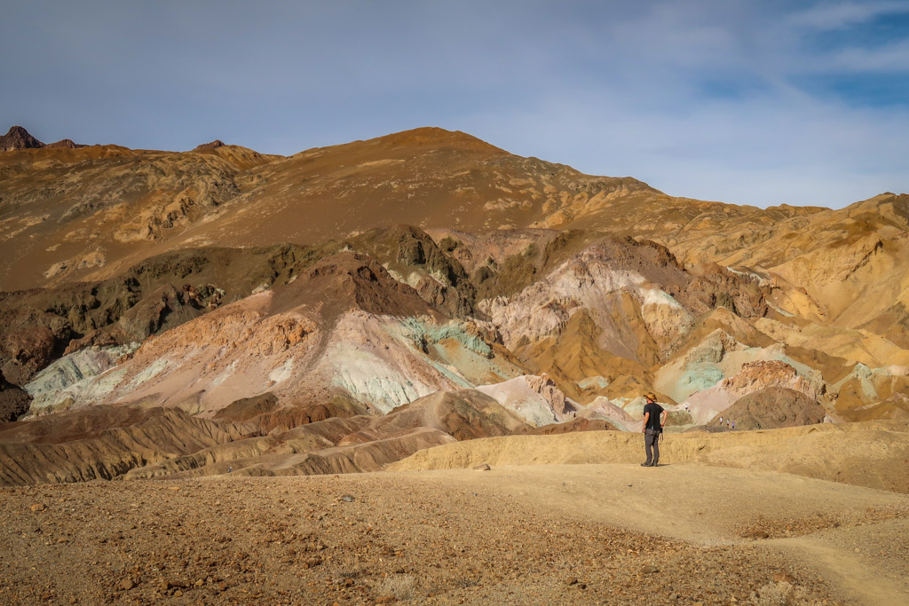
Artist’s Palette
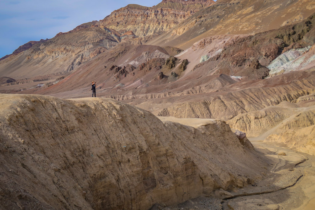
The photographer at work
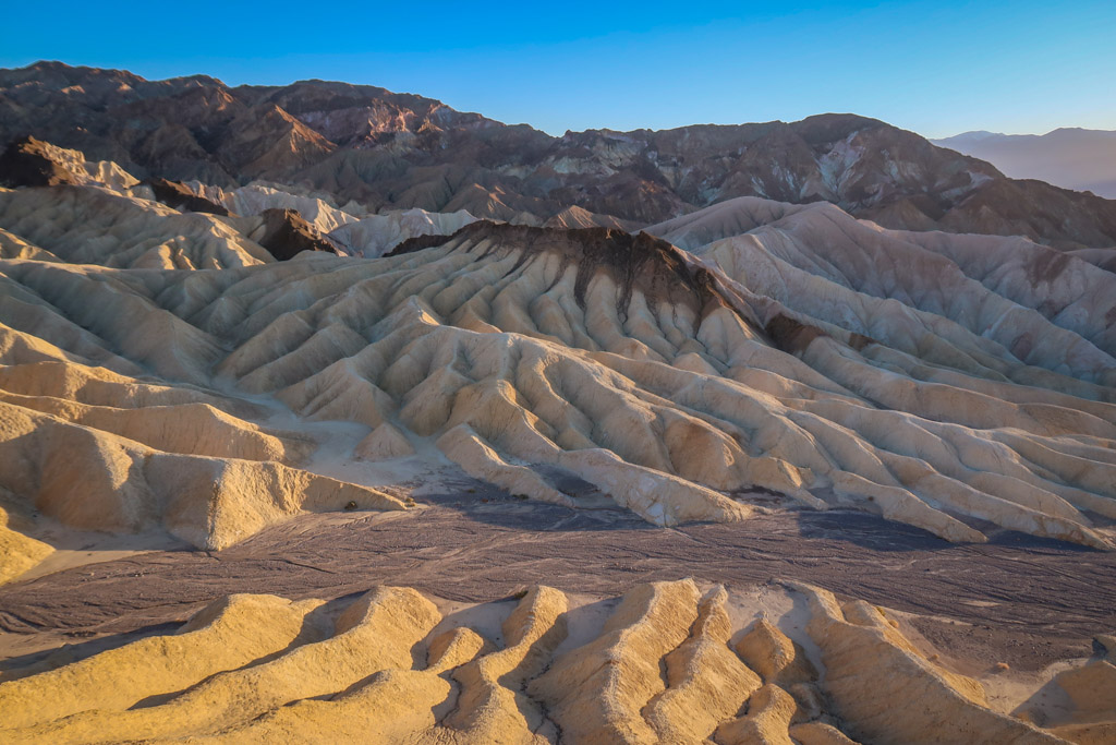
Zabriskie Point at Sunset
There’s no better way to end your one day at Death Valley National Park than by watching the sunset from Zabriskie Point. This vantage point has spectacular views of multi-colored Badlands as well as mountains rising majestically in the distance. Be warned that this is a popular sunset spot so arrive early to grab a good seat.
For another sunset-viewing option, check out Dante’s View south of Zabriskie Point. This spot affords sweeping panoramic views of Badwater Basin and the entire valley floor. Note this destination is located at an elevation of 5,475 feet (1668 meters) so be prepared for cooler weather. Daniel and I ultimately decided to skip Dante’s View since we weren’t sure if our motorhome’s transmission could handle the drive.

Sunset at Zabriskie Point
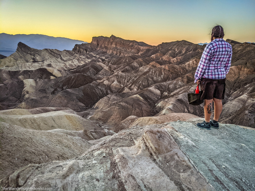
Catching the last rays of the sunset. Photo by Daniel.
The ethereal landscape of Zabriskie Point
Other Points of Interest
If one day in Death Valley isn’t enough time, consider extending your trip. There were so many amazing things to see in Death Valley National Park that I could have easily spent more time there. If you have an additional day (or two), consider adding the following to your itinerary:
- Hike the Golden Canyon – Gower Gulch Loop through the badlands by Zabriskie Point
- Visit Darwin Falls
- Trek along the Natural Bridge Canyon Trail and check out the Natural Bridge
- Hike the Mosaic Canyon Trail
- Visit the gift shop and general store at Stovepipe Wells Death Valley
- Catch the sunset from Dante’s View
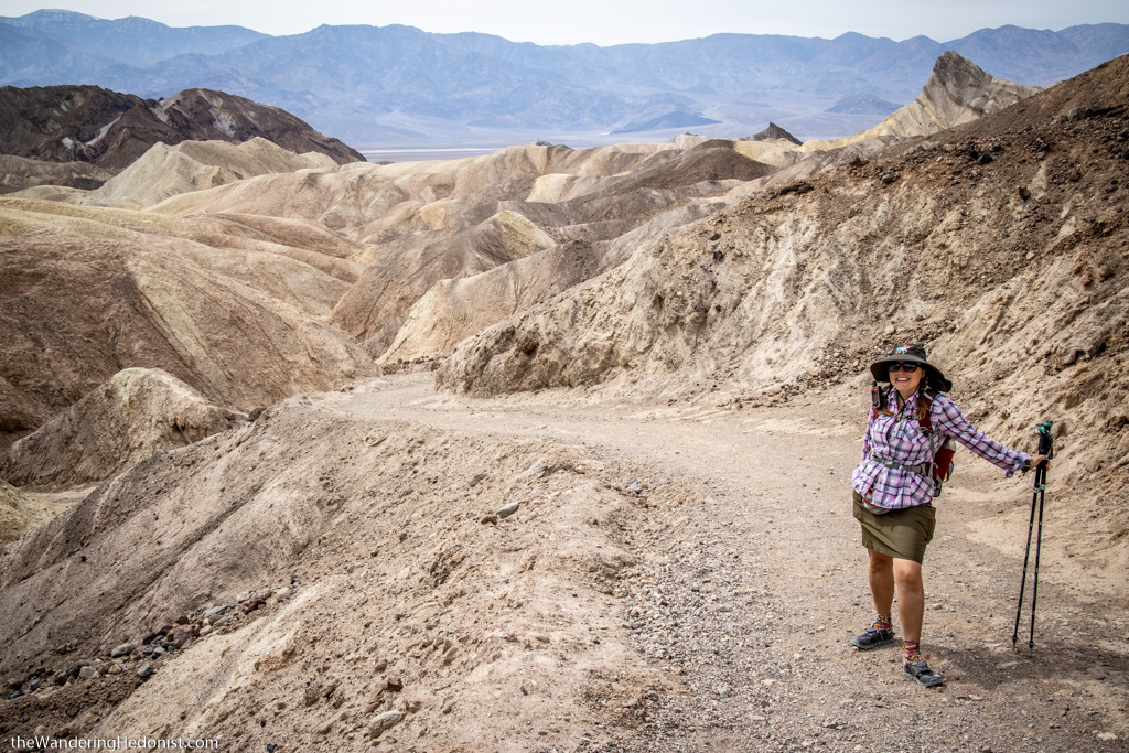
Hiking through the badlands by Zabriskie Point. Photo by Daniel.
Planning a Visit to Death Valley National Park
When planning a visit to Death Valley National Park, remember that you are entering a desert environment and pack accordingly. While there are some facilities throughout the park such as a gas station and a few restaurants, it is a big park and sometimes cars overheat due to the weather. You should be prepared to survive in the heat for a few hours in case your car breaks down.
Be sure to leave no trace of your visit behind.
Zabriskie Point
Entrance Fees and Parking
The fee to enter Death Valley National Park is $30 per vehicle which is good for seven days. Death Valley does not have toll booths to collect the fees, rather visitors are directed to buy passes online or at the visitor center or at fee kiosks.
I recommend buying the America the Beautiful Interagency Pass, however, which costs $80. This allows entry to all National Parks for an entire year, as well as most federal lands (including National Forests, Bureau of Land Management and more). Be sure to buy your pass online before arriving at the park in order to shorten the wait in line.
Welcome to Death Valley National Park!
Places to Stay in Death Valley
Death Valley National Park offers a variety of lodging options both inside and outside of the park. There are several hotels inside the park including The Oasis at Death Valley, Panamint Springs Resort, and Stovepipe Wells Village. For a unique hotel stay outside of the park, consider staying at the historic Amargosa Opera House Hotel in Death Valley Junction.
If camping is more your speed, there are quite a few options to choose from inside the park as well. For a complete list, check out the National Park Service’s official Camping in Death Valley page.
Since we booked our reservation last minute during the busiest time of the year, we did not secure a reservation inside of the park. Daniel and I ended up camping at the Longstreet Inn Casino & RV Resort just across Nevada state line. We actually quite liked it there and appreciated electricity hook-ups for our RV as well as easy access to bathrooms and facilities inside the Casino.
To read more about our experience at the Longstreet Inn, check out Daniel’s blog post: A Desert Casino on the Edge of Nevada.
Camping at the Longstreet Inn Casino & RV Resort
What to Bring
I recommend packing a lunch and lots of snacks, bringing plenty of water, and arriving with a full tank of gas. Check the weather forecast and make sure you’re prepared for the weather conditions. No cell reception is available throughout most of the park, so download hiking routes to your phone and maps in advance and pick up a paper map from the Visitor Center.
Most importantly, make sure you are prepared to deal with the high temperatures at Death Valley. Bring sun protection such as sunglasses, sun hats, and lots of sunscreen. Avoid hiking during the hottest part of the day (or hike during the winter months when it is cooler). If your car breaks down in the National Park do not leave your vehicle. Stay with it until help arrives and drink plenty of water.
Since this itinerary includes hiking, be sure to wear comfortable shoes. Here is a list of some of my favorite hiking gear:
- Hiking Shoes – Sturdy hiking or walking shoes are a must. Personally, I’m a big fan of Altra Lone Peak Trail Running Shoes. I pair them with Dirty Girl Gaiters to keep sand and rocks from getting into my shoes.
- Socks – Good thick socks are also important. I usually wear a pair of double-walled Wrightsock Coomesh II socks with my Altras. For longer hikes, I switch to Injinji Midweight socks to prevent toe blisters.
- Backpack – A backpack is essential so you can carry water, layers, and snacks. I love Ospreys and use the Osprey Manta pack which is technically a men’s pack (because I have a longer torso than most women). The women’s equivalent is the Osprey Mira pack.
- Hiking Poles – Hiking poles reduce pressure on your joints and help maintain your balance if you trip. My current favorites are the LEKI Micro Vario Carbon Trekking Poles because they are super lightweight and fold down to easily fit into my suitcase.
- Sun Hat – Protect your face (and scalp) with a broad sun hat. This sun hat is great because it has a wide brim and no back so it doesn’t bump into my backpack.
- Sun Shirt – Protect your neck and arms from the sun with a long-sleeved sun shirt. The Columbia Tamiami II is highly rated and comes with built-in UPF 40 sun protection.
- Sun Screen – Apply sun screen before hitting the trail and bring some along in case you need to reapply. I like these Banana Boat 1-oz tubes of sunscreen because they are super tiny and hardly take up any room in my bag.
- Camera – I love taking photos and always bring a camera along on my hiking trips. I use the Canon PowerShot G7X Mark II because it is lightweight yet has many advanced features.
- Electronics – if you are using your phone for navigation, bring a portable battery such as the Anker portable battery charger. For longer hikes or backpacking trips, consider bringing a Garmin InReach Explorer. This is a Personal Locator Device (PLB) that enables you to trigger a SOS call to search and rescue and 2-way texting over satellite.
Like this article? Pin it!

Loved reading this! It brought back wonderful memories of our trip there. Now I want to go anain!