
The Tatras are among some of the most beautiful mountains in all of Europe. These soaring peaks feature crystalline lakes along with picturesque valleys, flower-filled meadows, and incredible hiking trails.
Part of the Carpathian mountains in Eastern Europe, the Tatras Mountains form the border between Poland and Slovakia. While 90% of the mountain range is situated in Slovakia, the 10% that is located in Poland draws millions of visitors each year.
Nestled at the base of the Tatras Mountains, Zakopane is the natural jumping off point to explore the Polish Tatras. The town is located next to Tatra National Park with easy access and transportation options to all the popular Tatras hiking trails.
During a visit to Poland in August 2021 with my husband Daniel, I stopped by Zakopane for a few days in order to see the Tatras for myself. I decided to make the trip by myself from Krakow so I could focus 100% of my attention on hiking in Zakopane.
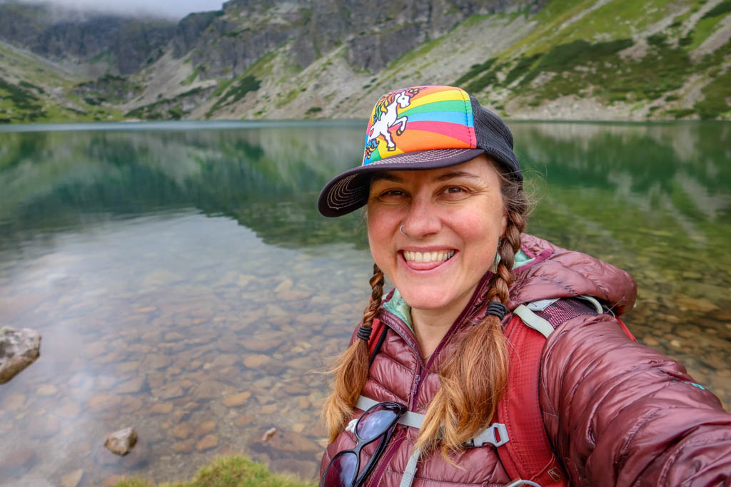
Selfie time at Czarny Staw GÄ…sienicowy in the High Tatras
The Slovakian Tatras are also reportedly very beautiful, but unfortunately the bus across the border to Slovakia is not running this year due to COVID. So, I spent my entire visit in and around Zakopane.
Zakopane is a busy resort town – so if you are looking for a quieter vacation you may want to stay somewhere else. That being said, I found it a convenient base of operations because there are numerous shuttle buses to nearby trailheads and I didn’t have a car.
Unfortunately, it rained pretty much the whole time I was there which impacted my hiking agenda. Luckily, the rain held out until the afternoon of my first day. So, I did get to spend my first morning in the High Tatras before the rain started in earnest. I spent the remainder of my time hiking at a lower elevation due to the bad weather.
Read on to learn more about my favorite trails in the Polish Tatras and tips for hiking in Zakopane!
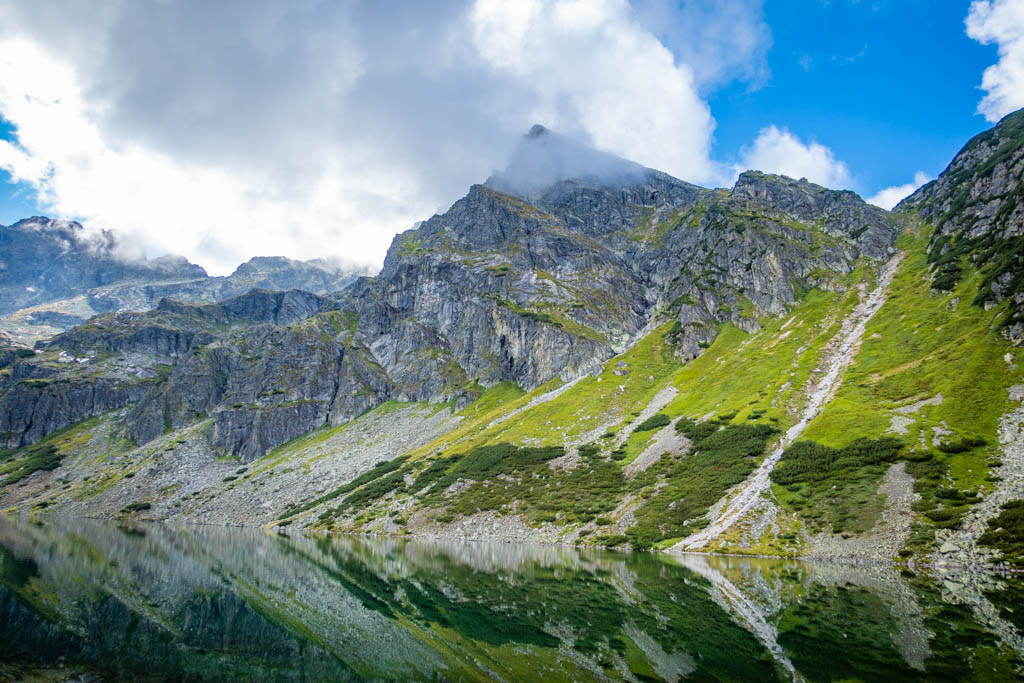
Czarny Staw with Kościelec Mountain in the background
Table of Contents
Hiking in Zakopane: Tatra National Park
If you plan on doing any hiking in Zakopane, then you will most likely be visiting Tatra National Park (TatrzaÅ„ski Park Narodowy). Established in 1954, the TNP covers 211.64 sq km (81.71 sq mi) and is one of Poland’s largest national parks.
Together with the Tatra National Park across the border in Slovakia, the area is protected as a UNESCO transboundary biosphere reserve. The park features over 170 miles (270 km) of hiking trails across two different mountain ranges.
The High Tatras are Poland’s tallest mountain range and are characterized by sharp-jagged granite peaks. The park’s best-known attractions are based in the High Tatras, including the picturesque alpine lake Morskie Oko and Poland’s tallest mountain – Mount Rysy.
While not as tall as the High Tatras, the Western Tatras are no less beautiful. These mountains are formed of slate and are generally more rounded in appearance. A number of famous caves are located in this part of the park, including Wielka Sniezna and several caves in the Kościeliska Valley.
Kościeliska Valley
Fee and Entrance Information for Tatra National Park
Tatra National Park is very busy in the high season so be prepared for crowds and plan accordingly.
There is limited parking available by Morskie Oko at Palenica BiaÅ‚czaÅ„ska and Åysa Polana, but these spots must be reserved online in advance. Parking costs 35 Polish zÅ‚oty ($8.74 USD) for cars and 70 Polish zÅ‚oty ($17.49 USD) for campervans.
I recommend traveling by minibus or public transportation from Zakopane if possible. There are lots of minibuses parked by the Zakopane train station which travel frequently to the most popular tourist spots. While these are inexpensive, it can be confusing to know which one to take. It’s best to ask the drivers for help on finding the right bus.
Once you’ve arrived at the entrance to Tatra National Park, be prepared to pay a small fee at the ticket booth. The fee for entering TNP on foot is 3.50 Polish zÅ‚oty ($0.87 USD) per day. You can buy tickets in advance on your phone at the Tatra National Park ticket page.
For current information on entrance fees and hours of operation, check the Tatra National Park web site.
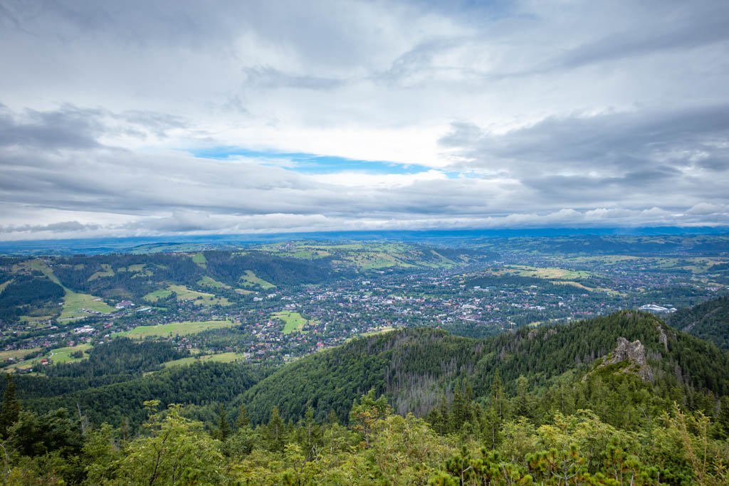
View of Zakopane from the top of Sarnia Skała in the Western Tatras
Zakopane Hike #1: Murowaniec Moutain Hut and Czarny Staw GÄ…sienicowy
- Distance: 8.4 miles (13.5 km) there-and-back; 10 miles (16 km) if you hike to the other end of the lake
- Elevation Gain: 2890 feet (880 m)
- Difficulty: Strenuous
- Trailhead: Kuźnice
Czarny Staw GÄ…sienicowy is a lovely alpine lake in GÄ…sienicowa Valley (Dolina GÄ…sienicowa) of the High Tatras. The lake is a popular day hiking destination and also a waypoint along longer distance hiking routes. The route passes a meadow with breathtaking views of the High Tatras as well as a mountain hut which serves drinks and hot food.
Note that there is more than one alpine lake in the High Tatras called “Czarny Staw” which simply means “black pond” in Polish. When checking your map, be sure to differentiate between the lakes by identifying the one located in Dolina GÄ…sienicowa.
Kuźnice Trailhead
The trail begins at Kuźnice, which is one of the most popular destinations in Tatra National Park. The Kasprowy Wierch Cable Car station is located in Kuźnice which shuttles visitors to the top of Mount Kasprowy. The cable car is very popular so plan to arrive early or be prepared to wait in a long line if you decide to ride it. There are also several shops and restaurants nearby.
The trailhead can be a little hard to find after arriving in Kuźnice. If you’re standing in the parking lot facing the cable car station, turn left and head east on Szlak Pieszy Niebieski (which means “blue walking trail” in Polish). You’ll go by a sport shop and restaurant before arriving at a small wooden ticket office directly before crossing the bridge.
Here is the exact location on Google Maps: Kasa TPN Kuźnice – wejÅ›cie na teren Parku (TPN ticket office – entrance to the Park)
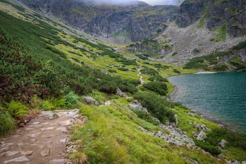
Hiking trail around to the opposite side of Czarny Staw GÄ…sienicowy
The Blue Trail vs the Yellow Trail
After arriving at the trailhead and paying the entrance fee, you’ll be faced with a choice: Blue Trail or Yellow Trail. The trails meet up after two miles and are approximately the same length, so you can take either one. I recommend taking one trail up and the other back down again to keep things interesting.
The Yellow Trail begins by following a stream through Jaworzynki Valley (DolinÄ™ Jaworzynki) and past some shepherd huts. The path is easy for the first 1.2 miles (2 km) as it passes through a valley that was historically used by shepherds, lumberjacks and miners. Then it climbs sharply uphill via a rocky path that has some switchbacks and stairs in places.
The Yellow Trail and DolinÄ™ Jaworzynki
The Blue Trail starts out by climbing uphill on a broad path through the forest until it reaches a small peak called Boczań. From there, the grade lessens somewhat as it continues through the forest. The trail eventually breaks out of the trees and continues along a ridge with sweeping views of Zakopane.
Personally I found the Blue Trail easier to hike as the path had a more consistent grade and was never as steep as the Yellow Trail. Also the ground was easier to walk on and less rocky. But both have lovely scenery.
The Blue Trail
GÄ…sienicowa Meadow and Murowaniec Mountain Hut
At the 2-mile (3.2 km) point, the two paths converge at the Przełęcz między Kopami. This mountain pass is a great place to stop and catch your breath as there are several benches here overlooking the view.
From here, the trail follows the blue blazes for the rest of the hike.
After hiking 2.8 miles (4.5 km) from the trailhead, the trail breaks out of the trees again and reveals GÄ…sienicowa Meadow (Hala GÄ…sienicowa). This scenic meadow features wildflowers and shepherd huts framed against a backdrop of the stunning High Tatras mountains.
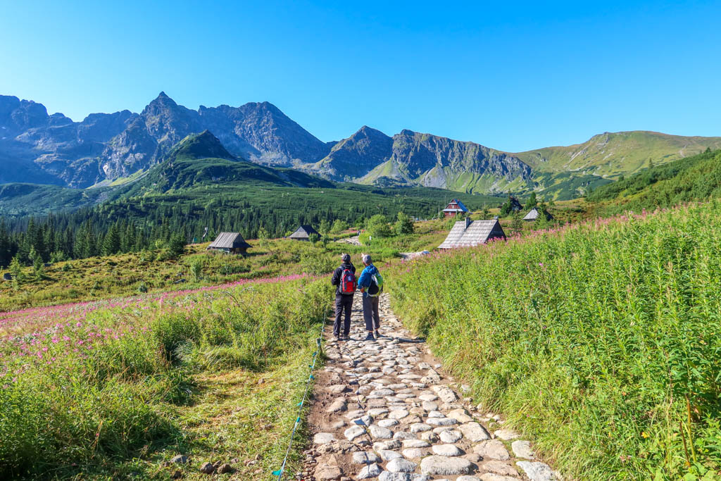
Lovely Hala GÄ…sienicowa (GÄ…sienicowa Meadow)
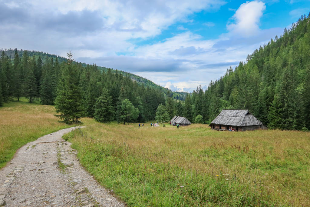
From here it is just a 5-minute walk to the Murowaniec Moutain Hut. The hut has nice flush toilets (which cost 2 Polish złoty) along with an impressive food and beverage menu. You can also sleep in the hut if you make reservations well in advance.
Be forewarned that this hut is *extremely* popular in the high season. I visited on a Saturday in August and had to basically fight my way through the crowds just to visit the toilet. I recommend arriving early before everyone else does.
More information: Schronisko Górskie PTTK Murowaniec
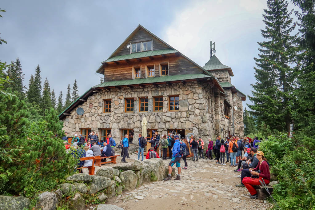
Murowaniec Mountain Hut can get really crowded in high season
Hiking to Czarny Staw GÄ…sienicowy
After leaving Murowaniec, it is only another mile (1.6 km) or so to the lake. Czarny Staw GÄ…sienicowy is the fifth biggest lake in the Polish High Tatras and features a small island near the northeastern shore.
Most hikers stop upon arriving at the lakeshore to admire the scenery and eat some snacks. The trail continues all the way around to the opposite side of the lake, however, where it continues into the High Tatras. There are fewer people on this side of the lake if you wish for a quieter alpine experience.
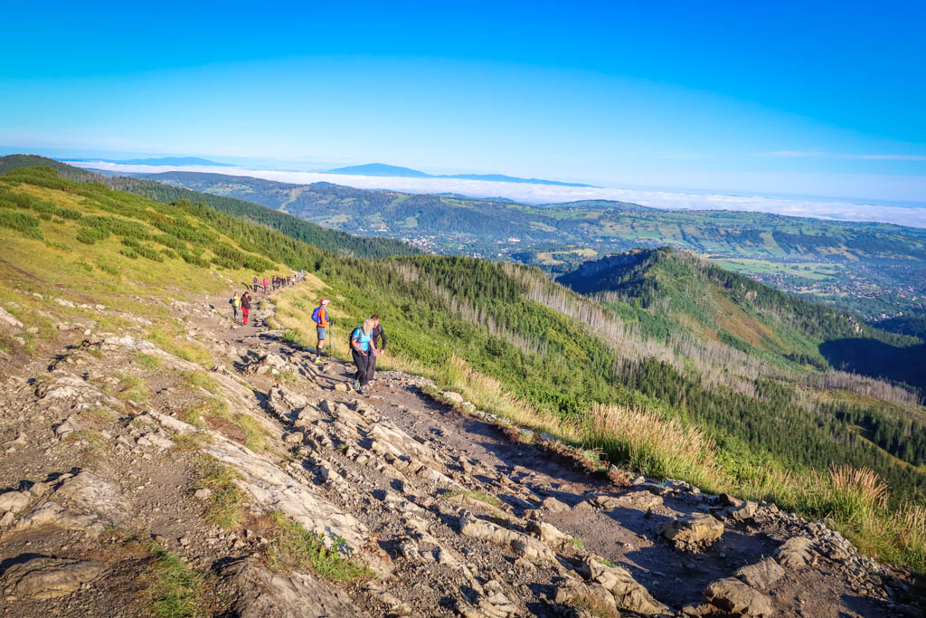
Kościelec Mountain towers above Czarny Staw at an elevation of 7071 feet (2155 meters). Hiking to the top of this peak is a popular pastime and I saw quite a few people hiking to the top. The trail looked incredibly steep however.
If you choose to extend your hike by trekking to the top of Kościelec, you can return to the mountain hut via a different scenic valley called Dolina Zielona Gąsienicowa. Be aware that this brings the total mileage for the hike to 11.2 miles (18 km) and the total elevation gain to 4300 feet (1310 meters).
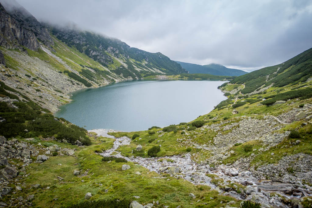
Czarny Staw GÄ…sienicowy
Zakopane Hike #2: Kościeliska Valley to Ornak Mountain Hut
- Distance: 7 miles (11.2 km) there-and-back to Ornak; 8.5 miles (13.7 km) if you continue to Smreczyński Staw
- Elevation Gain: 1893 feet (577 m)
- Difficulty: Easy
- Trailhead: Kiry-Kościelisko
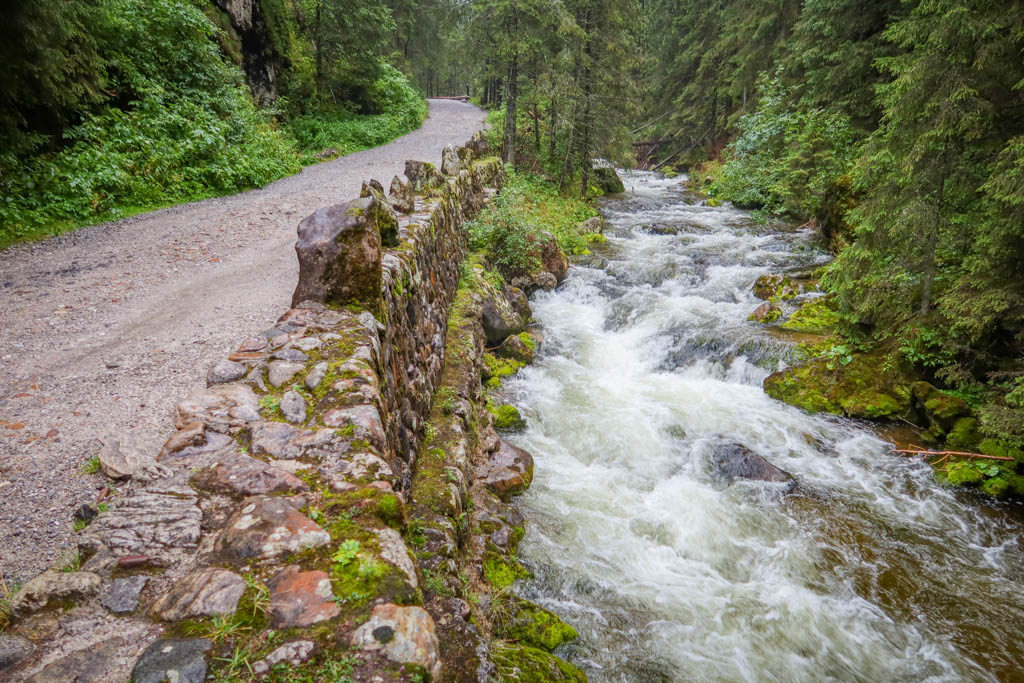
Kościeliska Valley (Dolina Koscieliska)
Koscieliska Valley (Dolina Koscieliska) is a lovely valley that follows the Kirowa Woda mountain stream into the Western Tatras.
The entrance to the trail is located in the small community of Kiry. Here is the location on Google Maps: TPN Kiry – pobór opÅ‚at
This is a fairly flat and easy trail that is also wheelchair accessible for a good portion of the way. There are also portable toilets conveniently positioned at several locations on the trail. For this reason, it is a popular trail with families that go hiking in Zakopane.
One of the biggest attractions in the valley are several caves, including Jaskinia Mroźna (Frosty Cave), Jaskinia Mylna (False Cave) and Jaskinia Raptawicka (Raptawicka Cave). These are easily accessible from the hiking trail. Note that some require paying an entrance fee.
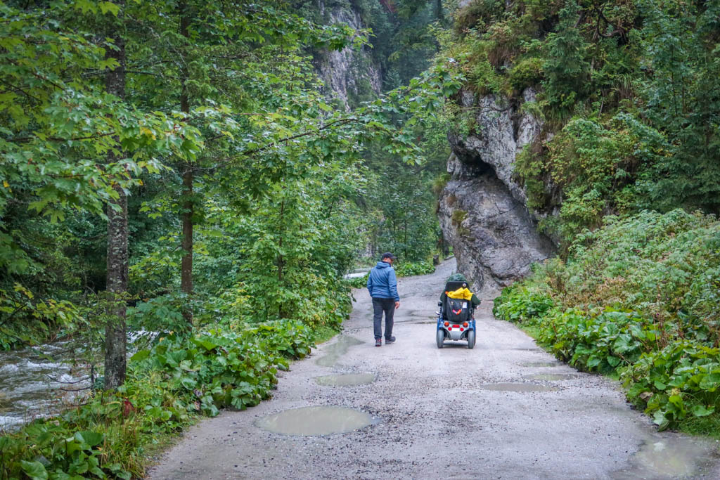
The Kościeliska Valley trail is accessible for hikers of most abilities
Ornak Mountain Hut
After walking along the trail for 3.5 miles (5.6 km), the path reaches Ornak Mountain Hut. This is a great place to stop for a hot meal and a drink before returning to the trailhead. You can also spend the night here and continue hiking into the mountains the following day.
If you wish to extend your hike, you can continue on to Smreczyński Staw (Lake) which is located 3/4 of a mile (1.2 km) from Ornak.
More information about the hut is available at the Ornak web site.
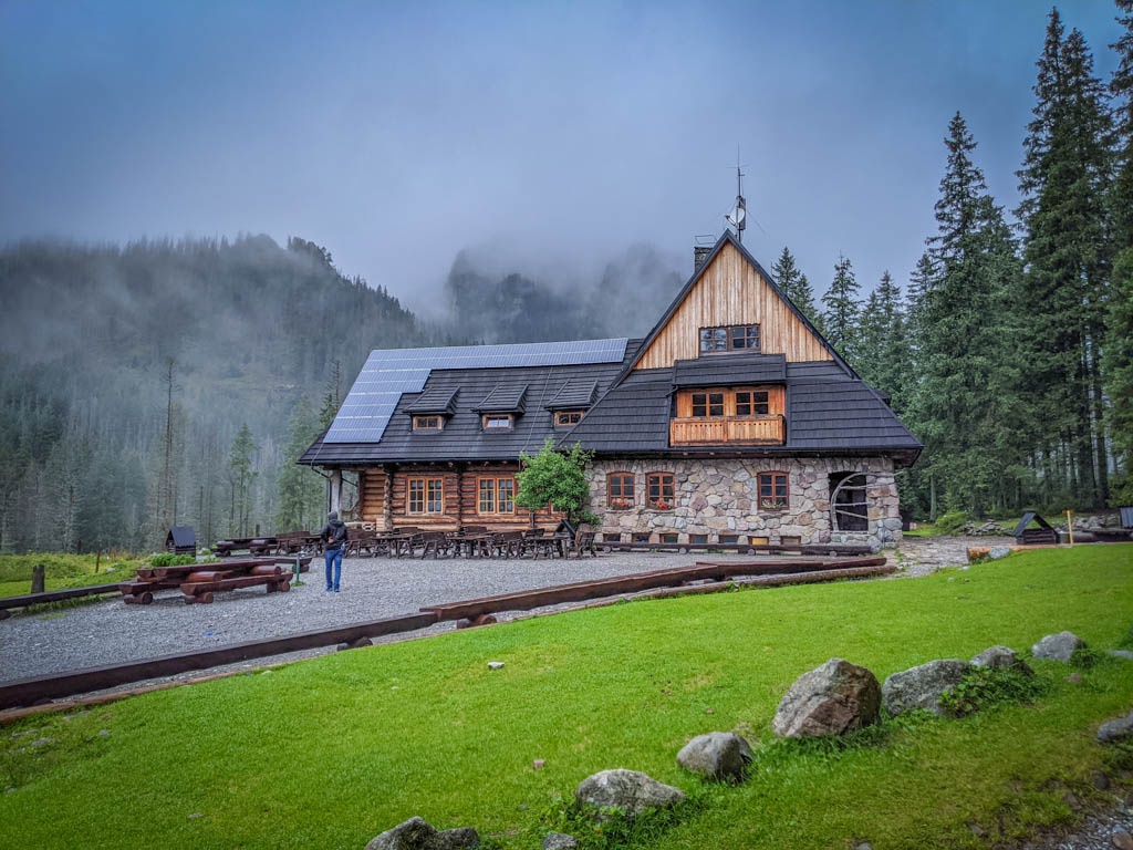
Ornak Mountain Hut on a rainy day
Zakopane Hike #3: Sarnia Rock via Strążyska Valley
- Distance: 5.5 miles (8.8 km) point-to-point
- Elevation Gain: 1841 feet (561 m)
- Difficulty: Moderate
- Trailhead: Dolina Strążyska or Wielka Krokiew
Strążyska Valley (Dolina Strążyska)
Sarnia Rock (Sarnia Skała) is a small mountain in the Western Tatras overlooking the town of Zakopane. The peak can be accessed by either hiking along Strążyska Valley (Dolina Strążyska) or via Białego Valley (Dolina Białego).
Another option is to hike along one valley on the way out and the other one on the return trip.
When I summited Sarnia Rock, I decided to start at Strążyska Valley. Here is the location on Google Maps: Punkt wejÅ›ciowy do TNP – Dolina Strążyska
The trail is wide and flat and fairly easy for most skill levels. After about 1.3 miles (2 km), the trail reaches Strążyska Clearing (Polana Strążyska) with some benches and a shepherd’s hut.
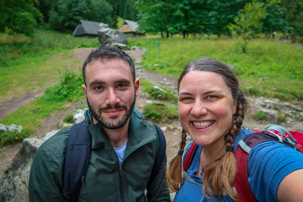
Selfie with my hiking partner for the day, Daniel, who I met at the hostel
Siklawica Waterfall (Wodospad Siklawica)
After reaching Strążyska Clearing, be sure to continue straight along the trail for five minutes or so along a small mountain creek. A lovely waterfall is located at the end of the trail which is definitely worth the visit.
After admiring the waterfall, retrace your steps back to the clearing and take the black trail heading uphill towards Sarnia SkaÅ‚a. The trail is a bit steep so I recommend heading back to the entrance of Strążyska Valley if you’re not up for a decent climb.
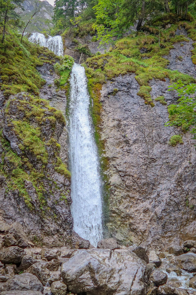
Siklawica Waterfall (Wodospad Siklawica)
Sarnia Rock (Sarnia Skała)
The path to Sarnia Rock is rocky and steep but worth the effort. Be sure to watch your footing if you are hiking in the rain as the rocks can get slippery.
After hiking for .8 miles (1.3 km), the trail reaches Czerwona Pass. This is a great place to stop and catch your breath before making the final push to the top.
To reach the summit, follow the black trail signs for Sarnia Skała. Be aware that a bit of scrambling is required to reach the summit at the very end.
Once you are done admiring the views, return to Czerwona Pass. Here you can choose to either return the way you came or by hiking through Białego Valley.
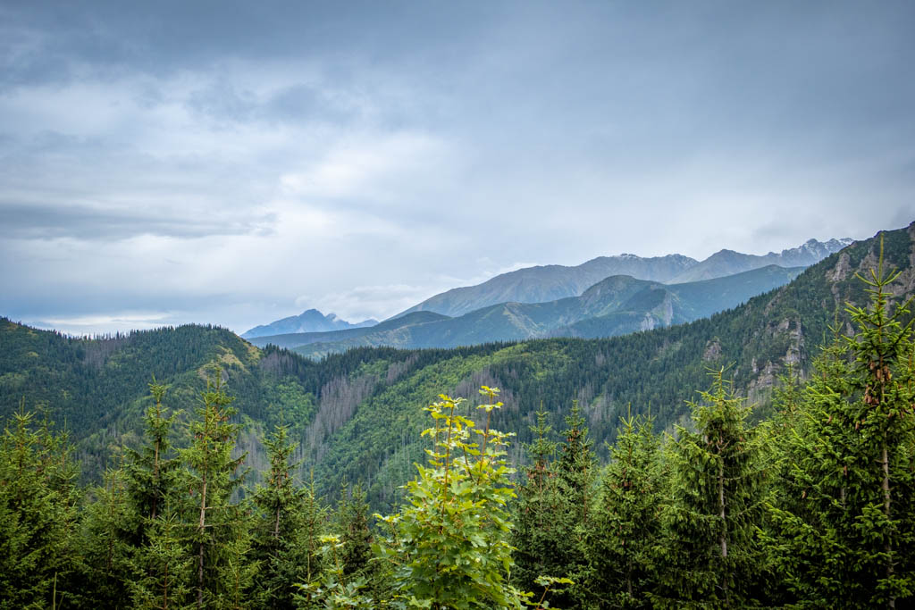
View from the top of Sarnia Skała with the High Tatras in the distance
Planning a Zakopane Hiking Adventure
When planning your hike, remember that you are entering a rugged outdoors environment and pack accordingly. While some of these trails go by mountain huts which have food and bathrooms, others don’t.
You’re going to be doing lots of walking so be sure to wear sturdy hiking shoes. Check the weather forecast and make sure you’re prepared for the weather conditions with plenty of layers or sun protection as appropriate.
Many of the trails in Zakopane are popular so consider hiking early in the mornings or the evenings to miss the crowds.
If you choose a remote hike, bring water and snacks. Familiarize yourself with proper hiking bathroom etiquette if you are hiking away from developed areas and bathrooms.
Be sure to leave no trace of your visit behind.
What to Wear When Hiking in Zakopane
Not sure what to bring or wear on your hike? This list includes some of my favorite gear for hiking in the mountains.
- Hiking Shoes – Sturdy hiking shoes are important. I’m a big fan of Altra Lone Peak Trail Running Shoes and pair them with Dirty Girl Gaiters to keep rocks from getting into my shoes.
- Socks – Good thick socks are key. I usually wear a pair of double-walled Wrightsock Coomesh II socks with my Altras. For longer hikes, I switch to Injinji Midweight socks to prevent toe blisters.
- Backpack – I love Osprey backpacks and use the Osprey Manta pack which is technically a men’s pack (because I have a longer torso than most women). The women’s equivalent is the Osprey Mira pack.
- Hiking Poles – Hiking poles reduce pressure on your joints and help maintain your balance if you trip. My current favorites are the LEKI Micro Vario Carbon Trekking Poles because they are super lightweight and portable.
- Camera – I love taking photos and always bring a camera along on my hiking trips. I use the Canon PowerShot G7X Mark II because it is lightweight yet has many advanced features.
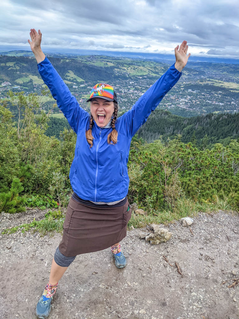
Victory pose on the top of Sarnia Skała
Maps and Navigation for Hiking in Zakopane
The first rule of not getting lost when hiking in Zakopane is to always know where you are. The good news is that most of these trails are clearly marked with signs and red blazes.
Even so, it is easy to get turned around. So be sure to have a map along and consult it regularly.
While cell reception is available throughout some areas closer to Zakopane, there is limited reception in the higher elevation areas. Be sure to download maps to your phone in advance.
Pro tip: GPS will work on your phone even if you have no cell signal. But it won’t do much good if you haven’t downloaded a map for the area.
If you are using a phone for navigation, bring a portable battery such as the Anker portable battery charger and protect it from the rain and elements.
AllTrails.com is a good resource for hiking maps and most routes in this guide can be found there. This is great for beginners because you can navigate using GPS without having to worry about GPX tracks.
Note that although the maps are free, downloading them to your phone requires a Pro subscription.
You can also download GPS trax from other hiking web sites.
If you’re heading to a remote location with spotty reception, I recommend downloading the GPX tracks rather than relying on Google maps. Keep in mind that you’ll need to download a navigation app first before using the GPX file. OsmAnd is a great tool for this (especially when hiking in Europe).
Have you gone hiking in Zakopane? If so I’d love to hear from you! Leave your comment below.
Note: This post contains affiliate links, which means I may receive a commission if you click a link and purchase something. While clicking these links won’t cost you anything, they will help me to keep this site up and running!

0 Comments