5 Miles
200 feet elevation gain
On Saturday, Daniel and I decided to explore the Middle Fork Snoqualmie River area. We were looking for a relatively easy trail near Seattle and I wanted to go someplace new. The closest I’ve previously been to the Middle Fork Snoqualmie River is when I hiked the increasingly popular Mailbox Peak trail earlier this spring.

At the Middle Fork Trailhead
As we passed Mailbox Peak on the way to the trail, we could see cars overflowing from the parking lot and lining the road for half a mile in either direction. Glad to escape the crowds, we continued along the Middle Fork Snoqualmie River Road for another 10 miles. The road is newly paved and winds through pristine forests along the banks of the Snoqualmie River. We passed many small turnouts and trailheads along the way that were virtually empty. I guess everyone else was too busy hiking Mailbox Peak.
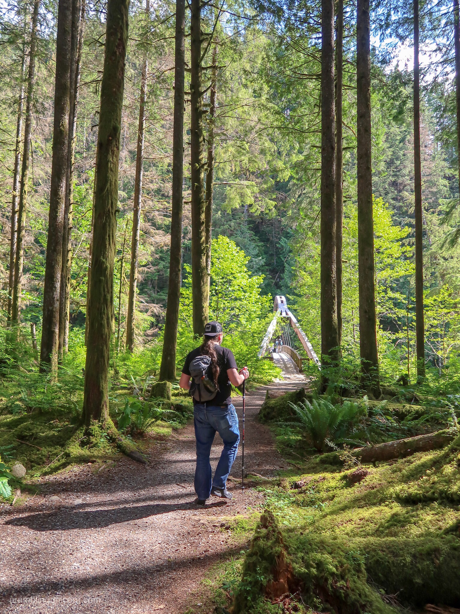
Daniel approaches the footbridge over the Snoqualmie River
We arrived at the Middle Fork Snoqualmie Trailhead around 3:30 pm. It has a spacious parking area and an even bigger overflow parking lot which were both fairly empty. I suspect that folks may be avoiding this trailhead because the Middle Fork Snoqualmie River Trail is currently closed due to a washout. This was fine by me as we had the place almost to ourselves.

Picnic area near the Middle Fork Snoqualmie River Trailhead. Â Photo by Daniel.
The trailhead has a nice day use area which includes several wheelchair-accessible picnic tables along a path to the river. The path is made of crushed gravel and is easily navigable by wheelchairs and strollers. It’s a lovely spot to have a picnic or to play in the river.

Crossing the footbridge. Photo by Daniel.
After exploring the day use area, we crossed the footbridge over the river and took the right fork for the Pratt River Trail. The path winds in and out of moss-covered Douglas Fir trees along the west bank of the Snoqualmie River to its junction with the Pratt River. It’s a fairly easy trail with just enough switchbacks and stairs to keep things interesting. We only encountered one muddy patch, but a wooden beam is placed over it so we didn’t have to get our feet muddy.

On the Pratt River Trail
We walked for 2.5 miles and decided to turn back before we reached the Pratt River as it was starting to get late. I was delighted to discover that the trail continues along the Pratt River all the way to Pratt Lake (although apparently it is not very well-maintained). From Pratt Lake multiple trails connect to the west side of the Alpine Lakes Wilderness along the I-90 corridor. That sounds like fun overnight or weekend trip.

One of the few switchbacks on the Pratt River Trail
I’m so excited to discover this neck of the woods. I can’t wait to come back and explore more.

View of the Snoqualmie River from the Pratt River Trail

Hey Unicorn! I am heading up to Seattle next week for a work conference and will have time to take a nice long day hike on Friday while I am there (I’ll have a rental car and am willing to drive an hour or two away). Wondering if you can suggest a few hikes around 8 miles or less that will be relatively snow/crowd free? Thanks so much and enjoy reading your blog! – Ben
Hi Ben! That’s awesome! Yes I definitely can recommend some hikes for you. Mt Si is the local favorite – it’s 8 miles with 3150 feet elevation gain so it’s a decent workout. You won’t be alone on that hike though, although the crowds will be a little less on a Friday. You might also try Poo Poo Point – it has lovely views of the sound. There are 2 trails – one starts at Issaquah High School and is 7 miles roundtrip. The other one, Chirico Trail, is only 3.8 miles but it’s a lot steeper – it’s also more popular and can get crowded. If you want less crowds and prefer a flatter trail with mossy forests, the Pratt Lake Trail and Carbon River Trails are both lovely. Hope you get some nice weather! Good luck 😊
Thank you so much for the suggestions!