
Issaquah is a suburb of Seattle, Washington nestled in the foothills of the Cascade Mountains. Known unofficially as the Issaquah Alps, these foothills are crisscrossed with a network of fabulous hiking trails that are 45 minutes or less from Seattle.
From spectacular views of the Puget Sound to magical paths through moss-laden forests, the Issaquah Alps offer a variety of recreation opportunities as well as some of the best hikes in Issaquah and beyond.
I’m an experienced hiker who has hiked thousands of miles on trails all over the world, but I keep returning to the Issaquah Alps. When I lived in Seattle, I spent years exploring these small mountains. In fact, my first solo hiking experience was on Tiger Mountain.
I have grown very fond of these foothills over the years and try to visit them any time I’m in the area.
This guide will introduce you to a variety of my favorite hikes in Issaquah from kid-friendly strolls through the woods to long-distance treks that will challenge the most experienced hiker.
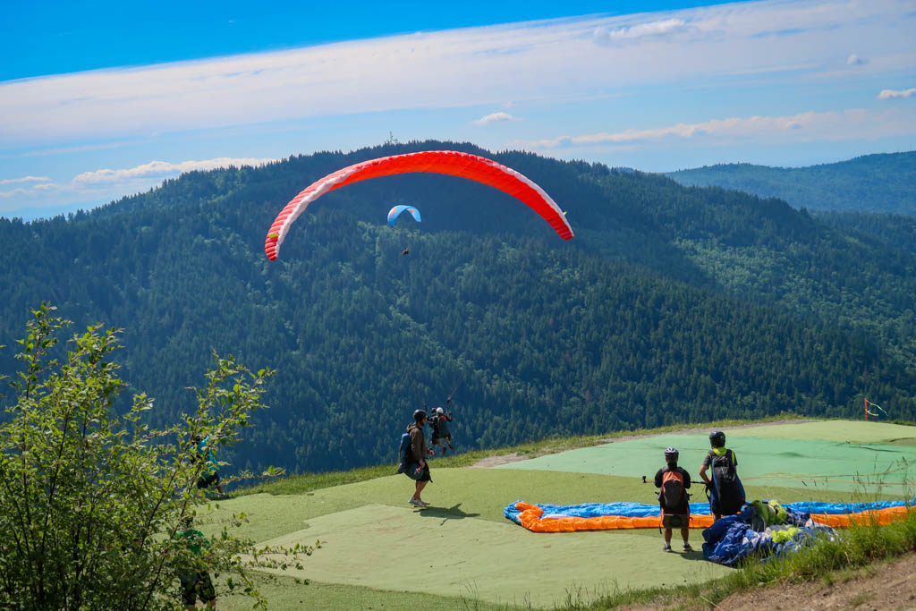
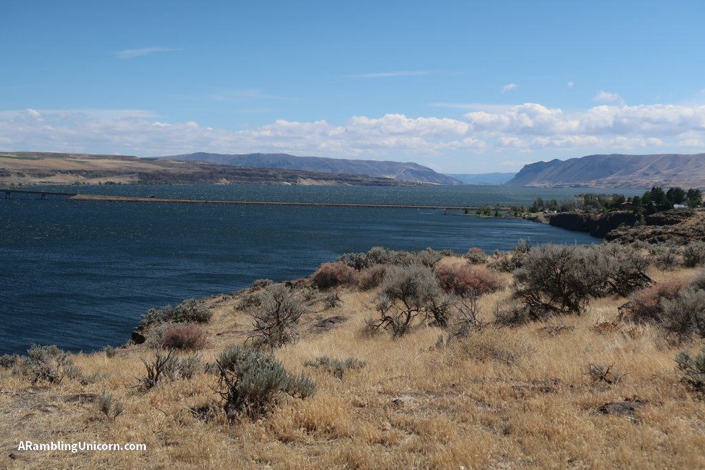
Paragliders launch from Poo Poo Point on Tiger Mountain
Table of Contents
A Brief History of the Issaquah Alps and Harvey Manning
In 1976, Harvey Manning first coined the term “Issaquah Alps” to describe the foothills surrounding Issaquah. A resident of Cougar Mountain, Manning was a well-known conservationist and author of numerous hiking guides as well as a longtime member of the Mountaineers.
At the time, the Issaquah Alps consisted of a patchwork of private and public lands that were being clear-cut at a rapid pace. Manning founded the Issaquah Alps Trails Club in 1979 to help protect the trails and lands that were so important to him and other members of the community.
Thanks to their efforts, many hiking trails were created and maintained in the Issaquah foothills and the surrounding land preserved for public use.
For a fascinating look at the life of Harvey Manning, check out the Harvey Manning biography on the HistoryLink web site.
The Issaquah Alps include a range of small peaks – from Cougar and Squak Mountains to the west and Rattlesnake Mountain to the east. For the purposes of this article, I’ll be focusing on the following four Issaquah peaks: Cougar Mountain, Squak Mountain, Tiger Mountain and Taylor Mountain.
Tiger Mountain
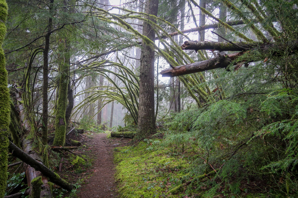
A moody day on the Tiger Mountain Trail
The biggest of the four mountains covered in this hiking guide, Tiger Mountain is also the most popular. Tiger mountain contains six different summits that range in height from 2,028 feet (South Tiger Mountain) to 3,004 feet (East Tiger Mountain).
The Poo Poo Point Chirico Trail and West Tiger #3 hikes, both located on Tiger Mountain, are two of most popular hikes in Issaquah so don’t expect solitude on these trails.
There are plenty of lesser-used hiking paths on Tiger Mountain, however, if you are looking to escape the crowds. Check out the Tiger Mountain Trail and create your own route by branching off on various other intersecting trails or hiking to a different summit. Just be sure to bring a map so you don’t get lost.
Note: there are currently two major trail closures on Tiger Mountain due to timber sale activities. These closures impact the Tiger Mountain Trail and West Tiger #3 Trail as well as the three West Tiger summits. Check the Hiking Alert: Tiger Mountain Closures section below for more details.
Poo Poo Point Chirico Trail
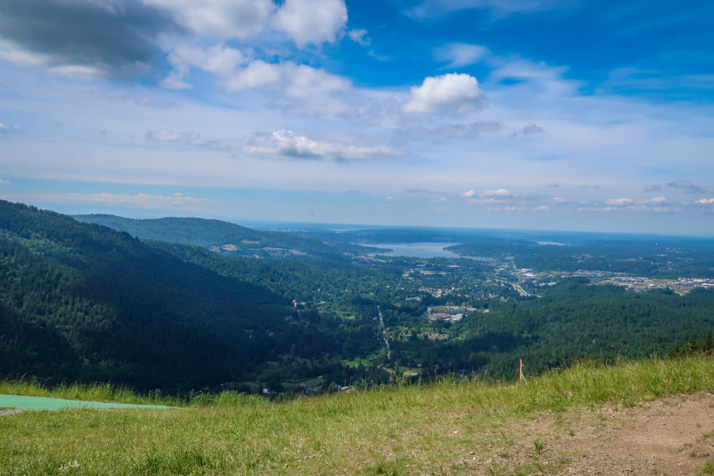
View of the Puget Sound from Poo Poo Point
- Distance:Â 4 miles there-and-back
- Elevation Gain: 1637 feet
- Difficulty: Moderate
- Trailhead: Poo Poo Point Trailhead
- Parking Fee: None
Poo Poo Point Trail (via Chirico Trail) is a beloved hiking destination for Seattle-area residents. Located on the west side of Tiger Mountain only 30 minutes from the city, the point features amazing views of Puget Sound and beyond. Poo Poo Point Chirico Trail is one of two paths that lead to the summit and is one of the most popular hikes in Issaquah. Short yet steep, the Chirico Trail zigzags up the mountain along a rocky path through a lush green forest.
Hikers are not the only ones who love to visit Poo Poo Point. Paragliders frequently use the area as a jumping off point before eventually landing in a field near the Chirico Trailhead. On a sunny day, hikers may be rewarded at the top not only with great views but also with paragliders soaring through the air.
The Shuttle Direct service provides bus service to this trailhead on the weekends during summer months (service not available in 2022).
Poo Poo Point High School Trail
Poo Poo Point High School Trail
- Distance: 6.9 miles there-and-back
- Elevation Gain: 2063 feet
- Difficulty: Moderate
- Trailhead: High School Trailhead (also called the Rainier Trailhead on Google Maps)
- Parking Fee: None
For a less crowded Poo Poo Point Trail, try the High School Trail instead. I personally prefer this hike because it isn’t as steep and there are fewer other hikers to contend with. The hike begins at the Issaquah High School and heads gradually uphill through a pretty green forest.
After about a mile from the trailhead, you’ll come to a major trail junction with the Section Line Trail along with a path leading to Tradition Plateau. Bear right to continue towards Poo Poo Point. From here, the trail steepens until it eventually reaches Poo Poo Point. You’ll be rewarded with an incredible vista of Puget Sound and beyond.
To explore the trails starting from High Point Trailhead and Tradition Plateau, simply bear left at the trail junction.
The Shuttle Direct service provides bus service to this trailhead on the weekends during summer months (service not available in 2022). For more information about where to park for this trailhead, check out the WTA Poo Poo Point Trail web page.
Tiger Mountain Trail
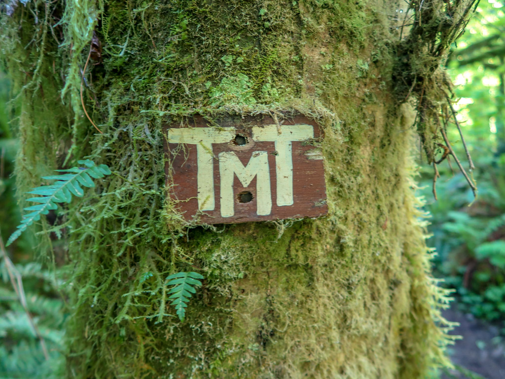
An old Tiger Mountain Trail sign
- Distance: 15.4 miles point-to-point
- Elevation Gain: 3848 feet
- Difficulty: Very Strenuous (if hiked in a single day)
- South Trailhead: Tiger Mountain Trailhead South
- North Trailhead: High Point Trailhead
- Parking Fee: None at the South Trailhead; Discover Pass is required at High Point Trailhead
A mini thru-hike along the entire length of Tiger Mountain, the Tiger Mountain Trail (TMT) is a long meandering path that penetrates deep into the heart of the Issaquah Alps. The trail does not lead directly to any of Tiger Mountain’s six summits, but it does come close to several of them. The hike can be explored in sections, or for a bigger challenge, hike the entire 15+ mile trail in a single day.
The Tiger Mountain Trail is one of my favorite hikes in Issaquah. I love the long winding trail through ferns and moss and the old TMT trail signs nailed to trees. Be sure to look for rustic signs pointing out fun locations such as Manning’s Reach, Fred’s Corner, Ruth’s Dove and Denny’s Bulge. These are tributes to the volunteers who originally built the trail in the 1970s.
For more information about hiking the entire TMT in a single day, check out my trip report from hiking the trail in 2018: Through-Hiking the Tiger Mountain Trail in the Issaquah Alps
Note: two sections of the Tiger Mountain Trail are currently closed due to timber sale activities. All three of the West Tiger summits are included in the closure and not currently accessible. Check the Hiking Alert: Tiger Mountain Closures section below for more details.
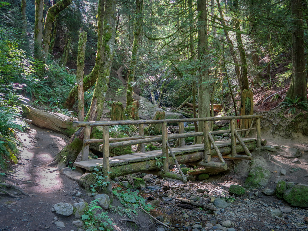
Murat’s Bridge Hike
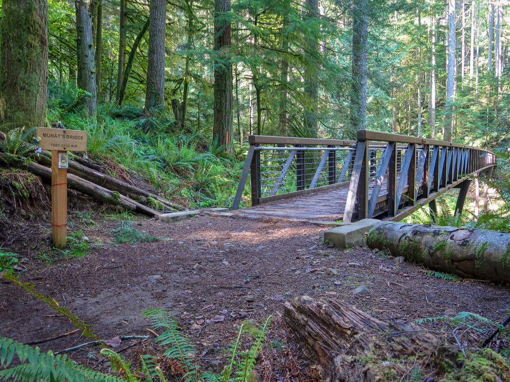
Murat’s Bridge
- Distance: 5.5 miles there-and-back
- Elevation Gain: 1000 feet
- Difficulty: Easy
- Trailhead: High Point Trailhead
- Parking Fee: Discover Pass Required
Murat’s Bridge Hike is a lovely jaunt through the forest to an impressive steel bridge over High Point Creek. An engineering marvel, Murat’s Bridge is a 220′ long steel footbridge that was assembled from 13 different sections that were transported by helicopter to West Tiger Mountain.
The hike is also a great introduction to the Tiger Mountain Trail. To begin the hike, start at the High Point Trailhead and follow the Tiger Mountain Trail for 2.3 miles until it reaches Murat’s Bridge. The bridge can also be accessed by hiking along High Point Trail, which begins just past exit 20 on the south side of I-90.
Murat’s Bridge is named for Murat Danishek who passed away at the age of 33. Murat’s parents, Steve and Dee Danishek, dedicated the bridge to his memory after his death in 2013.
Bus Trail Loop
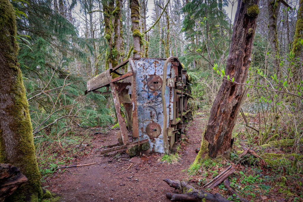
The old broken-down bus along Bus Trail
- Distance: 2.1 miles loop trail
- Elevation Gain: 134 feet
- Difficulty: Very Easy
- Trailhead: High Point Trailhead
- Parking Fee: Discover Pass Required
The Bus Trail Loop is a fun and super easy hike that is great for beginners and families. The hike begins at High Point Trailhead and follows the Bus Trail for about half a mile until it reaches the abandoned bus. From here, hikers can turn back or keep exploring the other trails around Tradition Lake.
According to the Seattle Times, the bus is a vintage Kenworth split-level bus that was “used by logging companies to haul crews to work sites on the mountain. In the early 1950s, the bus apparently was used like a building in a logging camp.” Today it is an interesting reminder of the area’s history.
To complete the 2.1 mile loop, continue past the bus on Bus Trail until about .9 miles from the trailhead. From here, take a right and head north for about half a mile. Take a right on Puget Power Road and follow it past Tradition Lake back to the High Point Trailhead.
West Tiger #3
- Distance: 5.5 miles there-and-back
- Elevation Gain: 1948 feet
- Difficulty: Moderate
- Trailhead: High Point Trailhead
- Parking Fee: Discover Pass Required
West Tiger #3 is one of those hikes that deserves a mention on this list because everyone hikes it. But I’ll be honest – it’s not my favorite. The trail is a long steep slog up a trail that I personally don’t find very interesting.
The path ends at the West Tiger #3 Summit which is surrounded by trees and doesn’t have a view (although there is a fleeting peek-a-boo view on the trail near the top). However, this may change after the timber harvest which is currently underway at the summit as of July 2021.
West Tiger #3 is a great workout, however, and a good choice if you want to get some training in. For an even steeper trek, you can take the Cable Line Trail alternate which begins at the 1.2-mile point.
Note: the top section of the West Tiger #3 Trail is currently closed due to timber sale activities. This means the West Tiger #3 summit is not currently accessible. Check the Hiking Alert: Tiger Mountain Closures section below for more details.
Cougar Mountain
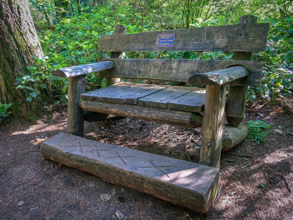
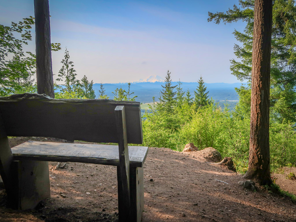
This lovely bench awaits weary hikers at the highest point on Cougar Mountain
Cougar Mountain is the westernmost and most developed peak of the Issaquah Alps. At 1,614 feet, it is also the lowest peak of the small mountain range and popular with trail runners and nearby residents.
The mountain is home to Cougar Mountain Regional Wildland Park which preserves 3,115 acres of land for public use along with 38 miles of hiking trails. You can download a map of the park which includes all hiking trails mentioned below from the King County web site:
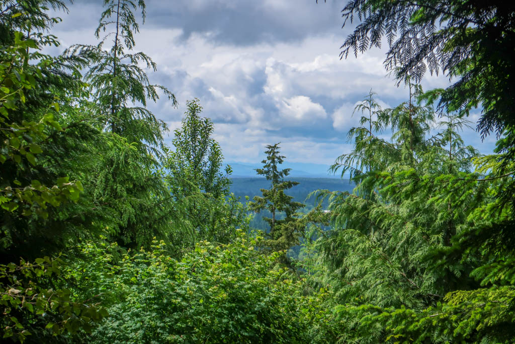
Anti-Aircraft Peak Loop
Million Dollar View on a hazy day
- Distance: 4.75 miles loop trail
- Elevation Gain: 450 feet
- Difficulty: Easy
- Trailhead: Sky Country Trailhead
- Parking Fee: None
Anti-aircraft Peak Loop is a fun stroll through the woods around a peak that formerly housed a missile installation. The peak is named after a battery of Nike anti-aircraft missiles that were located on the site during the Cold War. Evidence of coal mining and brick clay mining can also be found along the trail.
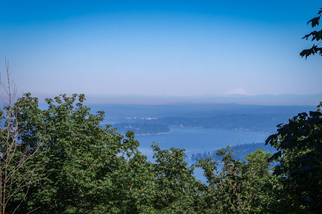
This hike starts at the Sky Country Trailhead on Clay Pit Road before turning onto Klondike Swamp Trail and eventually Shangri La Trail. The route loops around Radar Park where a short detour takes you to the Million Dollar View. On a clear day you can see all the way to Mt. Baker from this viewpoint.
From here, the route loops back to the Sky Country Trailhead via Harvey Manning Trail and a network of interconnected hiking paths. Be sure to bring a map as it’s easy to get turned around.
For more details about this hiking route, check out Anti-Aircraft Peak Loop on the Washington Trails Association web site. You can also begin hiking at the Harvey Manning Trailhead and customize the route by taking some of the other interlinked trails in the park.
Coal Creek Falls
Coal Creek Falls during the summer months
- Distance: 2.6 miles there-and-back
- Elevation Gain: 593 Feet
- Difficulty: Very Easy
- Trailhead: Red Town Trailhead
- Parking Fee: None
Coal Creek Falls is a family-friendly hike to a lovely little waterfall along Coal Creek. The hike begins at the Red Town Trailhead and winds through the northwest corner of Cougar Mountain Regional Wildland Park through an area that used to see a lot of coal mining.
The hike ends at Coal Creek Falls which tends to run dry in the summer months. For the best view of the waterfall, visit in the rainy winter or spring months.
Red Town Trailhead has a large parking lot but it tends to fill up in the summer months. You can also access the waterfall by parking at Sky Country Trailhead if the other parking lot is full.
Wilderness Peak Loop
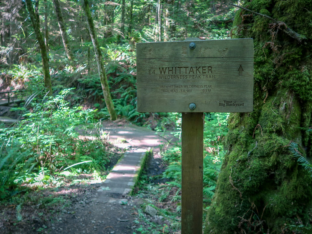
The Jim Whittaker Wilderness Peak Trail
- Distance: 3.2 miles loop trail
- Elevation Gain: 1210 feet
- Difficulty: Moderately Easy
- Trailhead: Jim Whittaker Wilderness Peak Trailhead
- Parking Fee: None
If you’re looking for a workout on Cougar Mountain, the Jim Whittaker Wilderness Peak Loop is your best bet. This short but steep trail gains 1,200 feet of elevation in 1.5 miles before reaching the tallest point in the Cougars.
There’s not much of a view when you reach the peak, but there is an oversized wooden bench with a footrest to reward you for your efforts. To complete the loop, head back on the Gombu Wilderness Cliffs Trail.
This trail is named for Jim Whittaker, the first American to reach the summit of Mount Everest in 1963. The Gombu Wilderness Cliffs Trail is named after his hiking partner, Nawang Gombu.
Squak Mountain
Debbie’s View on Squak Mountain
Located between Cougar and Tiger Mountains in the Issaquah Alps, Squak Mountain is easily accessible from the I-90 corridor and only a 40-minute drive from downtown Seattle.
Squak Mountain is a good alternative to the busy hiking trails in Tiger and Cougar Mountains as it is typically less crowded.
Margaret’s Way to Debbie’s View
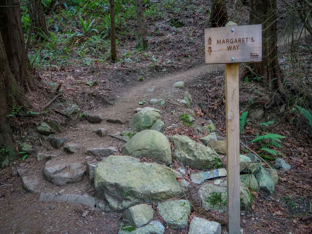
Margaret’s Way Trail
- Distance: 6.8 miles
- Elevation Gain: 1500 feet
- Difficulty: Moderate
- Trailhead: Margaret’s Way Trailhead
- Parking Fee: None
Margaret’s Way Trail to Debbie’s View is a pleasant 6.8-mile ramble through the forest on Squak Mountain. The trail ambles through a dense canopy of trees and past a couple of nice viewpoints until it ends at the best viewpoint of them all – Debbie’s View. Here, a bench awaits the weary traveler with a fabulous view of Mt. Rainier.
A relatively new trail in the Issaquah Alps, the trail was completed in 2015 and offers a new way to access the existing trail system at the top of the mountain. For hikers wanting more of a challenge, consider extending your hike by completing the Chybinski Loop Trail.
The Shuttle Direct service provides bus service to this trailhead on the weekends during summer months (service not available in 2022). For more information about Margaret’s Way Trail, check out my hiking guide: Margaret’s Way Trail to Debbie’s View
Bullitt Fireplace Trail

Bullitt Fireplace on Squak Mountain – Photo by Anita George
- Distance: 4.1 miles
- Elevation Gain: 1325 feet
- Difficulty: Moderately Easy
- Trailhead: Bullitt Fireplace Trailhead
- Parking Fee: None
The Bullitt Fireplace Trail is a great hike on the north side of Squak Mountain that leads to an interesting piece of local history. The hike ends at the site of a cabin formerly owned by the Bullitt Family. Today, all that is left is the foundation and a giant fireplace.
The Bullitt Family donated the land in this area in order to create Squak Mountain State Park. The Bullitt Family also founded the King Broadcasting Company, a major television network in the Seattle area.
Taylor Mountain
The view from Holder Knob on Taylor Mountain
Taylor Mountain is the southernmost peak in the Issaquah Alps mountain range, located just south of Tiger Mountain. As one of the newer additions to the King County Parks and Recreation System, not very many people know about it.
Taylor Mountain is a great place to escape the crowds that are flocking en masse to the more popular hikes in Issaquah on Tiger Mountain and Cougar Mountain.
Holder Knob + Holder Ridge Trail Loop

Holder Ridge Trail
- Distance: 3.8 miles loop
- Elevation Gain: 695 feet
- Difficulty: Easy
- Trailhead: Taylor Mountain Forest Trailhead
- Parking Fee: None
The Holder Ridge to Holder Knob loop trail is a great introduction to a lesser-known peak in the Issaquah Alps. This easy trail leads to a small knob in the forest on Taylor Mountain.
While there is a limited viewpoint on Holder Knob, it can be hard to find. Follow the signs for the horse picnic area near the top of Holder Knob to find a picnic table and view of the surrounding area.
Be on the lookout for horses on this trail as the area is popular with equestrian riders.
Preparing for Hikes in Issaquah
Even though these trails are located near developed areas in Issaquah, remember that you are entering a rugged outdoors environment and prepare accordingly. Pack a lunch, bring plenty of water, and wear sturdy hiking shoes. Check the weather forecast and make sure you’re prepared for the weather conditions with plenty of layers as appropriate.
Some of these trails are really popular so consider hiking on the weekdays or early in the morning to secure a parking spot. The Shuttle Direct service provides transportation to the most popular trailheads on the weekends during summer months.
Familiarize yourself with proper hiking bathroom etiquette before hitting the trail and be sure to leave no trace of your visit behind.
Hiking Gear for Hikes in Issaquah
Not sure what to bring or wear on your hike? This list includes some of my favorite gear when going on hikes in Issaquah.
- Hiking Shoes – Sturdy hiking shoes are important. I’m a big fan of Altra Lone Peak Trail Running Shoes and pair them with Dirty Girl Gaiters to keep rocks from getting into my shoes.
- Socks – Good thick socks are key. I usually wear a pair of double-walled Wrightsock Coomesh II socks with my Altras. For longer hikes, I switch to Injinji Midweight socks to prevent toe blisters.
- Backpack – I love Osprey backpacks and use the Osprey Manta pack which is technically a men’s pack (because I have a longer torso than most women). The women’s equivalent is the Osprey Mira pack.
- Hiking Poles – Hiking poles reduce pressure on your joints and help maintain your balance if you trip. My current favorites are the LEKI Micro Vario Carbon Trekking Poles because they are super lightweight and portable.
- Rain Gear – Raingear is essential when hiking in the PNW. My favorite rain jacket is the Outdoor Research Helium II jacket since it is very lightweight.
- Camera – I love taking photos and always bring a camera along on my hiking trips. I use the Canon PowerShot G7X Mark II because it is lightweight yet has many advanced features.
Maps and Navigation for Hikes in Issaquah
One of my favorite things about hiking in Issaquah is that there are so many trails to choose from – it’s easy to create your own route from a network of intersecting trails. This also means that it’s easy to take the wrong path and get turned around. Be sure to have a map on your phone or bring a paper map (and know how to use it).
Green Trails makes my favorite maps when hiking in the Pacific Northwest because they are so easy to read. You can buy paper maps or digital versions and download them to your phone. Here are the ones referenced in this Hiking Guide:
- Cougar Mountain and Squak Mountain, WA No. 203S
- Tiger Mountain and Taylor Mountain, WA No. 204S
AllTrails.com is another good resource for hiking maps and most routes in this guide can be found there. This is great for beginners because the maps are free (although downloading the maps requires a Pro subscription). Gaia GPS is another popular resource for hiking maps (although I personally find it a little complicated to use). The City of Issaquah Trails Map is another good resource but only includes hikes in the city limits.
While cell reception is available throughout some of the Issaquah Alps, some areas have no connectivity. Be sure to download maps to your phone in advance. If you are using a phone for navigation, bring a portable battery such as the Anker portable battery charger and protect it from the rain and elements.
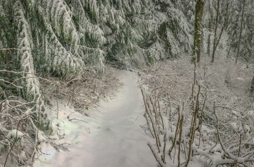
Hiking on Tiger Mountain during a rare snowstorm
When to Go on Hikes in Issaquah
The great thing about hikes in Issaquah is that they are generally available all year-round. Unlike trails further east in the Cascade mountain range, these trails see little to no snow and you typically don’t have to worry about avalanches.
That being said, it generally snows in the greater Seattle area about once per year. When it does, hiking in the Issaquah Alps is a magical experience and the snow level is usually no more than a foot high at the deepest.
Except for the summer months of July to mid-September, you should be prepared for rain more often than not. Check the hourly weather forecast to optimize your chances of a dry hike.
For a report on current trail conditions, look up the hike on the Washington Trails Association web site before heading out and read the most recent trip reports.
Hiking Alert: Tiger Mountain Closures
As of July 2021, there are currently two major trail closures on Tiger Mountain due to timber sale and harvest activities.
West Tiger Mountain Closure due to Weyerhaeuser Harvest
Beginning July 6, 2021, sections of Tiger Mountain Trail (TMT), West Tiger No. 3, Cable Line, Seattle View, Section Line, Poo Top, and Preston Trails on Tiger Mountain are closed until further notice due to timber sale activities occurring on privately managed land. Unfortunately, this area also includes all three West Tiger Summits. The Department of Public Resources asks that you respect the public closure area for your safety.
For more information on on this closure, view the following resources:
- West Tiger Closure Map on the DNR web site
- West Tiger Mountain Natural Resources Conservation Area page on the DNR web site
- Statement on the Weyerhaeuser Tiger Mountain Harvest by the Issaquah Alps Trails Club
Iverson RR Grade Trail and TMT Closure Near Middle Tiger
Due to timber sales activities, starting February 22, 2021 until Fall 2021, the Iverson RR Grade Trail & 1.6 mile section of Tiger Mountain Trail (TMT) from Middle Tiger Trail intersection to the 1000 Rd will be temporarily closed. For more information on this closure, view the Iverson RR Grade Trail and TMT Closure Map on the DNR web site.
Have you hiked in the Issaquah Alps? If so I’d love to hear from you! Leave your comment below.
Note: This post contains affiliate links, which means I may receive a commission if you click a link and purchase something. While clicking these links won’t cost you anything, they will help me to keep this site up and running!


0 Comments