
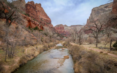
After spending a couple of months hiking in Joshua Tree National Park on our Great America (socially-distant) Road Trip, my husband Daniel and I headed northeast. We wanted to check out Zion National Park and visit some other points of interest in northern Arizona such as Horseshoe Bend. After looking at a map, we concluded the best route between these two destinations was the Vermillion Cliffs Scenic Highway along the U.S. Route 89A.
We didn’t know much about the drive before starting out, other than that it was supposed to be incredibly scenic. Also we suspected that Vermillion Cliffs were involved, given the road’s name.
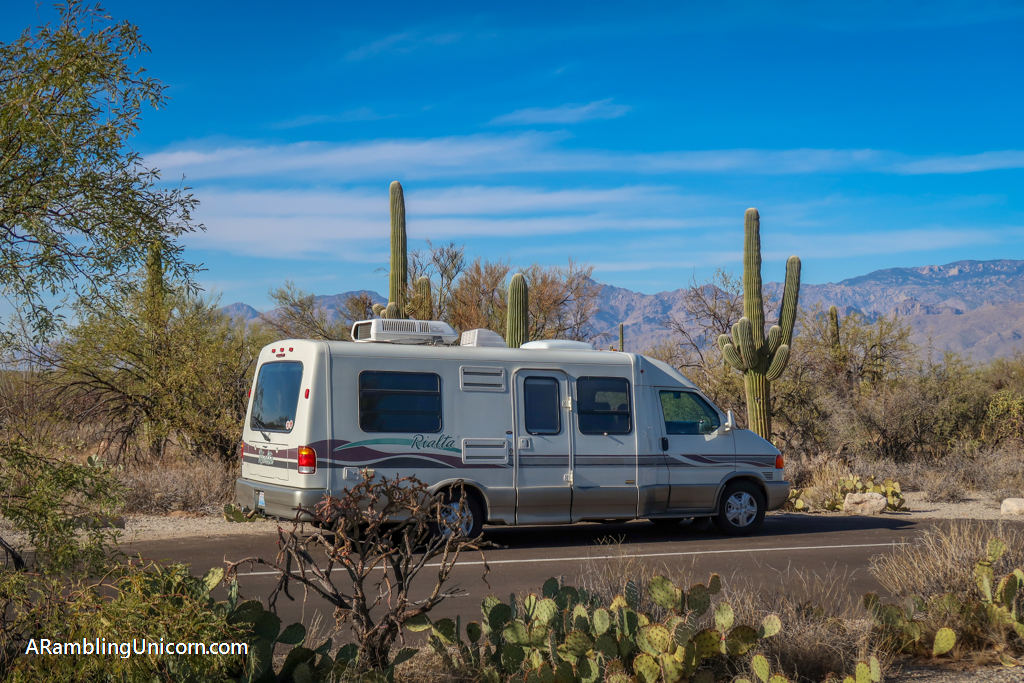
So after concluding our visit to Zion National Park, we headed east in our 21-foot VW Rialta motorhome to drive U.S. Route 89A and see these famed Vermillion Cliffs for ourselves.
Table of Contents
About the Vermillion Cliffs Scenic Highway
Vermillion Cliffs Scenic Highway, also known as Fredonia-Vermillion Cliffs Scenic Road, is a 92-mile highway along magnificent towering cliffs. Stretching from Kanab, Utah to Bitter Springs, Arizona, the route crosses the Kaibab National Forest and then winds across a plateau that forms the southernmost border of Vermilion Cliffs National Monument.
The geology of the area is fascinating. The Vermillion Cliffs is just one of many layers of sedimentary rock that create the Grand Staircase along the Colorado Plateau. Stretching north from the Grand Canyon to Bryce National Park and the Grand-Staircase Escalante National Monument, the Grand Staircase consists of five major rock layers. Each stripe corresponds to a different era in earth’s history and is a unique color. The Vermillion layer, specifically, forms the second step in the Grand Staircase.
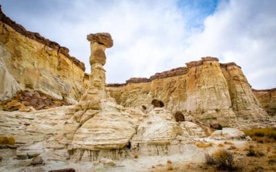
To get a closer view of the Vermillion Cliffs, visitors to the area can also venture inside of the rugged and remote Vermilion Cliffs National Monument. The park includes incredible hiking opportunities, including famed hiking trail The Wave in Paria Canyon. Be forewarned, however, that hiking The Wave requires a permit which is rather hard to get.
Additionally, there are no paved roads inside the park. Most roads require four-wheel-drive and high clearance vehicles to navigate them. Since our RV can barely handle even well-maintained dirt roads, that ruled us out. So, we had to content ourselves with viewing the cliffs from the Vermillion Cliffs Scenic Highway.
The Vermillion Cliffs! This is the second layer in the Grand Staircase geological formation.
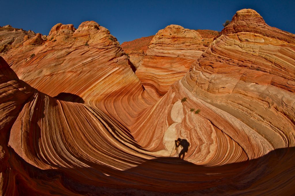
The Wave, one of the most photographed places in Vermilion Cliffs National Monument. We did not visit The Wave on this trip but it is on my bucket list!
Photo by Stephen Leonardi on Unsplash
Map of the Vermillion Cliffs Scenic Highway
Highlights of Driving the Vermillion Cliffs Scenic Highway
While there are quite a few things to see along the Vermillion Cliffs Scenic Highway, here’s a roundup of our favorites. We drove the road in early March during the middle of a snowstorm (more about that later) which probably influenced the items in this article. If we make the drive again during the summer, the list would probably change to add some additional destinations.
Vermillion Cliffs Scenic Highway as viewed near Pasture Canyon Lookout
Vermillion Cliffs
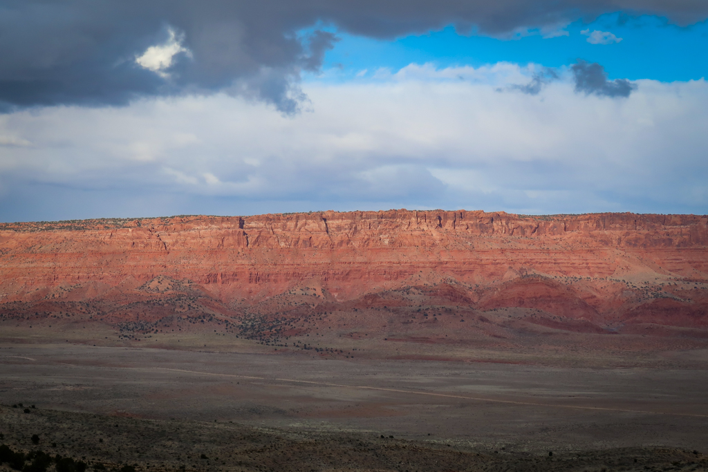
It should probably come as no surprise that one of the highlights of this drive is the Vermillion Cliffs. After passing over the mountain pass through Kaibab National Forest, there are spectacular views of these towering scarlet cliffs from Pasture Canyon Lookout all the way to Bitter Springs. You can pull over pretty much anywhere along this stretch of road for fabulous views of the Vermillion Cliffs.
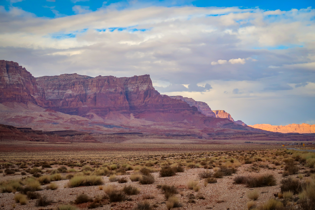
Vermillion Cliffs as viewed from Highway 89A near Marble Canyon
Pasture Canyon Lookout
When driving the Vermillion Cliffs Scenic Highway heading eastbound, the first clear vantage point of the Vermillion Cliffs is from the Pasture Canyon Lookout. This is a great place to stop and take some photos because the road has not yet fully descended to the plateau floor. From here, you get terrific views of the plateau stretching for miles from an elevated position.
It was lightly snowing when we stopped at the Pasture Canyon Lookout (you can see the snowflakes below if you look closely in the below photo).
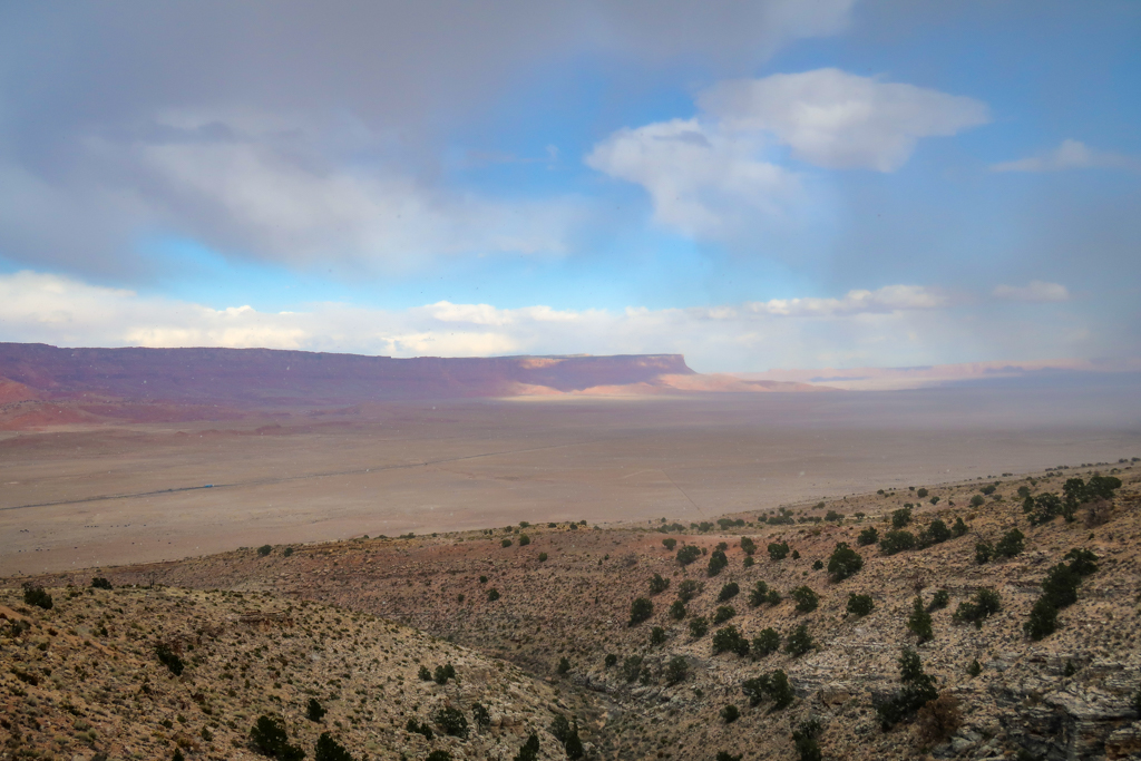
View of the Vermillion Cliffs from Pasture Canyon Lookout
Marble Canyon
Another highlight of driving the Fredonia-Vermillion Cliffs Scenic Road is Marble Canyon. Carved out of layers of reddish limestone by the Colorado River, Marble Canyon marks the beginning of the Grand Canyon in northern Arizona.
A small community of the same name is located near Marble Canyon with a hotel and a gas station. Lee’s Ferry is also located nearby which includes swimming and fishing opportunities as well as hiking trails. We didn’t get a chance to visit Lee’s Ferry on this trip but it is definitely on my bucket list if we return to the area!
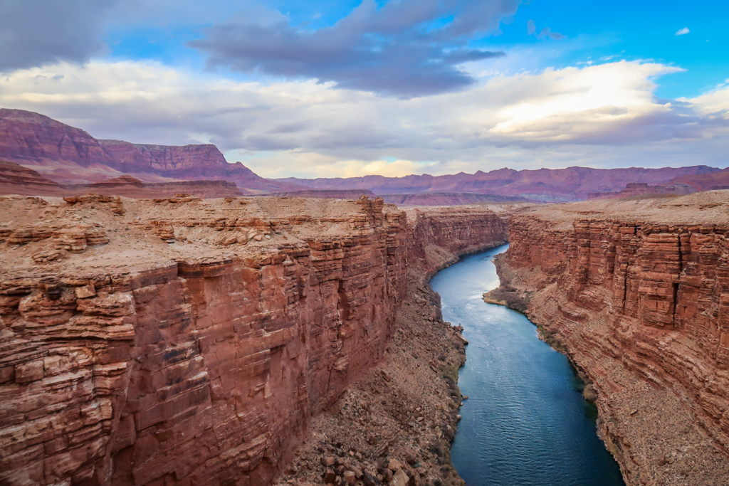
Marble Canyon as viewed from the Navajo Bridge
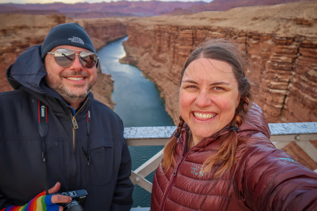
Marble Canyon selfie!
Navajo Bridge
The best views of Marble Canyon are from the historic Navajo Bridge. The 9th highest bridge in the United States, Navajo Bridge consists of two steel arches spanning the Colorado River at a dizzying height of 470 feet. Constructed in 1929, the first Navajo Bridge was eventually replaced with a more modern structure in 1995.
Today, visitors can walk across the original bridge span while admiring the canyon views as well as majestic California Condors soaring overhead. The Navajo Bridge Interpretive Center located on the western side of the canyon provides additional information about the bridge and the area’s history.
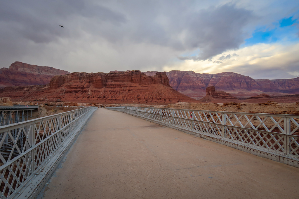
View from the Navajo pedestrian bridge looking west towards the Vermillion Cliffs.
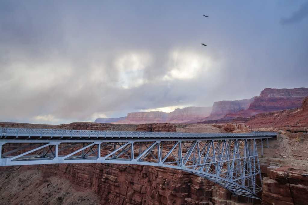
The new Navajo Bridge as viewed from the old Navajo pedestrian Bridge with condors soaring overhead.
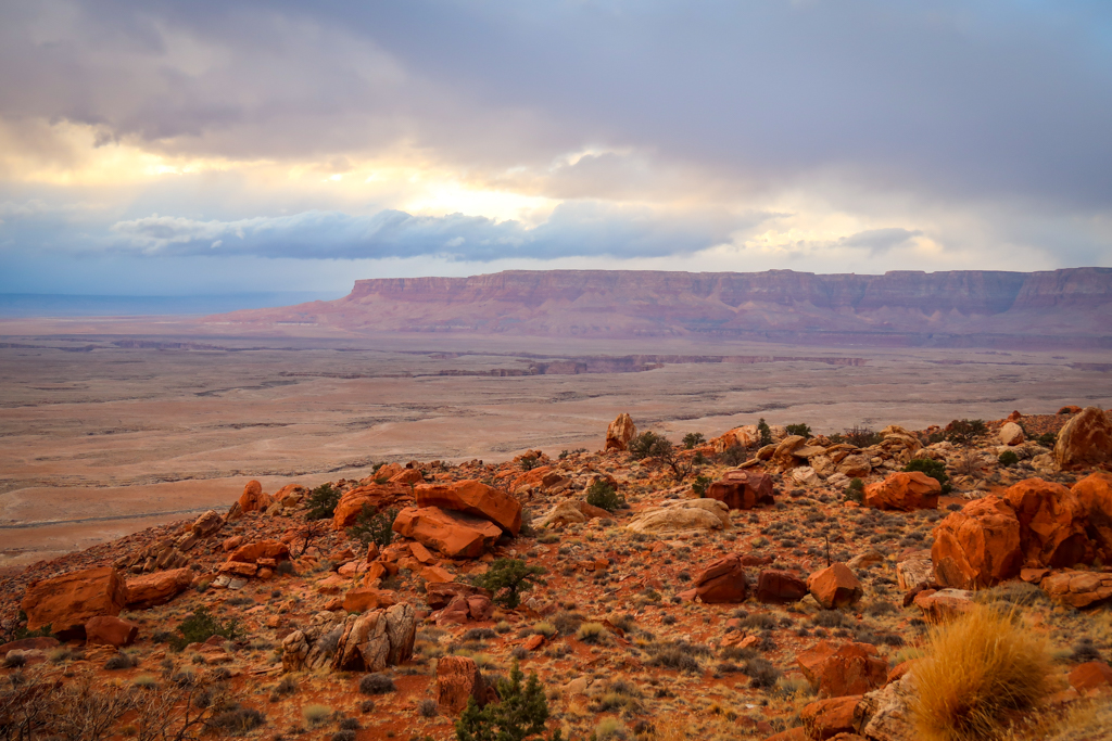
Le Fevre Overlook
Le Fevre Overlook is the first major scenic pullout along the Vermillion Cliffs Scenic Highway heading eastbound. Located 26 miles east of Kanab, the overlook is positioned along the western edge of Kaibab National Forest and marks the beginning of the mountain pass.
The lookout point is a great place from which to view all layers in the Grand Staircase geological formation. You can see all the way to Bryce National Park and Grand-Staircase Escalante National Monument from Le Fevre Overlook on a clear day.
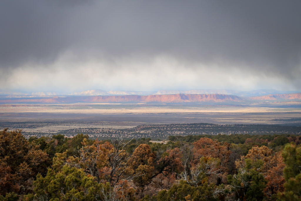
View of the Grand Staircase from Le Fevre Overlook on a moody day
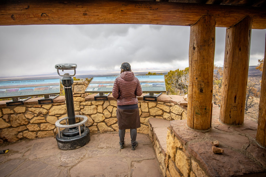
Hanging out in Le Fevre Overlook
Additional Points of Interest Near the Vermillion Cliffs Scenic Highway
Horseshoe Bend
Horseshoe Bend is a distinctive U-shaped section of the Colorado River that is also one of the most iconic wonders of the American Southwest. While not technically located on the Vermillion Cliffs Scenic Highway, this attraction is only 20 miles north of Bitter Springs on Highway 89 and worth a visit if you’re in the area.
Horseshoe Bend is best viewed from an overlook about 5 miles south of Page. The lookout provides stunning panoramic views of the entire river bend from 1000 feet above the Colorado River. An easy 1.5-mile roundtrip hike is required to reach the overlook platform. The fee to park at the overlook is $5 for cars and $10 for RVs.
For more information, including current conditions and fees, check out the official City of Page Horseshoe Bend web site.
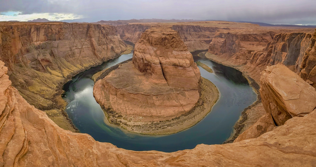
Horseshoe Bend in all her glory
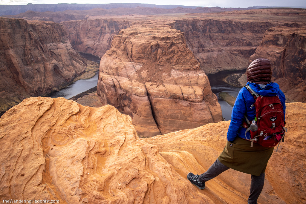
I contemplate life while admiring Horseshoe Bend. Photo by Daniel.
Antelope Pass Vista
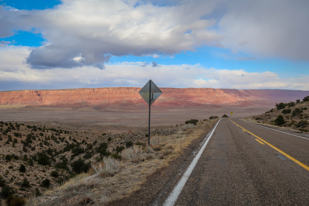
Located only 3.5 miles north of Bitter Springs on Highway 89, Antelope Pass Vista is another great location from which to view the Vermillion Cliffs. While there is not an official parking area here per se, there is plenty of room along the side of the road to pull over and take some photos.
If you plan to drive from Bitter Springs to Horseshoe Bend, Antelope Pass Vista is on the way and worth a stop.
View of the Vermillion Cliffs from Antelope Pass Vista on Highway 89.
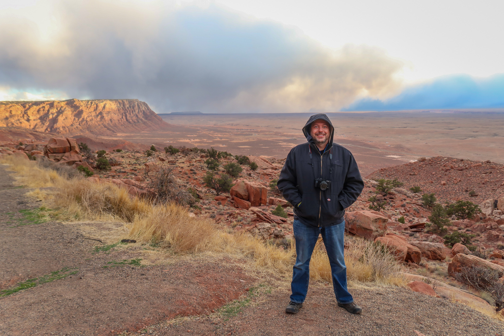
Photo Op time!
Kanab, Utah
The western terminus of Vermillion Cliffs Scenic Highway, Kanab is a cute little town with a decidedly western feel. Over 100 movie productions have taken place in Kanab over the years, leading the town to earn the nickname “Utah’s Little Hollywood”.
Daniel and I didn’t spend much time in Kanab during our road trip, but we did stop briefly to get gas and eat a socially distant lunch in our RV.
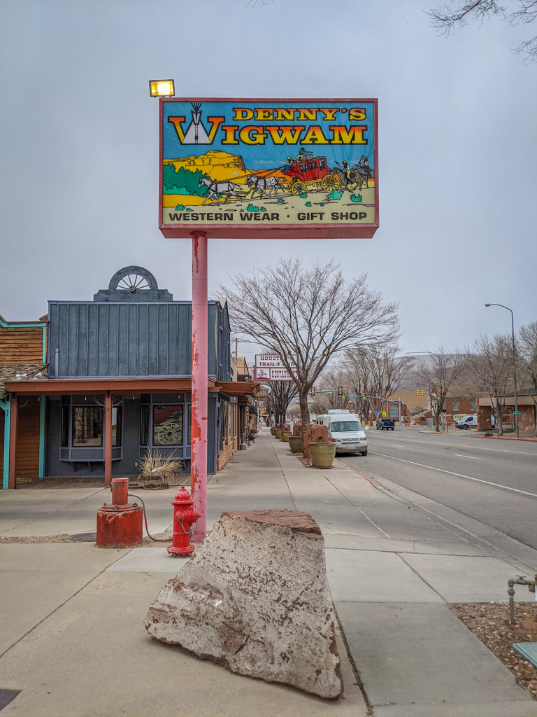
Downtown Kanab, Utah
Our Experience Driving the Vermillion Cliffs Scenic Highway
After stopping in Kanab for a late lunch, Daniel and I began our road trip around 3:00 pm. We got a later start than expected because we had spent the morning driving through the scenic Zion-Mount Carmel Tunnel.
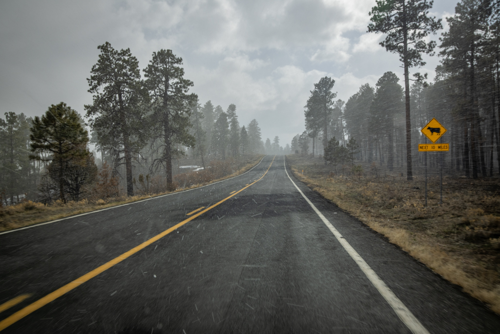
After passing the town of Fredonia, the Vermillion Cliffs Scenic Highway turns east and crosses a vast plain towards Kaibab National Forest. The sky darkened as we crossed the plain and soon snow began swirling around us.
It was around this time that we began heading uphill. Before we knew it, we had gained over 3000 feet of elevation and summited the pass at Jacob Lake. This is the turnoff for the Grand Canyon North Rim (which is closed to visitors during March). Snow lay in the ground in big drifts and continued to fall around us, making driving difficult.
Daniel and I were getting pretty nervous at this point. Our rig is not equipped to handle snow at all. She is also a gutless wonder when it comes to climbing hills or mountain passes. The last thing we needed at this point was to pull for our transmission cool down.
Thankfully, the snow began to subside as we descended the other side of the pass and approached the Pasture Canyon Lookout. By the time we reached the plateau floor at the base of the Vermillion Cliffs, the snow had stopped completely.
Beware of cows!
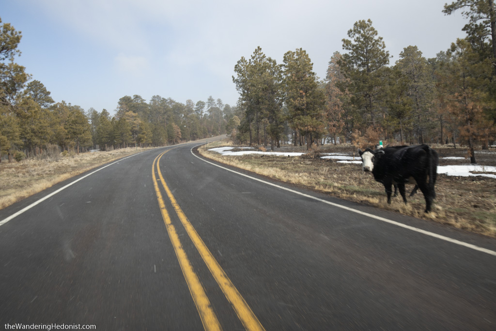
Hey look! It’s a cow! This guy is a little too close to the highway for comfort. Photo by Daniel.
What We Learned
In hindsight, we probably should not have attempted to drive both the Zion Tunnel and Vermillion Cliffs Scenic Highway in one day. Both roads are so gorgeous that we stopped frequently to admire the views and take photos. We really couldn’t help ourselves.
Plus, both roads involve driving over mountain passes that we hadn’t realized in advance. I had no idea that we’d be summiting a mountain pass at an elevation of 8000 feet on the Vermillion Cliffs Scenic Highway. It probably wasn’t the best idea to attempt this drive in our RV during the early spring but thankfully everything worked out ok.
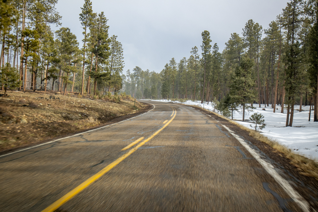
Vermillion Cliffs Scenic Highway near the summit at Jacob Lake.
A Note about Spelling: Vermillion vs Vermilion
Spelling and grammar nerds may have noticed that I have used two different spellings of the word vermillion. Which one is correct, you may ask? Well they both are!
Technically vermillion (with two l’s) is an alternate spelling of the word vermilion (with one l). Vermilion Cliffs National Monument uses the spelling with one l, so I have used that spelling in any references to the official park.
However, most people tend to spell this word with two l’s. I know this because I have researched what keywords people use when searching for the Vermillion Cliffs Scenic Highway. So this is the primary spelling that I have used throughout the article.
Have you driven the Vermillion Cliffs Scenic Highway? I want to hear from you! Leave a comment in the field below.
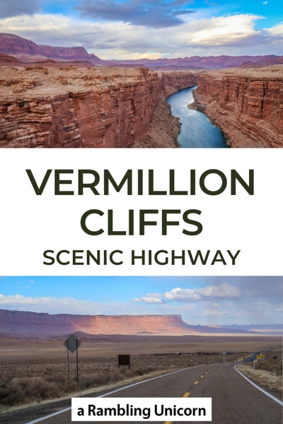
Like this article? Pin it!

Loved this entry! My family is from Southern Utah and its one of my favorite places in the country. In fact, my ancestors are one of the founding families of Kanab! There is so much to explore in that area I highly recommend staying a while. The Coral Pink Sand Dunes is one of my favorite spots if you go back.
Thanks Kara! I was disappointed to have so little time to explore the area. I can’t wait to go back! Thanks for the recommendation to visit Coral Pint Sand Dunes, I’ll definitely check it out next time we’re in the area!
Wonderful article, thanks for sharing
You’re very welcome, Jackie! I’m glad you enjoyed it ☺ï¸
Great article. Just passed through the 89A route after leaving the north rim and was amazed at the sight of so much red! Your noting of details will help me with my scrapbooking efforts when I get home and print my pictures. Miriam Bonk of MD
I was so glad to find this post because this is exactly what we are looking to do in a few weeks,
You say it was too much to go from Vermillion to St George Ut in one day?
Hi Brian! I’m glad you enjoyed it. I think it’s possible depending on a few factors. The first is what route you take. After reaching Fredonia you can drive north and then go through Zion National Park via Mt. Carmel Junction. That’s the most scenic route and incredibly beautiful if you’ve never done it before. But it will take longer to drive it than you think because you’ll stop and take a million photos (at least we did). The other option is to go south via AZ-389. That’s a much quicker route but less scenic. The second factor is how early you start, especially if you try to see both Zion Tunnel and Vermillion Cliffs Scenic Highway in one day. I recommend starting as early as possible because it will take longer than you think, especially if driving an RV. Also be cautious about the weather driving this late in the season. Do some advance research and be prepared for possible snow at higher elevations. Hope you have a wonderful time!