If you’re looking for a great place to explore the high desert, it’s hard to beat Joshua Tree National Park.
Joshua Tree is a magical wonderland filled with twisted and bristled trees along with endless piles of loose boulders. It is a wonderful region to discover on foot and miles of hiking trails are available in every corner of the park.
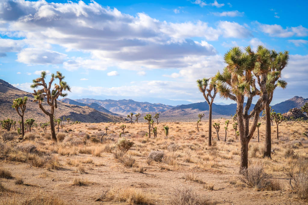
The Mojave Desert dominates the northern part of the park with its endless forests of spiny Joshua Trees. In the park’s southern half, the Colorado Desert prevails. Here you can find creosote scrub, cholla cactus and desert saltbush along with mule deer and jackrabbits.
There is a wide variety of hiking trails within the National Park’s boundaries. Easy nature trails such as Hidden Valley and Barker Dam are great for families or those short on time. Some hikes lead to hidden oases, and others lead to sweeping panoramic views. The 35-mile California Riding and Hiking Trail is a great option for those wanting to go backpacking in Joshua Tree.
With so many trails to choose from, it can be hard to know where to begin. This hiking guide will walk you through the very best hikes in Joshua Tree so you can find the perfect trail – no matter your skill level.
So lace up your hiking shoes and get ready to explore the best hikes in Joshua Tree National Park!
Table of Contents
Preparing for Hikes in Joshua Tree
When planning your hike, remember that you are entering a desert environment and pack accordingly. There are no stores or restaurants once you enter the park, so you should come prepared with everything you need for your visit.
Pack a lunch, bring plenty of water, and arrive with a full tank of gas. No cell reception is available throughout most of the park, so download hiking routes to your phone in advance and pick up a paper map from the Visitor Center.
Avoid hiking during the hottest part of the day if you can help it (or hike during the winter months when it is cooler). Be sure to leave no trace of your visit behind and learn how to pee outside in case the urge strikes when you’re away from a bathroom.
When to Go
The best time to visit Joshua Tree is in spring (March to May) or fall (October to November). Weather in the park is the most comfortable during this time, with temperatures averaging around 85 degrees. This is when the park is the most crowded, however, so if you want to skip the crowds consider coming at a different time.
No matter when you visit, temperatures can vary wildly so it’s best to bring an assortment of layers. Daytime temperatures can get really hot in Joshua Tree, especially in the summer months, so be prepared with adequate sun protection and plenty of water. In the winter months be prepared for freezing temperatures at night (and occasionally snow).
Before heading to the park, check the weather forecast and make sure you’re prepared for Joshua Tree weather conditions.
Maps and Navigation
Spanning an area of over 1,200 miles, Joshua Tree National Park is a big place to explore. It takes 1.5 hours to drive from the park’s West Entrance to the South Entrance, assuming you don’t make any stops (and trust me, you will!).
This map depicts all the hiking trails mentioned in this guide along with other points of interest:
Before hitting the trail, be sure to have a Joshua Tree hiking map with you (and know how to use it). If you use hiking apps such as AllTrails, be sure to download the maps when you still have an internet connection. You should also bring along an external battery to ensure your phone doesn’t die.
Don’t forget to pick up a paper map from the visitor center on your way into the park in case your electronics fail. Â Joshua Tree National Park Maps, such as the one below, are also available for download from the Joshua Tree web site.
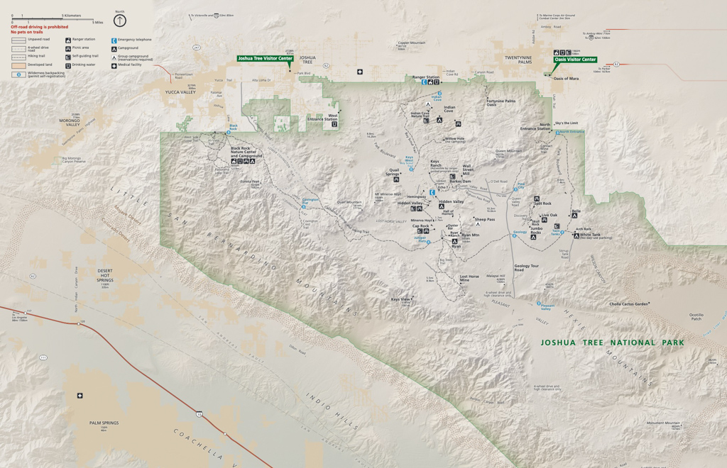
Joshua Tree Hiking Trails Map – close up view of the north side of the park. Grab a paper copy from the Visitor Center.
Hiking Gear
This list includes some of my favorite gear for day hiking in the desert.
- Hiking Shoes – Sturdy hiking or walking shoes are a must. Personally, I’m a big fan of Altra Lone Peak Trail Running Shoes. I pair them with Dirty Girl Gaiters to keep debris from getting into my shoes.
- Socks – Good thick socks are also important. I usually wear a pair of double-walled Wrightsock Coomesh II socks with my Altras.
- Backpack – A backpack is essential so you can carry water, layers, and snacks. I love Ospreys and use the Osprey Manta pack which is technically a men’s pack (because I have a long torso). The women’s equivalent is the Osprey Mira pack.
- Hiking Poles – Hiking poles reduce pressure on your joints and help maintain your balance if you trip. My current favorites are the LEKI Micro Vario Carbon Trekking Poles.
- Sun Hat – Protect your face (and scalp) with a broad sun hat. This sun hat is great because it has a wide brim and no back so it doesn’t bump into my backpack.
- Sun Shirt – Protect your neck and arms from the sun with a long-sleeved sun shirt. The Columbia Tamiami II is highly rated and comes with built-in UPF 40 sun protection.
- Sun Screen – Apply sun screen before hitting the trail and bring some along in case you need to reapply. I like these Banana Boat 1-oz tubes of sunscreen because they are super tiny and hardly take up any room in my bag.
- Camera – I love taking photos and always bring a camera along on my hiking trips. I use the Canon PowerShot G7X Mark III.
- Electronics – if you are using your phone for navigation, bring a portable battery such as the Anker portable battery charger. For longer hikes or backpacking trips, consider bringing a Garmin InReach Explorer. This is a Personal Locator Device (PLB) that enables you to trigger a SOS call to search and rescue and 2-way texting over satellite.
Best Hikes in Joshua Tree: Easy Hiking Trails
Joshua Tree National Park offers a wide range of trails at varying levels of difficulty. The first six trails in this guide are my favorites easy hikes that can be attempted by people of most skill levels and abilities, including families with children. Be aware that most hiking trails in Joshua Tree are not compatible with wheelchairs or strollers.
Hidden Valley Nature Trail – 1 mile
- Distance – 1 mile loop
- Elevation Gain – 114 feet
- Starting Elevation – 4233 feet
- Highest Elevation Point – 4277 feet
If you only have time for one trail in Joshua Tree National Park, this is the one. Hidden Valley Nature Trail is an easy 1-mile interpretive trail that is appropriate for hikers of all skill levels and one of the best hikes in Joshua Tree National Park.
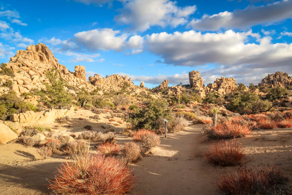
The trail loops through a gentle valley surrounded by tall granite boulders. These natural walls create a unique ecosystem inside where both Joshua Trees and pinyon-juniper woodlands co-exist together. The boulders act as giant water collectors which enables Pinyon Pines and California Junipers to thrive.
This loop trail is one of the park’s most popular attractions…so plan accordingly. I recommend visiting on a weekday or in the early morning/late afternoon to avoid the crowds. The trailhead is located on Park Boulevard 13 miles south of the town of Joshua Tree.
Arch Rock Nature Trail – 1.2 miles
- Distance – 1.2 miles there-and-back
- Elevation Gain – 88 feet
- Starting Elevation – 3909 feet
- Lowest Elevation Point – 3812 feet
Arch Rock is another must-see granite formation in Joshua Tree National Park. This natural arch spans about 30 feet in length and is located in a field of granite boulders. For campers lucky enough to get a spot at the White Tank Campground, Arch Rock is only a few steps away. Parking is limited at the campground, however, so for everyone else the best way to access the rock is via the Arch Rock Nature Trail.
The Arch Rock Nature Trail begins about a half-mile away at the Twin Tanks parking lot. Located an 8 minutes drive from Skull Rock on Pinto Basin Road, the Twin Tanks parking lot is fairly spacious and has room for plenty of cars. From here, the trail is an easy 1.2-mile hike to Arch Rock and back.
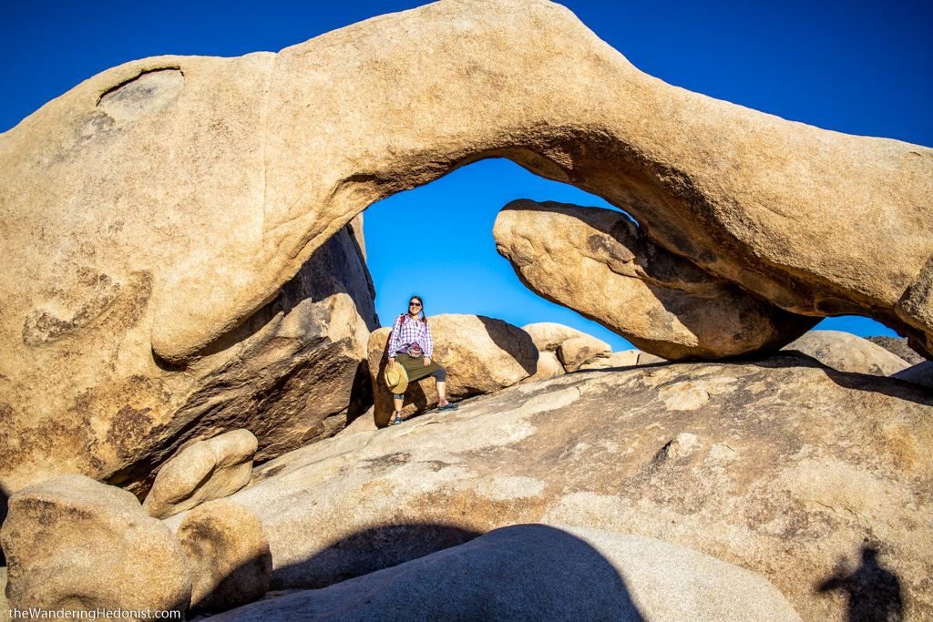
Arch Rock is a popular spot to pose for photos. Be prepared to wait in line for your turn. Photo by Daniel of The Wandering Hedonist.
Barker Dam Nature Trail – 1.3 miles
- Distance – 1.3 miles roundtrip
- Elevation Gain – 62 feet
- Starting Elevation – 4256 feet
- Highest Elevation Point – 4312 feet
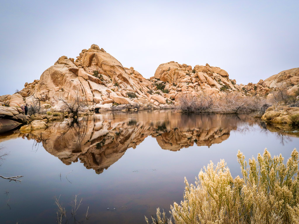
Barker Dam Nature Trail is an easy interpretive loop that leads to a lovely hidden pool in Joshua Tree National Park. This small lake attracts an array of animal life in an arid high-desert environment where water is exceedingly scarce.
Barker Dam (also called Big Horn Dam) was constructed by cowboys in the early 1900s in order to water cattle. Remnants from these early cattle-ranching days are still visible from the trail near the dam. A collection of ancient petroglyphs is also available along the trail and provide another point of interest for visitors.
The trailhead for Barker Dam Nature Trail is located on Barker Dam Road near the West Entrance in Joshua Tree National Park. The parking area tends to fill up quickly so plan accordingly. If the parking area is full, there are several pull-outs along Barker Dam Road about a quarter mile from the trailhead where you can park.
Cholla Cactus Garden Nature Trail – .2 miles
- Distance – .2 mile loop
- Elevation Gain – 13 feet
- Starting Elevation – 2185 feet
- Highest Elevation Point – 2198 feet
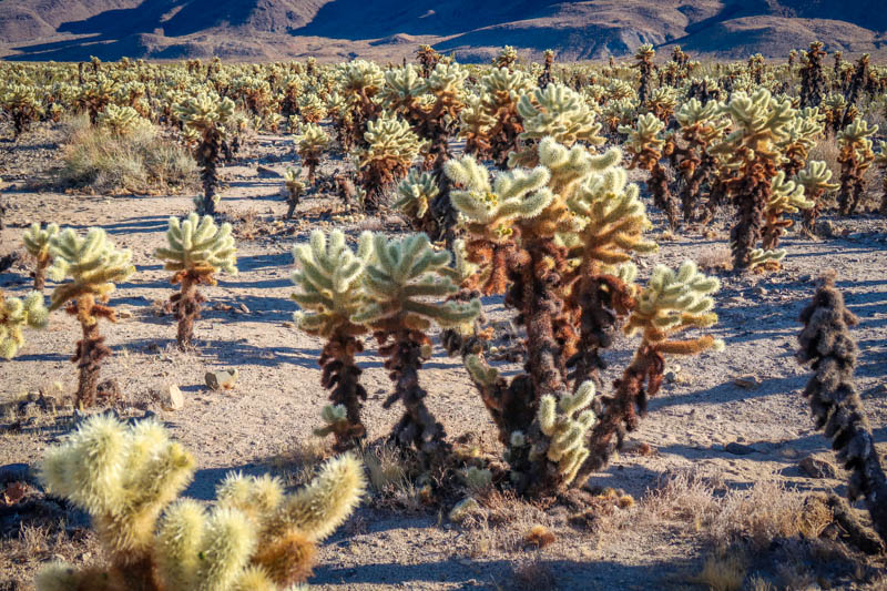
The Cholla Cactus Garden’s dense stand of teddybear cholla spans 10 acres and is one of Joshua Tree’s more unusual features. An easy quarter mile-long trail loops through the garden and provides an up-close and personal view of these magnificent cacti. But don’t get too close – this is one teddybear that you don’t want to hug. On my last visit I encountered not one but two screaming children who had painful run-ins with teddybear cholla.
The Cholla Cactus Garden Trail is perched on the edge of a mountain about 12 minutes drive south from the Twin Tanks parking area in a transition zone. From here, the road quickly loses elevation as it heads downhill towards the park’s southern area which is dominated by the Colorado Desert ecosystem.
High View Nature Trail – 1.3 miles
- Distance – 1.3 mile loop
- Elevation Gain – 321 feet
- Starting Elevation – 4155 feet
- Highest Elevation Point – 4460 feet
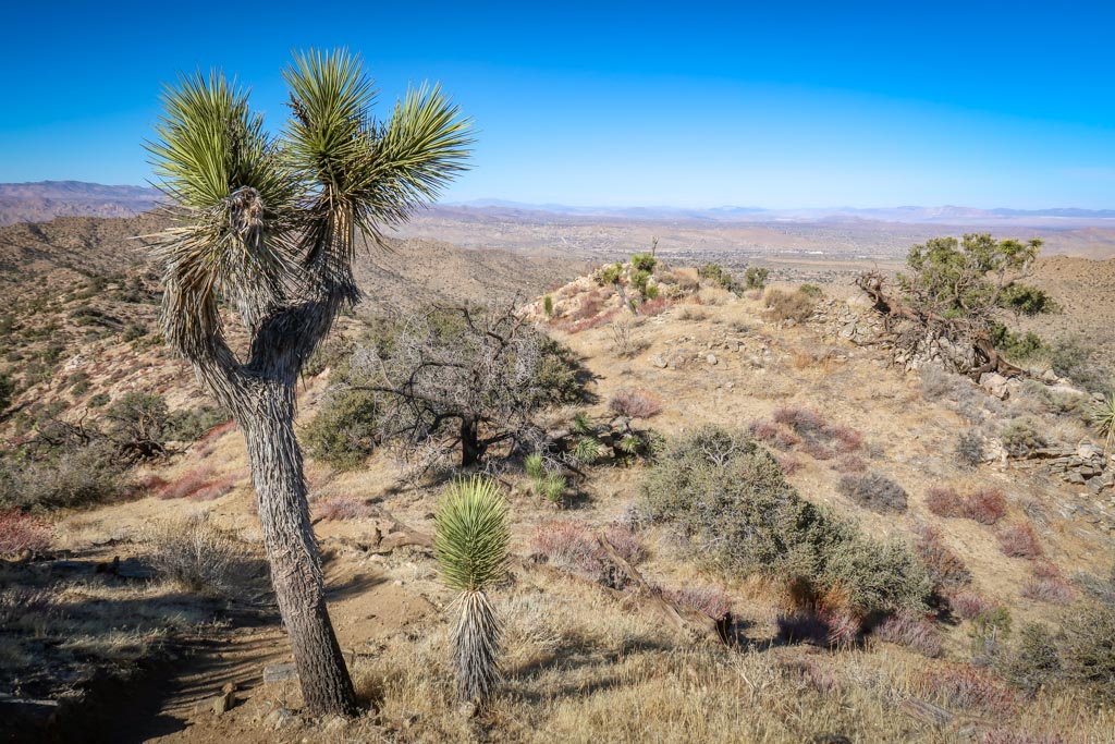
High View Nature Trail is a 1.3-mile loop that wanders through pinyon-juniper and Joshua Tree woodlands as it ascends up a short ridge. The highest point provides great views both towards Yucca Valley and San Gorgonio Mountain. If you’re looking to escape the crowds in busy Joshua Tree National Park, this is the place to do it. Tucked away in the park’s remote northwest corner, the High View Nature Trail tends to experience less traffic than other routes in the main part of the park.
The trailhead for High View Nature Trail is located at the Black Rock Canyon Campground and Nature Center in the northwest corner of the park near Yucca Valley.
Skull Rock Nature Trail – 1.7 miles
- Distance – 1.7 mile loop
- Elevation Gain – 160 feet
- Starting Elevation – 4331 feet
- Highest Elevation Point – 4447 feet
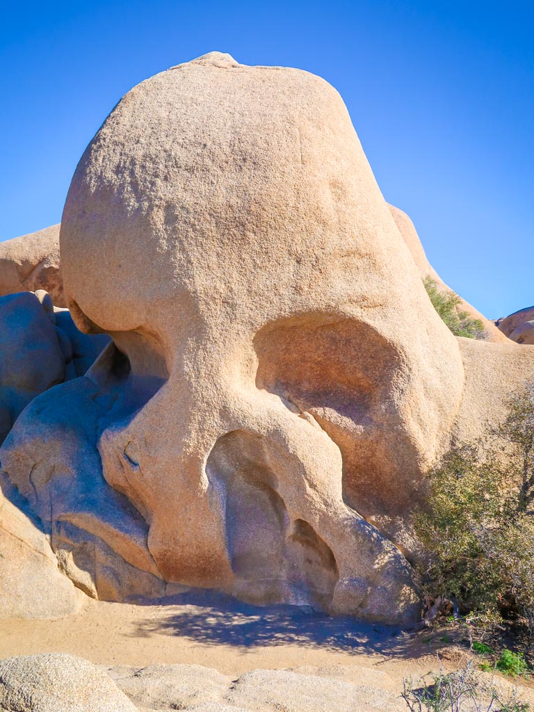
The 1.7-mile Skull Rock Nature Trail highlights one of the more unusual rock formations in Joshua Tree National Park. Skull Rock is a large granite rock formation that vaguely resembles a misshapen skull. Two depressions, located where the skull’s eye sockets should be, were created over many years by erosion. The trail begins at Skull Rock and then leads to the Jumbo Rocks campground and loops across the street. Interpretive markers along the way explain the rich biological diversity found in the Mojave Desert.
Skull Rock is located just off of Park Boulevard and is easy to access by only a few minutes walk. If you are short on time, I recommend skipping the rest of the nature trail and just visiting the rock.
Best Hikes in Joshua Tree: Medium Difficulty Hiking Trails
These moderately difficult trails are designed for hikers that are looking for more of a challenge.
49 Palms Oasis Trail – 3.1 miles
- Distance – 3.1 miles there-and-back
- Elevation Gain – 636 feet
- Starting Elevation – 2716 feet
- Highest Elevation Point – 3071 feet
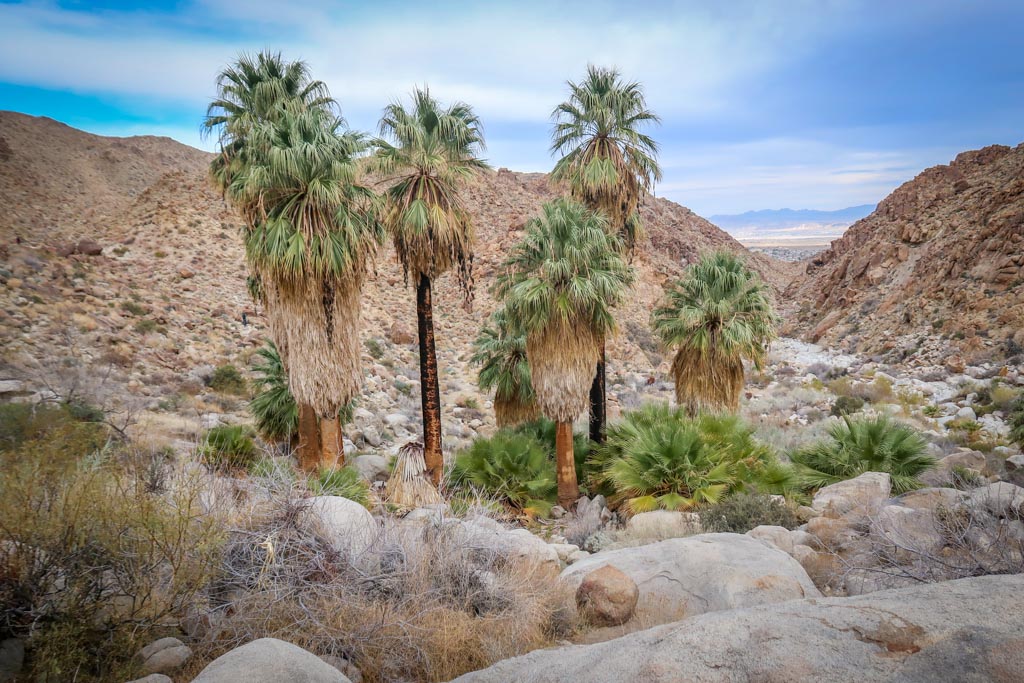
The 49 Palms Oasis Trail leads to one of five hidden fan palm oases located throughout Joshua Tree National Park. The oasis provides a welcome refuge for desert wildlife and is a great place to watch birds. Tucked along the northern boundary of the park, this 3-mile trek is one of Joshua Tree National Park’s more popular hikes – and for good reason. Not only does the trail lead to a hidden oasis, it also provides incredible views of the town of Twentynine Palms.
Don’t be fooled into thinking this is an easy hike, however. Even though the trail is only 3 miles long, it requires hiking up and down hills which can be especially difficult during hot weather. Avoid the heat and plan to tackle this hike in the early morning or evening hours (or better yet, in the winter).
West Side Loop Trail – 4.9 miles
- Distance – 4.9 miles
- Elevation Gain – 820 feet
- Starting Elevation – 4035 feet
- Highest Elevation Point – 4550 feet
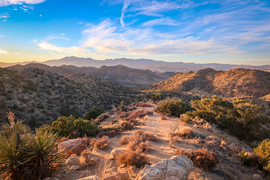
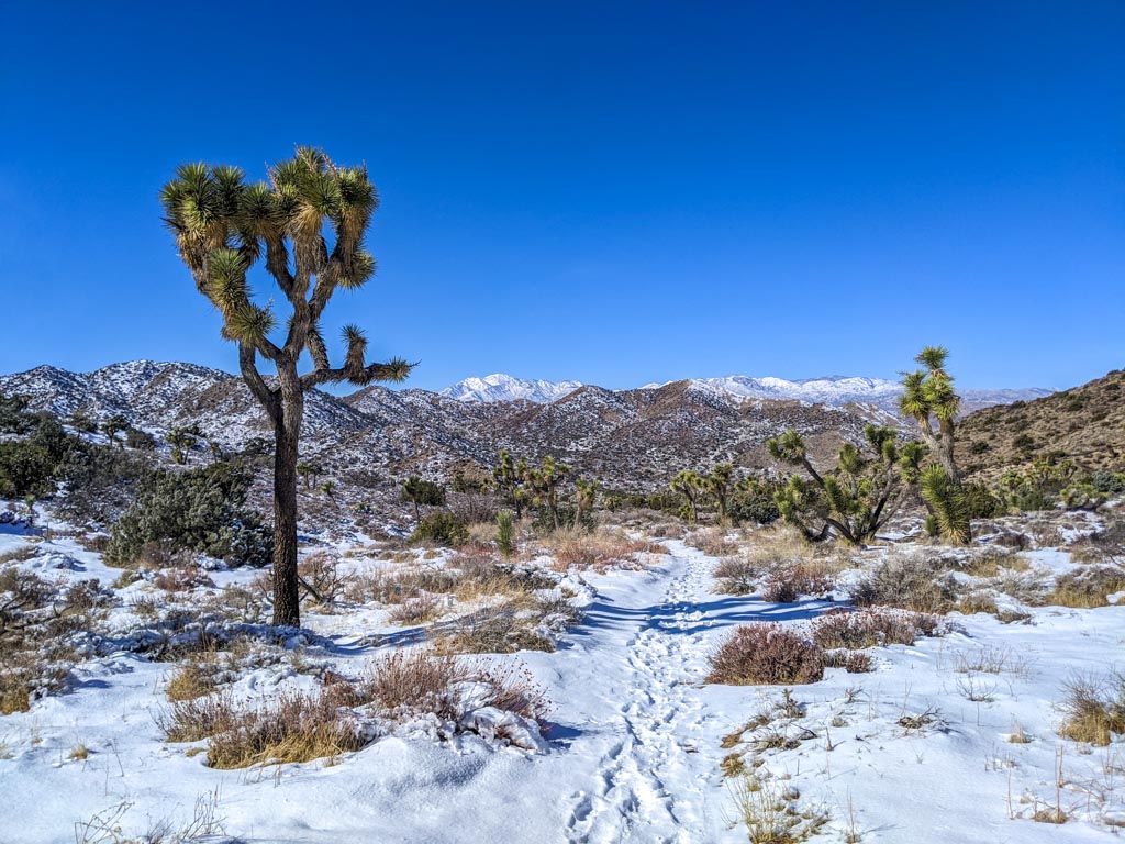
West Side Loop Trail Joshua Tree is a delightful moderate-length hike through dense groves of Joshua trees and pinyon pines. Tucked away in the park’s remote northwest corner, this 4.9-mile trail is often overlooked – yet it remains one of my favorites in the Black Rock Canyon area. West Side Loop Trail has a gentle rolling elevation profile, gaining 820 feet over 4.9 miles with some fabulous views of Mount San Jacinto and San Gorgonio Mountain in the middle of the hike.
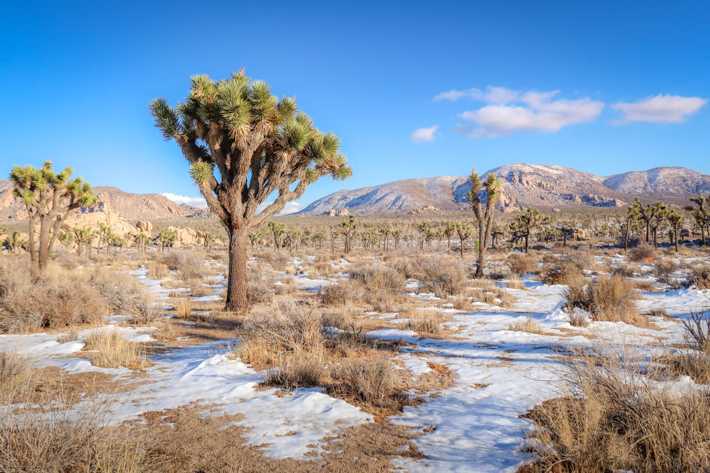
I liked this trail so much that I hiked it twice. On the second time around, the area experienced snowfall in the high desert and was transformed into a magical winter wonderland.
Lost Horse Mine Trail – 4 miles
- Distance – 4 miles there-and-back
- Elevation Gain – 515 feet
- Starting Elevation – 4603 feet
- Highest Elevation Point – 5063 feet
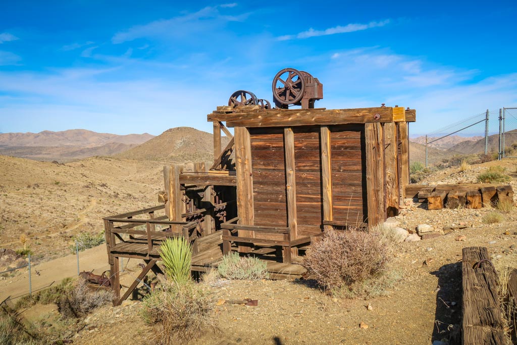
The Lost Horse Mine Trail leads to an abandoned mine with a fascinating history in Joshua Tree National Park. An impressive wooden structure, the mill built over top of the Lost Horse Mine is considered to be one of the best preserved mills of its kind in a National Park Service Unit.
The trailhead is located on Lost Horse Mine Road near the West Entrance in Joshua Tree National Park. The parking area is small and doesn’t have room for many cars so I recommend arriving early. The last mile of the drive requires driving on a single-lane dirt road. RVs and large vehicles are not permitted at the trailhead
Note that there is a separate trail to Lost Horse Mine called the Lost Horse Mine Loop Trail. The loop trail is 6.8 miles with 882 feet of elevation gain overall, whereas the trail described in this guide is 4 miles with 515 feet elevation gain overall.
Best Hikes in Joshua Tree: Difficult Hiking Trails
These difficult trails should only be attempted by hikers who are prepared for the desert hiking conditions. Bring plenty of water and avoid hiking at the hottest part of the day.
Panorama Loop Trail – 6.4 miles
- Distance – 6.4 miles
- Elevation Gain – 1,194 feet
- Starting Elevation – 3980 feet
- Highest Elevation Point – 5167 feet
Breathtaking views, unique geological formations and a picturesque desert landscape – all these and more await the adventurer who hikes the Panorama Loop Joshua Tree Trail. Tucked away in the park’s remote northwest corner at the Black Rock Canyon Entrance, this 6.4-mile gem tends to get ignored in favor of other more popular trails in the main part of the park. It’s a shame because the Panorama Loop Trail is a spectacular hiking experience and one of the best hikes in Joshua Tree National Park.
The trailhead for the Black Rock Canyon to Panorama Loop Trail is located at the Black Rock Canyon Campground in the northwestern corner of the park. Nestled among one of the area’s thicker stands of Joshua Trees, the campground is a short drive away from the town of Yucca Valley.
Willow Hole Trail – 6.8 miles
- Distance – 6.8 miles there-and-back
- Elevation Gain – 246 feet
- Starting Elevation – 4039 feet
- Highest Elevation Point – 4160 feet
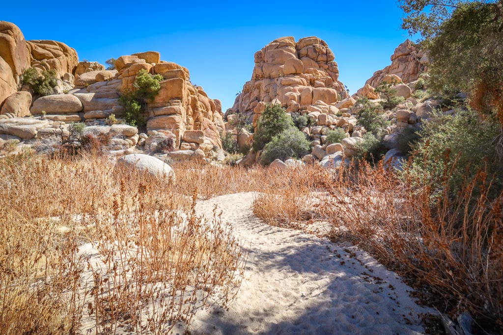
Hiking Willow Hole Joshua Tree is a great way to get an up-close and personal look at Joshua Tree’s Wonderland of Rocks and to visit a hidden oasis at the same time. Located in the northern part of Joshua Tree National Park, the Wonderland of Rocks is comprised of 12 square miles of jumbled massive boulders. This granite maze is home to secret oases and groves of Joshua Trees as well as some of the park’s Bighorn Sheep population.
One of the best ways to enter the Wonderland of Rocks is by hiking the Willow Hole Trail. This 6.8-mile trail shares the same trailhead with the Boy Scout Trail and ventures deep into the Wonderland of Rocks, providing a fascinating view of these magnificent boulders.
Lost Palms Oasis Trail – 7.2 miles
- Distance – 7.2 miles there-and-back
- Elevation Gain – 1026 feet
- Starting Elevation – 4160 feet
- Highest Elevation Point – 3457 feet
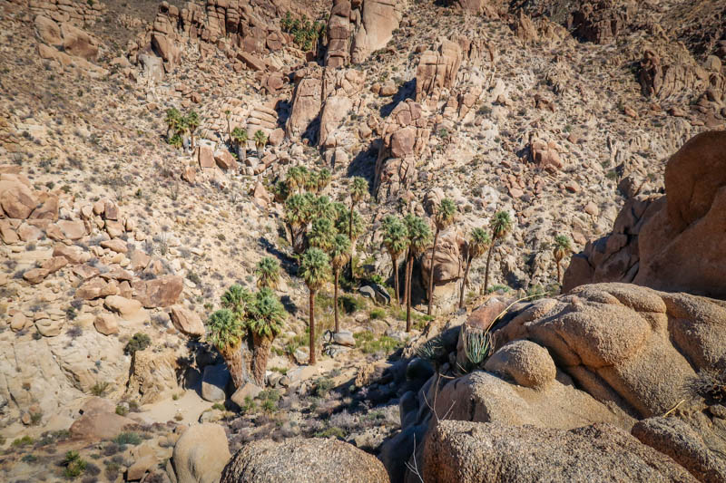
The Lost Palms Oasis Trail is unique in that it leads visitors to not one but two of Joshua Tree National Park’s hidden fan palm oases. The Cottonwood Oasis is only a 5-minute’s walk from the trailhead and very easy to access. The Lost Palms Oasis, however, is a 3.5-mile hike (one-way). The trail ends at a ridge overlooking the oasis which is nestled deep in a rocky canyon.
Parking for the Lost Palms Oasis Trail is available at the Cottonwood Spring trailhead. Located 7 miles from the park’s southern entrance, Cottonwood Spring tends to attract fewer visitors than some of the more centrally-located areas in the main part of the park.
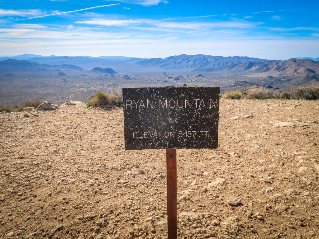
Ryan Mountain Trail – 3 miles
- Distance – 3 miles there-and-back
- Elevation Gain – 1057 feet
- Starting Elevation – 4400 feet
- Highest Elevation Point – 5457 feet
Ryan Mountain Trail is a short yet steep hike with great views overlooking the entire park. This hike is one of the most popular trails in the park so plan accordingly. It is also one of the best hikes in Joshua Tree at sunset.
The parking area for Ryan Mountain is located between Sheep Pass and Ryan Campground.
Best Hikes in Joshua Tree: Multi-Day Hiking Trails
Wilderness camping in Joshua Tree is a great way to leave the crowds behind and truly experience the beauty that this spectacular National Park has to offer, up close and in person. There are miles of trails to choose from in the backcountry, provided you follow a few simple rules.
For more detailed information about backpacking in Joshua Tree, including caching water, check out my ultimate guide to backpacking in Joshua Tree.
Here are three of the best long hikes in Joshua Tree:
Boy Scout Trail – 7.8 Miles
- Distance – 7.8 miles point-to-point / 15.6 there-and-back
- Elevation Gain/Loss – 173 feet gain/ 1347 feet loss (1 way)
- Starting/Ending Elevation – 4049 feet starting / 2848 feet ending
- Highest Elevation Point – 4195 feet
Boy Scout Trail Joshua Tree is a popular hike that travels deep into the park’s Wonderland of Rocks area. The hike begins near the West Entrance in a stunning Mojave Desert landscape dotted with Joshua Trees. After traveling through miles of rocky terrain, Boy Scout Trail Joshua Tree descends over 1000 feet in elevation and ends near the Indian Cove Campground.
At roughly 8 miles in length, Boy Scout Trail is a popular point-to-point hike for visitors who can arrange transportation on both ends (or a 16-mile roundtrip hike). Boy Scout Trail is also an excellent choice for hikers who want to try their hand at backcountry camping. The trail is moderately difficult but not too hard in case things go wrong and the hiker needs to bail out early.
California Riding and Hiking Trail – 37.6 miles
- Distance – 37.6 miles point-to-point
- Elevation Gain/Loss – 3175 feet (when hiked from west to east)
- Starting/Ending Elevation – 4042 feet starting / 2877 feet ending
- Highest Elevation Point – 5167 feet
The big granddaddy of them all, the California Riding and Hiking Trail traverses the northern part of the park for 37 miles through a variety of Mojave Desert landscapes. After starting at the Black Rock Canyon trailhead, the heads east past Eureka Peak and Quail Mountain to Ryan Mountain and Arch Rock. The eastern terminus for the California Riding and Hiking Trail is located near the North Entrance at the town of Twentynine Palms.
Hiking this multi-day trail is a great way to get fully acquainted with Joshua Tree National Park’s unique desert ecosystem. It also requires a bit of pre-planning, particularly with regards to caching water as no water is available inside of the park.
Joshua Tree Fee and Entrance Information
Joshua Tree National Park has three entrances: the West Entrance, North Entrance and South Entrance. The West Entrance is the main one used to enter the park. As a result it can attract long lines – especially on weekends during the high season. If you don’t want to wait in line, you can usually shorten the wait by entering at the North Entrance in Twentynine Palms or at the South Entrance.
The fee to enter Joshua Tree National Park is $30 per vehicle which is good for seven days. I recommend buying the America the Beautiful Interagency Pass, however, which costs $80. This allows entry to all National Parks for an entire year, as well as most federal lands (including National Forests, Bureau of Land Management and more).
Be sure to check the Joshua Tree National Park web site for current conditions before heading to the park. If you have only one day to spend in Joshua Tree, consider planning a Joshua Tree day trip.
While you’re in the area, don’t forget to explore outside of the national park as well. There are lots of fun and quirky things to do near Joshua Tree besides hiking and camping.
Additional Joshua Tree Resources
If you enjoyed this hiking guide, be sure to check out my other articles about Joshua Tree National Park!
Like this blog post? Pin it!
Note: This post contains affiliate links, which means I may receive a commission if you click a link and purchase something. While clicking these links won’t cost you anything, they will help me to keep this site up and running!


I am longing to go to Joshua Tree! It looks like such a cool National Park and all of these hikes sound amazing. I am hoping to go at some point this year. Great guide! 🙂
Thanks Taylor!
Sometimes, all of the different landscapes of the USA just blow me away! It seems like a different country. Granted, I am from the East Coast, so they really are vastly different. These are gorgeous photos, I’d love to make it to Joshua Tree one day. I love how you broke the hikes up by difficulty. Thanks for sharing!
Thanks! I hope you make it to Joshua Tree too. I feel lucky that I got to spend 2 months whole months there.
Love Joshua Tree! I need to check out a few more of these hikes next time I go!
Wow! Fantastic landscape to hike in. Love the rocks especially Skull rock.
Thanks Alma. Yeah Skull Rock is pretty amazing.
I really want to go hiking here because the landscape looks amazing, so it’s great to know the types of trails you can take and how long they all are!
We absolutely love hiking, but haven’t made it out to Joshua Tree! I will be saving this post for later.
Awesome guide. It would be amazing to stay in the area for a few days and explore a few hikes from this list. Though of course there will be the temptation to do some of them twice ðŸ˜
I have seen countless pictures from Joshua Tree but never knew it has so many hikes.
Some stunning desert scenery in Joshua Tree NP. I’d love to go hiking there! Your pics are beautiful!
Thank you! I hope you make it there someday. Joshua Tree is incredible!
Sun shirt is something I have been longing to invest in. Thank you for the suggestion.
You are welcome!
You took an amazing pic of Skull Rock. It looks human. Great article.
Thanks Terri! Skull Rock is pretty distinctive. It’s one of my favorite spots in Joshua Tree!
Gosh, I want to go to Joshua Tree so so so badly! Thanks for all the info, I have bookmarked!
You’re welcome. Joshua Tree is amazing. You’ll love it 🙂🙂
Joshua Tree NP is one of those places that I’ve driven by probably hundreds of times on I-10, but haven’t had a chance to stop. I really need to get out there before it gets too hot again. Thanks for all these great tips!
Yes definitely go in the spring or fall before it’s too hot. You’ll love it ☺ï¸
I love Joshua Tree. You have some of my favorite hikes detailed here and more that I want to try. My daughter was just there and so it was fun to share some hike ideas with her.